The Gorgas Creek Cave Loop at Wissahickon Valley Park in Philadelphia, Pennsylvania is an easy 1.7-mile loop trail that features the Gorgas Creek Cave and an old restored outhouse at the park.
Trails
This hike follows several trails in order: West Mount Airy Ave Access Trail, Forbidden Drive, Gorgas Creek Trail, Yellow Trail, and finally a turquoise-blazed trail to connect back to Forbidden Drive.
Hike Description
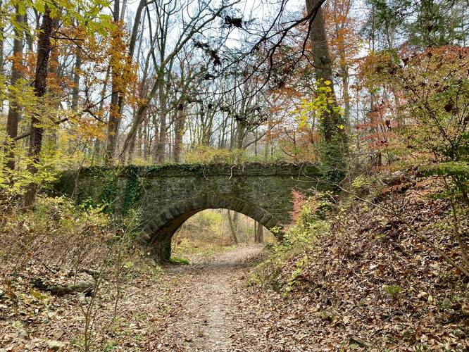
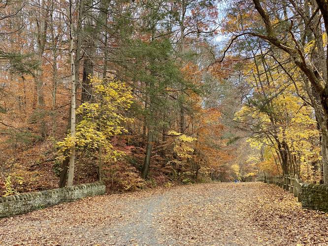
This hike begins at the dead end of West Mount Airy Ave and follows the unnamed trail downhill, past the stone bridge underpass, to reach the Wissahickon Creek bridge. At the bridge, take a right-hand turn along Forbidden Drive to head north.
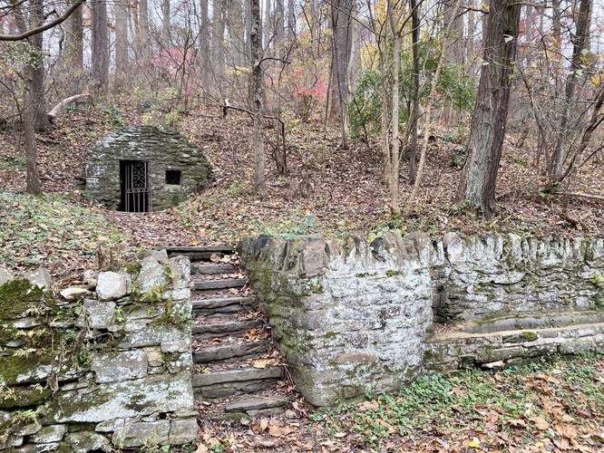
Restored Outhouse - mile 0.25
Around mile 0.25, hikers will find an old stone outhouse just off of the trail. Note the stone bath for washing adjacent to the trail. This old outhouse was rebuilt and restored in 2001by the Friends of the Wissahickon.
Just after passing the old outhouse, the trail takes a left-hand turn to head west along the Gorgas Creek Trail (officially unnamed). Here, hikers will walk only a couple-hundred feet down the trail before noticing a small stone archway that crosses the creek.
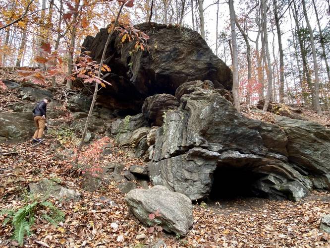
Gorgas Creek Cave - mile 0.45
Just after passing over the stone creek archway over Gorgas Creek, hikers will note a small path that leads alongside the edge of the creek's hillside. Follow this short trail for about 50-feet or less, to reach the Gorgas Creek Cave, which sits on the sloped hillside along the creek. The cave can be reached within 0.45-miles from the parking lot, making this a very easy out-and-back hike if you do not wish to explore this area as a loop.
Hike the Loop
After visiting Gorgas Creek Cave, this recording heads west along the trail - headed toward Gorgas Lane; however, this hike takes a left-hand turn along the Yellow Trail. The recording follows the yellow trail for about 0.6-miles until it reaches a small turquoise-blazed trail that heads downhill. Follow this short connecting trail back down to Forbidden Drive. Cross the Wissahickon Creek bridge and follow the unnamed trail back up to West Mount Airy Ave to complete the hike for approximately 1.6-miles.
Parking
Hikers will find street parking along West Mount Airy Ave near the coordinates provided. Do not drive down to the dead-end street gate at the park as this will block resident's driveways.
Pets
Dogs are allowed if leashed and their waste must be carried out by the hiker.
Biking
Mountain biking is permitted along all of these trails. Watch out and move over for bikers as Wissahickon Valley Park is a well-known and popular mountain biking area near Philadelphia.
Trails
This hike follows several trails in order: West Mount Airy Ave Access Trail, Forbidden Drive, Gorgas Creek Trail, Yellow Trail, and finally a turquoise-blazed trail to connect back to Forbidden Drive.
Hike Description
This hike begins at the dead end of West Mount Airy Ave and follows the unnamed trail downhill, past the stone bridge underpass, to reach the Wissahickon Creek bridge. At the bridge, take a right-hand turn along Forbidden Drive to head north.
Restored Outhouse - mile 0.25
Around mile 0.25, hikers will find an old stone outhouse just off of the trail. Note the stone bath for washing adjacent to the trail. This old outhouse was rebuilt and restored in 2001by the Friends of the Wissahickon.
Just after passing the old outhouse, the trail takes a left-hand turn to head west along the Gorgas Creek Trail (officially unnamed). Here, hikers will walk only a couple-hundred feet down the trail before noticing a small stone archway that crosses the creek.
Gorgas Creek Cave - mile 0.45
Just after passing over the stone creek archway over Gorgas Creek, hikers will note a small path that leads alongside the edge of the creek's hillside. Follow this short trail for about 50-feet or less, to reach the Gorgas Creek Cave, which sits on the sloped hillside along the creek. The cave can be reached within 0.45-miles from the parking lot, making this a very easy out-and-back hike if you do not wish to explore this area as a loop.
Hike the Loop
After visiting Gorgas Creek Cave, this recording heads west along the trail - headed toward Gorgas Lane; however, this hike takes a left-hand turn along the Yellow Trail. The recording follows the yellow trail for about 0.6-miles until it reaches a small turquoise-blazed trail that heads downhill. Follow this short connecting trail back down to Forbidden Drive. Cross the Wissahickon Creek bridge and follow the unnamed trail back up to West Mount Airy Ave to complete the hike for approximately 1.6-miles.
Parking
Hikers will find street parking along West Mount Airy Ave near the coordinates provided. Do not drive down to the dead-end street gate at the park as this will block resident's driveways.
Pets
Dogs are allowed if leashed and their waste must be carried out by the hiker.
Biking
Mountain biking is permitted along all of these trails. Watch out and move over for bikers as Wissahickon Valley Park is a well-known and popular mountain biking area near Philadelphia.