The Gore Range Overlook at Rocky Mountain National Park
near Estes Park, Colorado is an easy universally-accessible 0.1-mile
out-and-back roadside walk that features views of
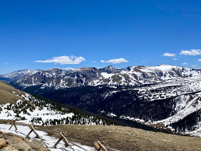
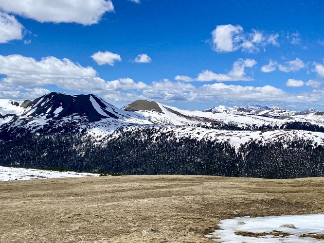
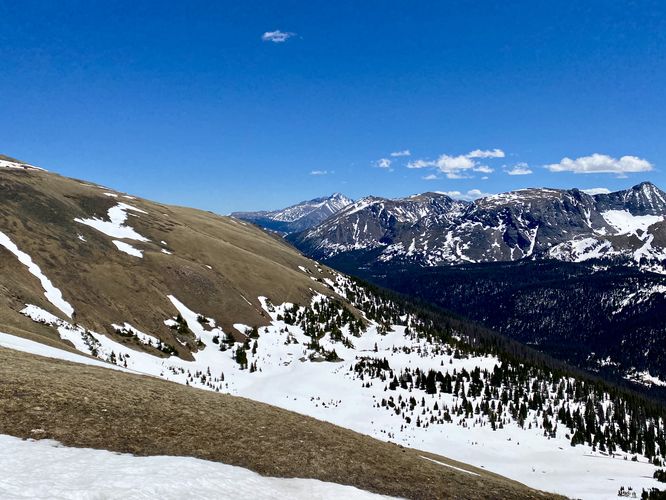
This is not a hike and just barely a walk, but rather a short roadside stop that features stunning views of the rocky mountain's Gore Range. The sidewalk provides a universally-accessible pathway that runs along the parking lot to provide visitors with different views and vantage points. Visitors will find views of Specimen Mountain and Lulu Mountain from the northwest end in addition to Forest Canyon views from the southeast end of the sidewalk path.
Due to this overlook's altitude at 12,000-feet above sea level, it's a great place for visitors to take-in the natural beauty while also taking short walks to acclimatize.
Paved Path & Universal Access
This short parking lot viewpoint is universally accessible via pavement and a sidewalk.
Pets
Dogs are only allowed at the parking lot and must be cleaned-up after.
Parking
Hikers will find a medum-sized parking turnout at the coordinates provided along Trail Ridge Road. The turnout is large enough to fit a dozen vehicles as of June 2024.
Timed-Entry Reservations
Between the months of late May through early October you must purchase a timed-entry pass to visit Rocky Mountain National Park. If you wish to visitor and hike anything off of the Bear Lake Road, you must purchase a dedicated Bear Lake timed-entry pass. You can find more information about timed entry on the park's website.
Warnings
Elevation sickness: This trail brings hikers through terrain at 12,000-feet above sea level. Around the 7,000-foot mark above sea level, hikers may start to experience symptoms of elevation sickness including headache, muscle aches, shortness of breath, among other warning signs. In order to avoid elevation sickness it's recommended to ascend to higher elevations and take short walks to acclimate over the course of several days before taking a long or physically-demanding hike. At any time you feel elevation sickness kicking in, that's the time to turn back and head for lower altitude or the parking lot.