Gate WR13 at Quabbin Reservoir in Ware, Massachusetts is an easy 1.4-mile out-and-back trail that leads to two different shorelines and beautiful views of Quabbin Reservoir.
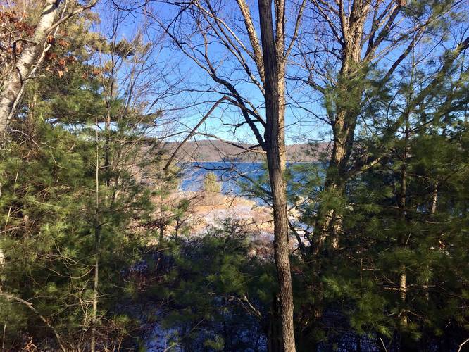
The trail begins at the gate labeled "WR13" and follows a mostly-flat trail for about 0.1-miles before reaching a trail junction. At the junction, hikers can take either turn to reach the water; however, each turn has its benefits and it's worth exploring both branches of the trail before hiking back to parking.
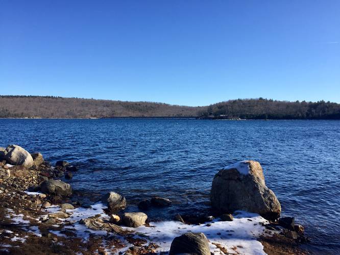
Taking a right-hand turn at the junction will bring hikers down a gradual hill along a fairly short trail that reaches the water. From the shores of the reservoir along this section of the trail, hikers will be able to see the Goodnough Dike directly across the water. From here, hiking back is quick and easy up back to the trail junction.
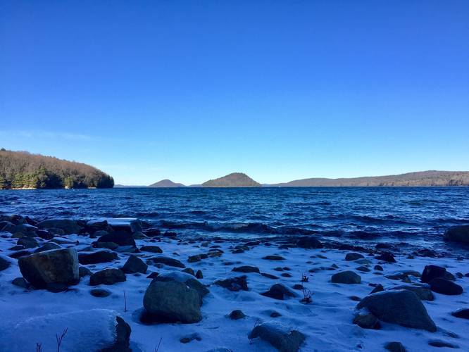
Back at the trail junction, hikers should continue straight (or what would have been a left-hand turn heading in from the gate) to follow a longer, but more scenic vista by the water. This section of the trail is about twice as long as the other offshoot, but the payout is well worth it as you get a vista looking north with views of Little Quabbin Island to the left and Mount Lizzie straight ahead.
The hike back to parking is fairly easy as well, despite the small elevation gain along the way. This trail should be considered easy for most hikers.
Vista
At each end of the offshoot trails has a vista with views of Quabbin Reservoir.
Pets
Dogs are not allowed on any trail at Quabbin Reservoir.
Parking
Hikers can find parking on the side of the road next to Gate WR13, at the coordinates provided.
The trail begins at the gate labeled "WR13" and follows a mostly-flat trail for about 0.1-miles before reaching a trail junction. At the junction, hikers can take either turn to reach the water; however, each turn has its benefits and it's worth exploring both branches of the trail before hiking back to parking.
Taking a right-hand turn at the junction will bring hikers down a gradual hill along a fairly short trail that reaches the water. From the shores of the reservoir along this section of the trail, hikers will be able to see the Goodnough Dike directly across the water. From here, hiking back is quick and easy up back to the trail junction.
Back at the trail junction, hikers should continue straight (or what would have been a left-hand turn heading in from the gate) to follow a longer, but more scenic vista by the water. This section of the trail is about twice as long as the other offshoot, but the payout is well worth it as you get a vista looking north with views of Little Quabbin Island to the left and Mount Lizzie straight ahead.
The hike back to parking is fairly easy as well, despite the small elevation gain along the way. This trail should be considered easy for most hikers.
Vista
At each end of the offshoot trails has a vista with views of Quabbin Reservoir.
Pets
Dogs are not allowed on any trail at Quabbin Reservoir.
Parking
Hikers can find parking on the side of the road next to Gate WR13, at the coordinates provided.