The Fox Run Trail at Fox Run Conservation Land in Provincetown, Massachusetts is an easy 0.3-mile out-and-back hike that features a beautiful and eerie Atlantic White Cedar swamp.
Hike Description
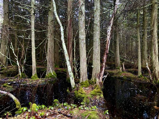
Hikers will reach this trailhead, first, by hiking in from Snail Road along the Old Colony Nature Pathway which is approximately 0.45-miles one-way. Once at the trailhead, the hike head south, passing between two Atlantic White Cedar swamps. The swamp on the right-hand (western) side has a couple of short trails that lead to the water where you'll find vibrant green moss growing under the trees with dark-red, almost black, swamp waters surrounding the trunks. The red-ish color of the water comes from the cedar's tannins that naturally seep into any surrounding waters. The forest and swamp are the main attraction for this hike, but the trail continues south.
Fork in the Trail - Mile 0.1
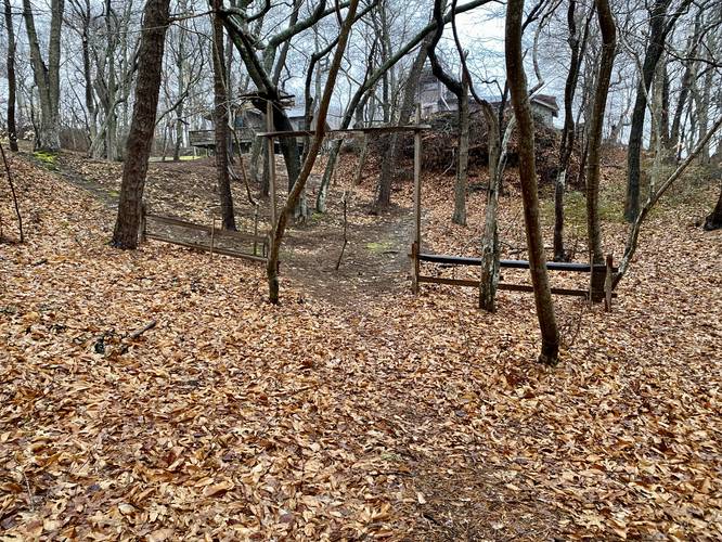
Around mile 0.1 is a fork in the trail where the right-hand side is trafficked far less and leads through a lot of overgrowth - likely further into this small tract of public land. The trail on the left-hand side leads to private property. Please turn around before the private property.
Parking
Hikers will find parking at the coordinates provided along Snail Road.
Pets
Per town rules as of April 2023: All dogs must be licensed and have a rabies vaccine. Dogs are allowed if leashed and must be cleaned up after. Off-leash Hours as follows - Memorial Day to Nov 1: 6AM - 9AM and 6PM - 9PM. Nov 2 to Memorial Day: 6AM - 9PM. Violations against not cleaning up and/or not obeying off-leash hours.
Hike Description
Hikers will reach this trailhead, first, by hiking in from Snail Road along the Old Colony Nature Pathway which is approximately 0.45-miles one-way. Once at the trailhead, the hike head south, passing between two Atlantic White Cedar swamps. The swamp on the right-hand (western) side has a couple of short trails that lead to the water where you'll find vibrant green moss growing under the trees with dark-red, almost black, swamp waters surrounding the trunks. The red-ish color of the water comes from the cedar's tannins that naturally seep into any surrounding waters. The forest and swamp are the main attraction for this hike, but the trail continues south.
Fork in the Trail - Mile 0.1
Around mile 0.1 is a fork in the trail where the right-hand side is trafficked far less and leads through a lot of overgrowth - likely further into this small tract of public land. The trail on the left-hand side leads to private property. Please turn around before the private property.
Parking
Hikers will find parking at the coordinates provided along Snail Road.
Pets
Per town rules as of April 2023: All dogs must be licensed and have a rabies vaccine. Dogs are allowed if leashed and must be cleaned up after. Off-leash Hours as follows - Memorial Day to Nov 1: 6AM - 9AM and 6PM - 9PM. Nov 2 to Memorial Day: 6AM - 9PM. Violations against not cleaning up and/or not obeying off-leash hours.