The Fork Hill Loop hike at Tioga State Forest near Morris, Pennsylvania is a moderate 6.4-mile loop trail that features views of Pine Creek Gorge (Pennsylvania Grand Canyon), a view of Fork Hill, and also features a large campsite for backpackers.
Trails
This hike follows several named trails: Mid State Trail, Quarry Trail, and Clay Mine Road.
Trail Description
This hike starts along Clay Mine Road near Morris, Pennsylvania and follows the Mid State Trail, heading south. Hikers should note that the parking area is located about 100-feet west of the trailhead.
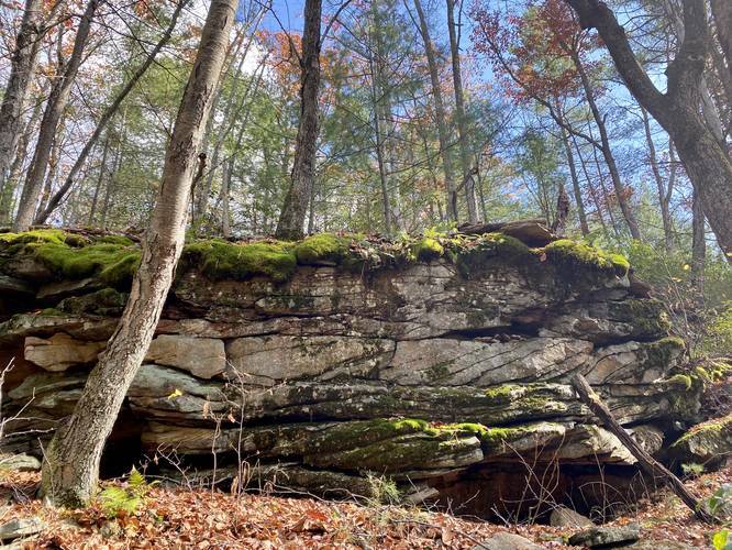
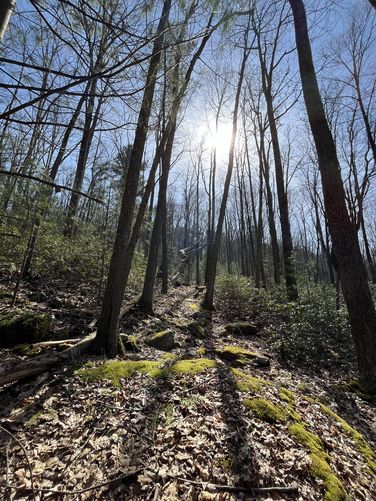
The first 1-mile or so of this trail is very rocky. During Autumn, the leaves cover the rocks, making this trail even more difficult to hike. The difficulty is listed as "moderate" for this reason; however, the rockiest section of the trail does not last much longer than 1 mile.
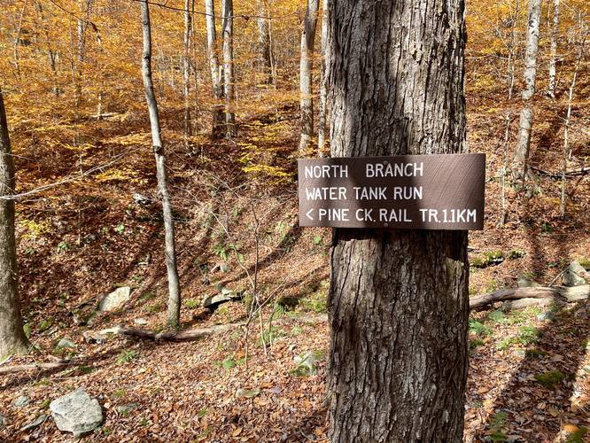
Hikers will pass the trailhead for the Water Tank Hollow Trail, located around mile 1. On the state forest map, it depicts this trail connecting to Clay Mine Road, but out of experience, these two sections do not meet up anywhere and the Water Tank Hollow Trail appears to terminate or start along the Mid State Trail instead.
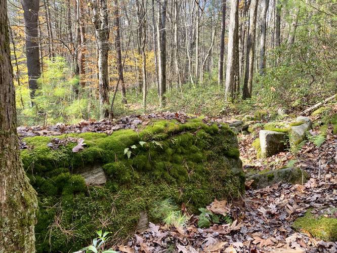
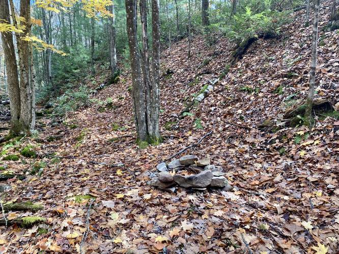
After passing the Water Tank Hollow Trail, hikers will pass one more creek before the trail heads to the top of the hill where the elevation gain keeps to a minimum. At this second creek crossing (South Branch Water Tank Run), hikers will find a very small campfire pit - hence the "campsite" listed on the map. This campsite is only large enough for a hammock or a tiny 1-person tent, if that.
Fork Hill Vista and Canyon Overlook
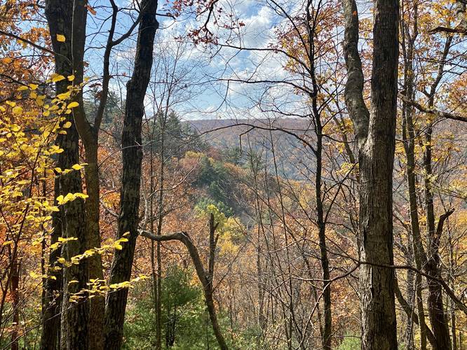
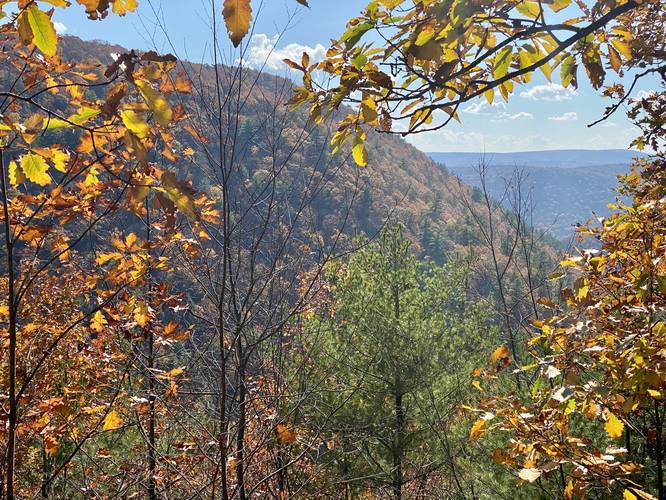
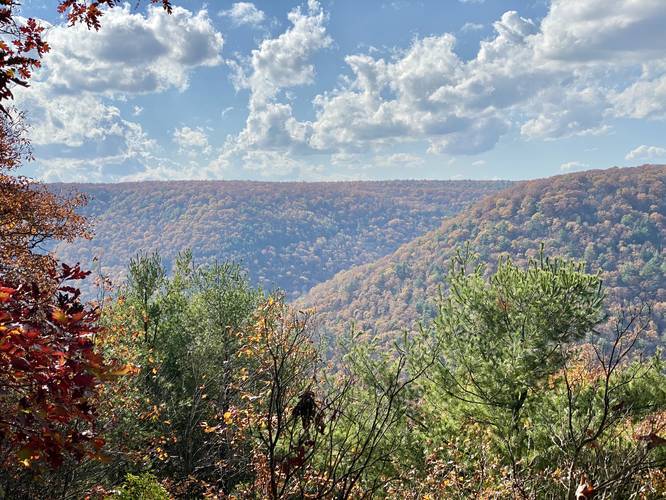
Around mile 2.65, hikers will reach a yellow-blaze sign that points to a "view". Follow this short spur trail out to two views, which are located around mile 3.1. If you follow the yellow blazes to the end (3-blazes on a tree marks the end), there is a view of Fork Hill. This vista is unnamed so we can call this the "Fork Hill Vista" for simplicity. Trek back along the spur trail to the first overlook of Pine Creek Gorge / Pennsylvania Grand Canyon. For simplicity we can call this unnamed vista the "Canyon Overlook". The Canyon Overlook is the better of the two vistas, as hikers get a view of the west rim of the canyon. The West Rim Trail technically follows parts of those hills across the gorge as well.
Hiking Out
After visiting the views, follow the yellow-blazed spur trail back to the Mid State Trail. Here, hikers will stay to the right to continue following orange blazes. This section of the forest was once owned by a private mining company, hence Quarry Trail. Back in the day, these folks used wagons to haul stone out of the nearby quarry, so today, hikers can still see the wagon tracks that dug into the side of the old road - which is now the trail. These old wagon tracks are most obvious near the view spur trail junction.
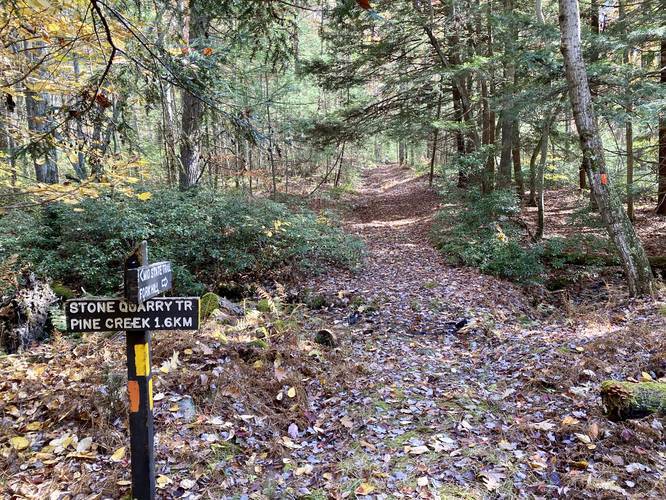
Around mile 3.73, hikers will hit a junction with the Stone Quarry Trail - head straight here to stay along the loop. Finally, around mile 4.1, hikers will reach a junction with the Mid State Trail - keep straight here to hike 100 more feet to reach your next turn. The next turn is along the Quarry Trail, which has no trailhead sign. The Quarry Trail is technically a service road that is closed during 9 months out of the year. It looks like a road and cannot be missed -- turn left here to head back to parking.
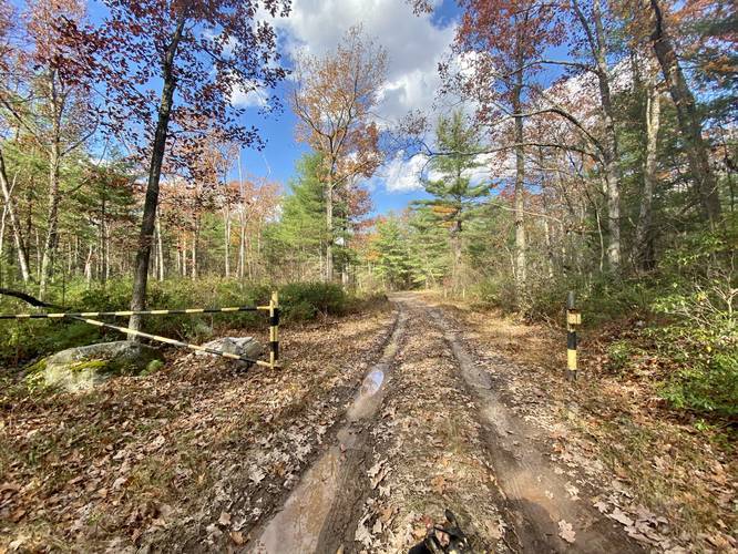
Hikers will follow the Quarry Trail until they pass the yellow trailhead gate. After passing the yellow gate trailhead, continue hiking straight to reach Clay Mine Road. Keep left at the fork to stay on Clay Mine Road to reach the parking lot.
Parking
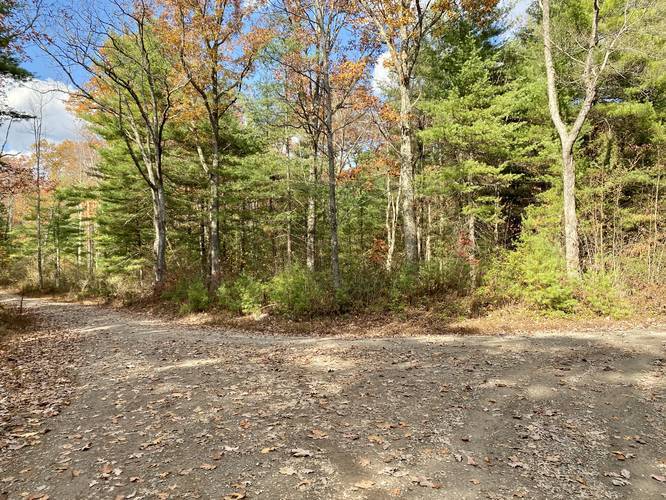
Hikers will find a small parking lot near the coordinates provided. The lot is large enough to fit about 5 vehicles max. If the lot is full, additional parking can be found in turnouts along Clay Mine Road closer to the Quarry Trail (south of parking).
Pets
Dogs are allowed if leashed.
Camping and Backpacking
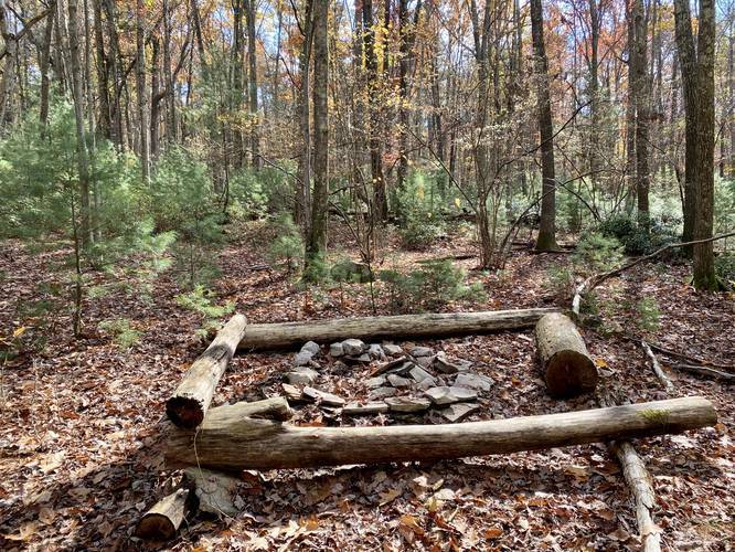
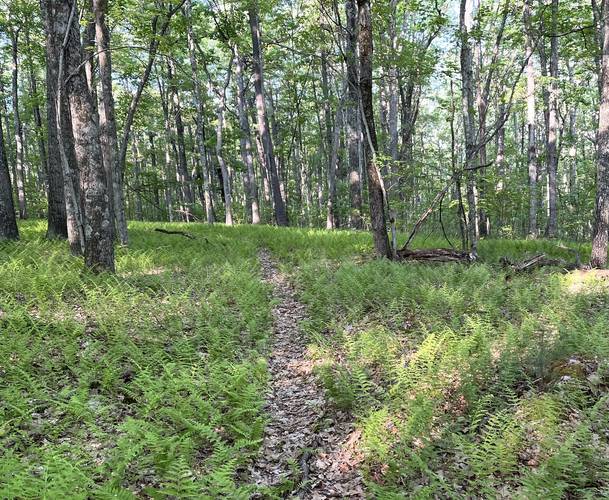
There's one large campsite along the trail around mile 1.73. Backpackers will also find a tiny one-person campsite, good for a hammock, around mile 1.5. There are other flat and open areas near the top of the hill, after mile 2.3, which makes setting up a campsite easy - if so, please leave no trace. Please follow all state forest rules and regulations when primitive / backcountry / dispersed camping.
Timber Rattlesnakes
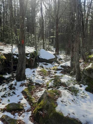
This area of the state forest is known for its rattlesnakes - especially near the rocky sunny vista areas. Please use caution when hiking during warmer months (April - September) as they tend to leave their dens and sun in the rocky areas. Timer Rattlesnakes can also be found among the rocky sections of trail sometimes as well.
Blaze Color
This trail follows orange blazes from the beginning of the hike until the view spur trail. The view spur trail follows yellow blazes. The rest of the loop follows orange blazes until the hiker reaches the Quarry Trail - in which there are no blaze colors to follow back to parking.
Pine Creek Pinnacles (PCP20)
This hike is part of the Pine Creek Pinnacles hiking challenge. For more information, details, and FAQs, please visit our Pine Creek Pinnacles (PCP20) page.
Trails
This hike follows several named trails: Mid State Trail, Quarry Trail, and Clay Mine Road.
Trail Description
This hike starts along Clay Mine Road near Morris, Pennsylvania and follows the Mid State Trail, heading south. Hikers should note that the parking area is located about 100-feet west of the trailhead.
The first 1-mile or so of this trail is very rocky. During Autumn, the leaves cover the rocks, making this trail even more difficult to hike. The difficulty is listed as "moderate" for this reason; however, the rockiest section of the trail does not last much longer than 1 mile.
Hikers will pass the trailhead for the Water Tank Hollow Trail, located around mile 1. On the state forest map, it depicts this trail connecting to Clay Mine Road, but out of experience, these two sections do not meet up anywhere and the Water Tank Hollow Trail appears to terminate or start along the Mid State Trail instead.
After passing the Water Tank Hollow Trail, hikers will pass one more creek before the trail heads to the top of the hill where the elevation gain keeps to a minimum. At this second creek crossing (South Branch Water Tank Run), hikers will find a very small campfire pit - hence the "campsite" listed on the map. This campsite is only large enough for a hammock or a tiny 1-person tent, if that.
Fork Hill Vista and Canyon Overlook
Around mile 2.65, hikers will reach a yellow-blaze sign that points to a "view". Follow this short spur trail out to two views, which are located around mile 3.1. If you follow the yellow blazes to the end (3-blazes on a tree marks the end), there is a view of Fork Hill. This vista is unnamed so we can call this the "Fork Hill Vista" for simplicity. Trek back along the spur trail to the first overlook of Pine Creek Gorge / Pennsylvania Grand Canyon. For simplicity we can call this unnamed vista the "Canyon Overlook". The Canyon Overlook is the better of the two vistas, as hikers get a view of the west rim of the canyon. The West Rim Trail technically follows parts of those hills across the gorge as well.
Hiking Out
After visiting the views, follow the yellow-blazed spur trail back to the Mid State Trail. Here, hikers will stay to the right to continue following orange blazes. This section of the forest was once owned by a private mining company, hence Quarry Trail. Back in the day, these folks used wagons to haul stone out of the nearby quarry, so today, hikers can still see the wagon tracks that dug into the side of the old road - which is now the trail. These old wagon tracks are most obvious near the view spur trail junction.
Around mile 3.73, hikers will hit a junction with the Stone Quarry Trail - head straight here to stay along the loop. Finally, around mile 4.1, hikers will reach a junction with the Mid State Trail - keep straight here to hike 100 more feet to reach your next turn. The next turn is along the Quarry Trail, which has no trailhead sign. The Quarry Trail is technically a service road that is closed during 9 months out of the year. It looks like a road and cannot be missed -- turn left here to head back to parking.
Hikers will follow the Quarry Trail until they pass the yellow trailhead gate. After passing the yellow gate trailhead, continue hiking straight to reach Clay Mine Road. Keep left at the fork to stay on Clay Mine Road to reach the parking lot.
Parking
Hikers will find a small parking lot near the coordinates provided. The lot is large enough to fit about 5 vehicles max. If the lot is full, additional parking can be found in turnouts along Clay Mine Road closer to the Quarry Trail (south of parking).
Pets
Dogs are allowed if leashed.
Camping and Backpacking
There's one large campsite along the trail around mile 1.73. Backpackers will also find a tiny one-person campsite, good for a hammock, around mile 1.5. There are other flat and open areas near the top of the hill, after mile 2.3, which makes setting up a campsite easy - if so, please leave no trace. Please follow all state forest rules and regulations when primitive / backcountry / dispersed camping.
Timber Rattlesnakes
This area of the state forest is known for its rattlesnakes - especially near the rocky sunny vista areas. Please use caution when hiking during warmer months (April - September) as they tend to leave their dens and sun in the rocky areas. Timer Rattlesnakes can also be found among the rocky sections of trail sometimes as well.
Blaze Color
This trail follows orange blazes from the beginning of the hike until the view spur trail. The view spur trail follows yellow blazes. The rest of the loop follows orange blazes until the hiker reaches the Quarry Trail - in which there are no blaze colors to follow back to parking.
Pine Creek Pinnacles (PCP20)
This hike is part of the Pine Creek Pinnacles hiking challenge. For more information, details, and FAQs, please visit our Pine Creek Pinnacles (PCP20) page.