The Ferncliff Trail at Ohiopyle State Park's Ferncliff Natural Area is a moderate 2-mile loop trail that encompasses the Ferncliff Natural Area with amazing views of the Youghiogheny River and Ohiopyle Falls.
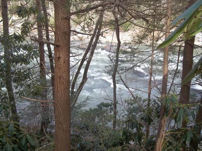
This trail begins at the main parking lot for the bike trail at Ohiopyle State Park and heads directly into the Ferncliff Natural Area before heading south along the Ferncliff Trail. Shortly after the trail reaches the banks of the Youghiogheny River, you'll begin to hike over large, mostly-flat, bedrock. You can even find fossilized plants within the riverbank bedrock.
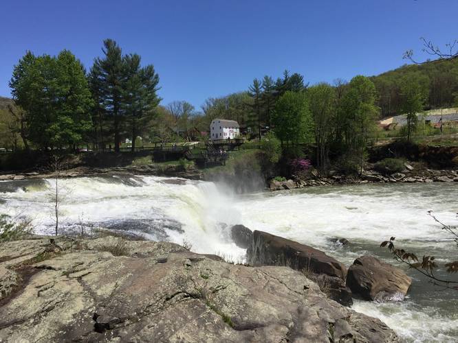
Follow the riverbank bedrock until you reach Ohiopyle Falls. At Ohiopyle Falls, you'll get an amazing view directly next to the waterfall before continuing along the trail. After visiting Ohiopyle Falls, the trail heads back into the woods and can be difficult to spot -- look to the right-hand side of where the cliff ends next to the riverbank and you'll spot the trail.
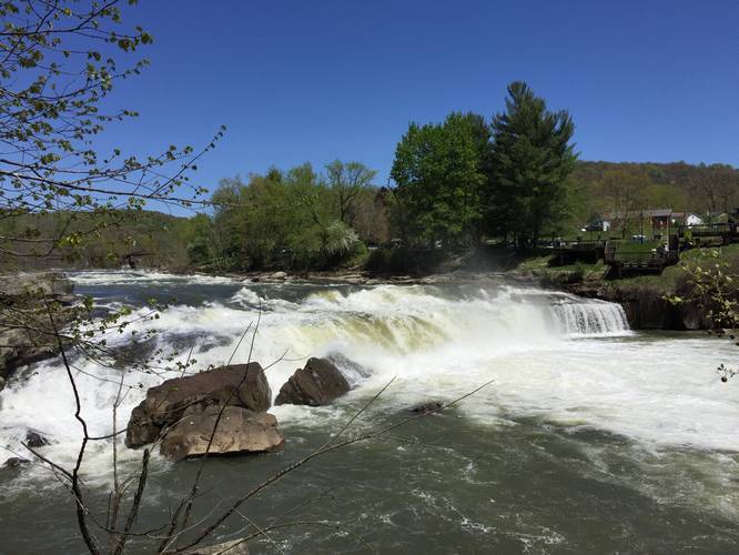
Hiking further south there are a couple of additional lookout points with one lookout point having an even better view of Ohiopyle Falls than earlier. After the last lookout point, you won't get many more views of the river, but the remainder of the trail is mostly-flat and really nice.
The trail will wrap around the southern peninsula of the Ferncliff Natural Area before heading back north along the west side. There is one more small lookout point along the west side of the trail, but the view is not as spectacular as the Ohiopyle Falls lookout points. Once you reach the northern side of the trail, you'll find the bike trail heading over the trail and there's a staircase that heads uphill on your right-hand side -- take this staircase to stay along the Ferncliff Trail. Follow this back to the parking lot.
Dogs are allowed on this trail.
This trail begins at the main parking lot for the bike trail at Ohiopyle State Park and heads directly into the Ferncliff Natural Area before heading south along the Ferncliff Trail. Shortly after the trail reaches the banks of the Youghiogheny River, you'll begin to hike over large, mostly-flat, bedrock. You can even find fossilized plants within the riverbank bedrock.
Follow the riverbank bedrock until you reach Ohiopyle Falls. At Ohiopyle Falls, you'll get an amazing view directly next to the waterfall before continuing along the trail. After visiting Ohiopyle Falls, the trail heads back into the woods and can be difficult to spot -- look to the right-hand side of where the cliff ends next to the riverbank and you'll spot the trail.
Hiking further south there are a couple of additional lookout points with one lookout point having an even better view of Ohiopyle Falls than earlier. After the last lookout point, you won't get many more views of the river, but the remainder of the trail is mostly-flat and really nice.
The trail will wrap around the southern peninsula of the Ferncliff Natural Area before heading back north along the west side. There is one more small lookout point along the west side of the trail, but the view is not as spectacular as the Ohiopyle Falls lookout points. Once you reach the northern side of the trail, you'll find the bike trail heading over the trail and there's a staircase that heads uphill on your right-hand side -- take this staircase to stay along the Ferncliff Trail. Follow this back to the parking lot.
Dogs are allowed on this trail.