The Fall Brook Waterfalls Loop hike at Salt Springs State Park near Montrose, Pennsylvania is a popular, scenic loop that features several waterfalls, fishing pools, rock formations, and a salt spring for visitors to explore.
The Gorge Trail heads uphill along a difficult / steep elevation grade for 0.1 miles (~530 feet) before the trail levels out for easier hiking. An alternative route leads hikers up the nearby road, bypassing the Gorge Trail trailhead, to follow an easier path.
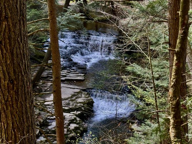
After the trail levels out, it passes through a hemlock forest before reaching a viewpoint of Upper Fall Brook Falls near mile 0.16.
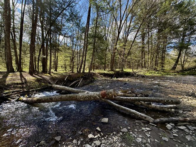
The Wetland Trail (blue blazes) follows a flat forest path, passing Fall Brook and hillside views along the way. You'll find flowering apple trees and wetland wildflowers during spring time. Near mile 0.95 sits the Fall Brook creek crossing where you'll either get your feet wet or balance your way across fallen trees to reach the Fall Brook Trail.
Once on the red blazed Fall Brook Trail, you'll hike south through the forest to reach Buckley Road once more. Not much to see along the Fall Brook Trail outside of a couple of muddy, but skinny creek crossings.
Located further down the boardwalk sits Penny Rock, near mile 1.85. Penny Rock is exactly what it sounds like—a rock formation (likely of shale)—where visitors of yesteryear have stuck bent pennies into the crevasses between the shale slabs. Penny Rock is a fun and weird place to take a break along the hike to appreciate just how many people have left their mark on this rock.
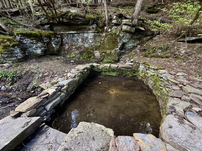
The Hemlock Trail leads back down the gorge along a moderate grade before it reaches the Hardwood Trail where you'll wrap up the hike, but along the way you'll find one of the salt springs from where the park gets its name. Near mile 2.05 sits a salt spring with bubbling water and an information kiosk where you can learn more about how indigenous people used these salt springs along their hunting expeditions long ago.
The hike finally wraps up back at the parking lot at mile 2.1.
Slippery rocks: Some of the nicest views along Fall Brook Gorge sit on slippery shale rock. If walking on these rocks, use extra caution.
Creek crossing: If hiking the southern end of the loop hike, you'll need to cross Fall Brook without any bridge access.
Exploring the Salt Springs Gorge & Waterfalls
This hike starts out along the Gorge Trail, which can be found on the south side of the main parking area. Before heading up the Gorge Trail, you'll find a nice view of Lower Fall Brook Falls from the northern terminus of the gorge. If you have extra time, it's worth hiking up Fall Brook to reach the base of Lower Fall Brook Falls for the best view, but watch your step on the slippery rocks especially when wet.The Gorge Trail heads uphill along a difficult / steep elevation grade for 0.1 miles (~530 feet) before the trail levels out for easier hiking. An alternative route leads hikers up the nearby road, bypassing the Gorge Trail trailhead, to follow an easier path.
After the trail levels out, it passes through a hemlock forest before reaching a viewpoint of Upper Fall Brook Falls near mile 0.16.
Upper Fall Brook Falls - Mile 0.25
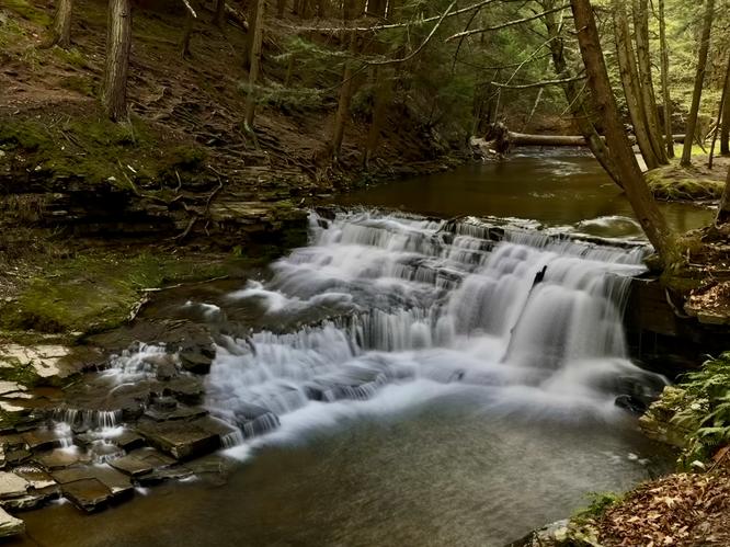
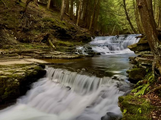
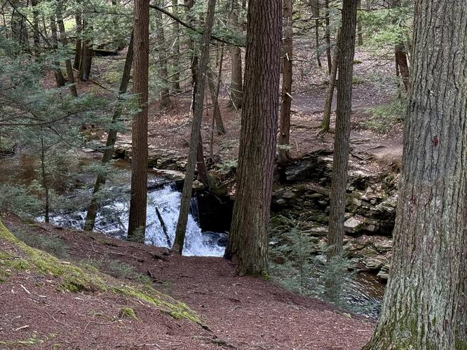
Once the trail passes the viewpoint, it heads down a hillside to reach the top of two waterfalls that form Upper Fall Brook Falls. Each waterfall is approximately 5 - 6 feet tall, but span the creek bed, forming a beautiful downstream view. For those who like to head off the beaten path, you can (carefully) make your way along the slick shale bed rock to reach a nice view of both waterfalls from the edge of the creek. Watch your step along the slippery rocks.Meadows / Creek Views / Fishing Hole - Mile 0.25 to 0.45
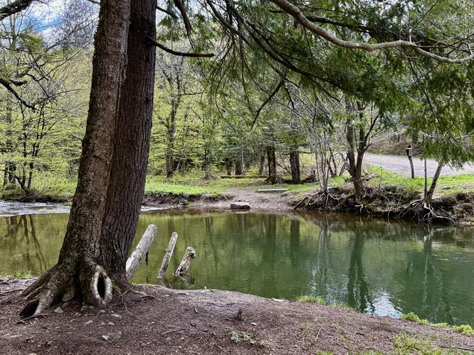
After passing Upper Fall Brook Falls, the Gorge Trail leads away from the gorge of Salt Springs State Park and passes through an open meadow with pasture and hillside views. The trail then tucks back into the forest as it runs alongside Fall Brook's shallow trickling water as it flows downhill toward the gorge. Just before reaching the Buckley Road crossing, the trail passes a popular fishing hole in Fall Brook.Wetlands Trail & Fall Brook Trail - Mile 0.45 to 1.45
After crossing Buckley Road, hikers will technically leave Salt Springs State Park to enter publicly-accessible land owned by the Friends of Salt Springs. Warning: if you plan to hike this entire loop, including these two trails, you'll need to get your feet wet by crossing Fall Brook or scurry across fallen trees, keeping your balance, to cross the creek because there's no footbridge! Not interested in the creek crossing? Simply use Buckley Road for a shorter loop hike.The Wetland Trail (blue blazes) follows a flat forest path, passing Fall Brook and hillside views along the way. You'll find flowering apple trees and wetland wildflowers during spring time. Near mile 0.95 sits the Fall Brook creek crossing where you'll either get your feet wet or balance your way across fallen trees to reach the Fall Brook Trail.
Once on the red blazed Fall Brook Trail, you'll hike south through the forest to reach Buckley Road once more. Not much to see along the Fall Brook Trail outside of a couple of muddy, but skinny creek crossings.
Waterfalls / Penny Rock / Salt Spring - Mile 1.45 to 2.1
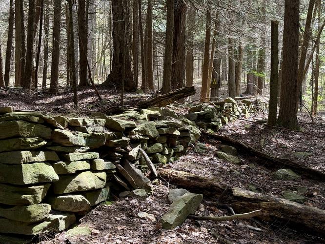
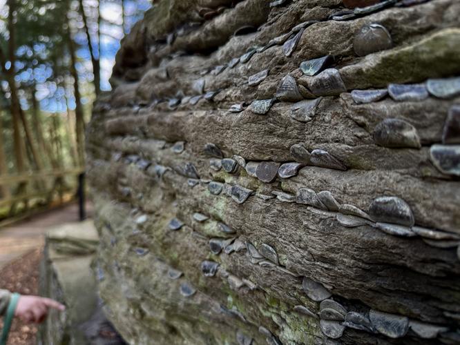
Once you cross Buckley Road, you'll follow the Fall Brook Trail as it passes the fishing hole once more before following alongside the scenic Fall Brook creek. The hike then follows the Hemlock Trail (white blazes) where it passes through an old growth Eastern Hemlock forest with trees that date back ~300 years with the oldest at 600 years old. At mile 1.75 sits a boardwalk vista point above Upper Fall Brook Falls. While the view here is not as nice as the waterfall view at mile 0.25, it's a nice way to view the upper-most waterfall from a different perspective.Located further down the boardwalk sits Penny Rock, near mile 1.85. Penny Rock is exactly what it sounds like—a rock formation (likely of shale)—where visitors of yesteryear have stuck bent pennies into the crevasses between the shale slabs. Penny Rock is a fun and weird place to take a break along the hike to appreciate just how many people have left their mark on this rock.
The Hemlock Trail leads back down the gorge along a moderate grade before it reaches the Hardwood Trail where you'll wrap up the hike, but along the way you'll find one of the salt springs from where the park gets its name. Near mile 2.05 sits a salt spring with bubbling water and an information kiosk where you can learn more about how indigenous people used these salt springs along their hunting expeditions long ago.
The hike finally wraps up back at the parking lot at mile 2.1.
Parking
Hikers will find a medium-sized parking lot at the coordinates provided (41.911647, -75.865432) in Montrose, PA. The parking lot can fit approximately 20 cars (or less) and fills up by noon during the summer.Restrooms
Located at the parking lot are pit toilets and hand sanitizer.Pets
Dogs are allowed only if leashed and must be cleaned up after.Warning
Steep slopes: The Gorge Trail passes steep slopes with plummeting drops into Fall Brook Gorge. Watch your step and keep back from ledges and loose soil slopes.Slippery rocks: Some of the nicest views along Fall Brook Gorge sit on slippery shale rock. If walking on these rocks, use extra caution.
Creek crossing: If hiking the southern end of the loop hike, you'll need to cross Fall Brook without any bridge access.