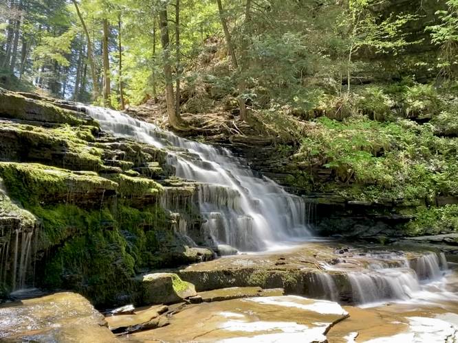
Lower Fall Brook Falls at Salt Springs State Park near Montrose, Pennsylvania is an easy 0.3-mile out-and-back hike that leads to the 13-foot waterfall Lower Fall Brook Falls.
Hike Description
This hike begins at the main entrance road to Salt Springs State Park, adjacent to the Gorge Trail trailhead. Hikers will head down the steep embankment of Fall Brook and then hike up the creek. Hikers have formed somewhat of a slate rock hillside trail that meanders its way up the western side of Fall Brook; however, the path is not completely flat, is often slippery and wet. The walking isn't difficult, but watch your step and always look for the flattest section of rock you can find to reduce risk of slipping or injury.
Lower Fall Brook Falls - Mile 0.15
Hikers will make it to the base of Lower Fall Brook Falls around mile 0.15. Here, you can sit and enjoy the waterfall as it tumbles down a ~13-foot tall shale bedrock ledge.
Parking
Hikers will find a large parking lot at the coordinates provided. The lot is large enough to fit a couple dozen vehicles.
Pets
Dogs are allowed only if leashed and must be cleaned up after.
Warning
Shale rock creek path: This hike follows an unofficial trail that leads up along a shale rock hillside that sits adjacent to Fall Brook. The rock can often be wet and slippery with seldom flat sections to step on - watch your step. Note that it's not smart to follow this path if the water level is high or rushing.