The Escarpment Trail to Vista hike at Porcupine Mountains Wilderness State Park near Ontonagon, Michigan is a moderate 1.9-mile out-and-back trail that leads to several views of the Big Carp River and the Porcupine Mountains along the way in addition to a stunning vista of the Lake of the Clouds.
Hike Description
This hike begins at the Lake of the Clouds Overlook and follows the blue blazes of the Escarpment Trail east as it traverses a northern mountain ridge along the Lake of the Clouds / Big Carp River.
Off-Trail Vista - Mile 0.11
After the hiker descends the first series of stairs, they'll reach a turn in the trail. Here is a small off-trail path that leads out to a rocky ledge in the mountains and provides hikers will some nice views of the Lake of the Clouds and the Porcupine Mountain range. The vista is located around mile 0.14.
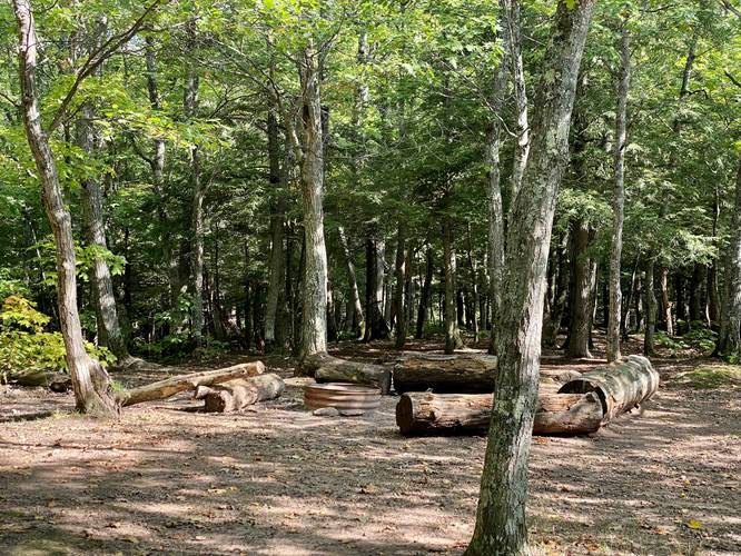
Campsite (Permit Required) - Mile 0.28
After returning to the trail, hikers will continue onward until reaching a campsite (permit required) around mile 0.28. At this point, the trail will be heading back uphill at a moderate grade.
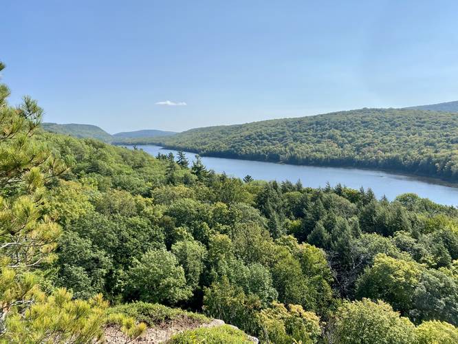
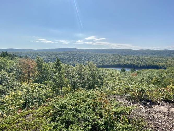
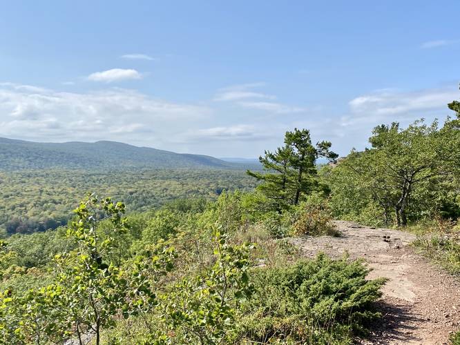
Vistas - Mile 0.54 - 0.6
Between miles 0.54 and 0.6, hikers will find a couple of spots off-trail that provide more views of the Big Carp River and the Porcupine Mountains; however, the Lake of the Clouds will be out of view at this point.
Big Carp River Vista - Mile 0.9
Around mile 0.9, hikers will find yet another bald spot on the mountain ridge that provides some views. They aren't stunning, but provide addition views of the Big Carp River. Just after passing this vista, the trail will lead through a pine forest before the main destination for this hike finally reveals itself - the Lake of the Clouds Vista.
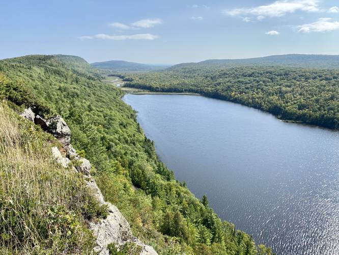
Lake of the Clouds Vista - Mile 1
At mile 1, where this recording ends, lies the stunning panoramic vista of the Lake of the Clouds and Big Carp River as it snakes its way east from the lake. This spot is a great place to hang out and relax; however, the sun exposure here is pretty bad. There are not many place to sit and enjoy the view without the sun beating down on you. Views from the rock ledges make for great pictures as well, but watch your steps.
Hiking Out
The hike out follows the opposite hike in and is not very difficult; however, considering the elevation gain, the hike should be considered moderate for most hikers. By skipping most of the off-trail vistas on the way out, the hike is also shortened slightly to just under 1-mile, making it a 1.9-mile out-and-back.
Parking & Fees
Visitors will find a very large parking lot at the coordinates provided that can fit several dozen vehicles. As of September 2022, there's a $10 entrance fee.
Pets
Dogs are allowed if leashed and their waste must be carried out by the hiker.
Warnings
Ledges: For those willing to venture away from the stone wall on the eastern side of the overlook to get a better view (away from the crowds), it's best to stay far away from the rock ledges since falling here would likely cause serious injury if not instant death.
No water: This trail has no water, so it's best to carry in at least 1 liter / 32oz of water per person just in case.
Camping & Backpacking
Permits are required to camp at any campsite along this trail. Please inquire at the state park office for more information on backcountry camping permits.
Hike Description
This hike begins at the Lake of the Clouds Overlook and follows the blue blazes of the Escarpment Trail east as it traverses a northern mountain ridge along the Lake of the Clouds / Big Carp River.
Off-Trail Vista - Mile 0.11
After the hiker descends the first series of stairs, they'll reach a turn in the trail. Here is a small off-trail path that leads out to a rocky ledge in the mountains and provides hikers will some nice views of the Lake of the Clouds and the Porcupine Mountain range. The vista is located around mile 0.14.
Campsite (Permit Required) - Mile 0.28
After returning to the trail, hikers will continue onward until reaching a campsite (permit required) around mile 0.28. At this point, the trail will be heading back uphill at a moderate grade.
Vistas - Mile 0.54 - 0.6
Between miles 0.54 and 0.6, hikers will find a couple of spots off-trail that provide more views of the Big Carp River and the Porcupine Mountains; however, the Lake of the Clouds will be out of view at this point.
Big Carp River Vista - Mile 0.9
Around mile 0.9, hikers will find yet another bald spot on the mountain ridge that provides some views. They aren't stunning, but provide addition views of the Big Carp River. Just after passing this vista, the trail will lead through a pine forest before the main destination for this hike finally reveals itself - the Lake of the Clouds Vista.
Lake of the Clouds Vista - Mile 1
At mile 1, where this recording ends, lies the stunning panoramic vista of the Lake of the Clouds and Big Carp River as it snakes its way east from the lake. This spot is a great place to hang out and relax; however, the sun exposure here is pretty bad. There are not many place to sit and enjoy the view without the sun beating down on you. Views from the rock ledges make for great pictures as well, but watch your steps.
Hiking Out
The hike out follows the opposite hike in and is not very difficult; however, considering the elevation gain, the hike should be considered moderate for most hikers. By skipping most of the off-trail vistas on the way out, the hike is also shortened slightly to just under 1-mile, making it a 1.9-mile out-and-back.
Parking & Fees
Visitors will find a very large parking lot at the coordinates provided that can fit several dozen vehicles. As of September 2022, there's a $10 entrance fee.
Pets
Dogs are allowed if leashed and their waste must be carried out by the hiker.
Warnings
Ledges: For those willing to venture away from the stone wall on the eastern side of the overlook to get a better view (away from the crowds), it's best to stay far away from the rock ledges since falling here would likely cause serious injury if not instant death.
No water: This trail has no water, so it's best to carry in at least 1 liter / 32oz of water per person just in case.
Camping & Backpacking
Permits are required to camp at any campsite along this trail. Please inquire at the state park office for more information on backcountry camping permits.