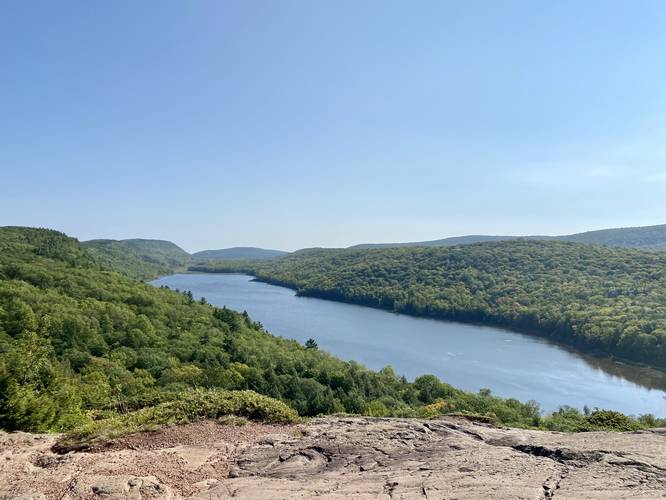
The Lake of the Clouds Overlook at Porcupine Mountains Wilderness State Park near Ontonagon, Michigan is an easy 0.2-mile out-and-back universal access trail that leads to the stunning overlook above Lake of the Clouds.
Hike Description
Note that this is less of a hike and more of a walk that leads out to the most popular overlook above Lake of the Clouds within the Porcupine Mountains. The trail is universally accessible as of September, 2022 with a ramp that leads up from the parking lot. The paved trail leads uphill to the overlook. Note that the track provided includes a non-accessible route once the visitor reaches the bedrock of the mountain; however, the accessible overlook can be found just to the west of the first sighting of bedrock.
The Lake of the Clouds is unique geological feature for the area as it sits ~450-feet above Lake Superior within the heart of the Porcupine Mountains.
Highly-Trafficked
This scenic overlook is one of the higher trafficked trails in the area, so expect a crowd unless you show up when the park opens. During peak foliage, the park can be overloaded with visitors (hence the large parking lot), so plan accordingly.
Parking & Fees
Visitors will find a very large parking lot at the coordinates provided that can fit several dozen vehicles. As of September 2022, there's a $10 entrance fee.
Pets
Dogs are allowed if leashed and their waste must be carried out by the hiker.
Warnings
Ledges: For those willing to venture away from the stone wall on the eastern side of the overlook to get a better view (away from the crowds), it's best to stay far away from the rock ledges since falling here would likely cause serious injury if not instant death.