Loading...

Distance:
0.2 Miles / 0.3 km
Type:
Out-and-Back
Difficulty:
Easy
Time to Hike:
~6 minutes
Features:
Surface Type:
Dirt
Park:
Erie Bluffs State Park
Town:
Lake City, Pennsylvania
Directions:
42.023052, -80.374819
Added:
March 04, 2018
Updated:
June 12, 2018
Loading...
Loading...
35 '

Total Change
11 '

Ascent
11 '

Descent

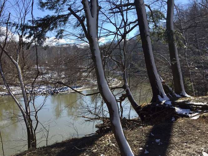
The Fisherman's Foot Path at Erie Bluffs State Park in Lake City, Pennsylvnia is an easy 0.2 mile out-and-back trail that leads from the eastern end of the Bluffs Edge Trail and runs between Elk Creek and Lake Erie before ending along the shoreline of Lake Erie.

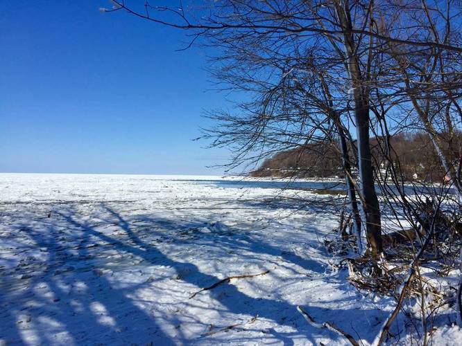
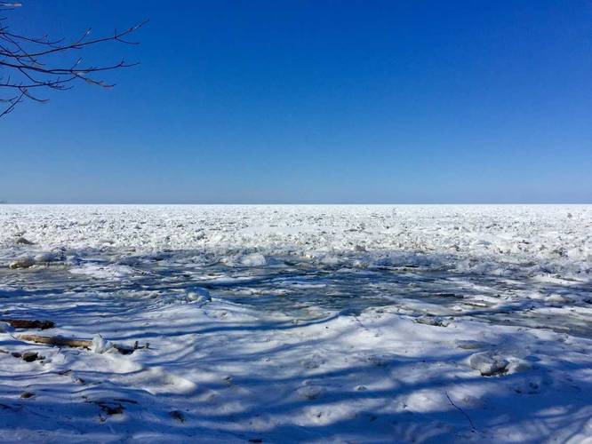
This trail is very short but worth the views of Lake Erie, Elk Creek, and The Mouth (where Elk Creek feeds into Erie). It's also a very popular fishing spot, hence the trail name.

The eastern portion of the trail heads downhill before reaching the shoreline and this hill is fairly steep so watch your step. Dogs are allowed on this trail.

Note: as of early March 2018, there's a large tree that's blocking the last section of this trail where it leads down to the shoreline. You can likely find a way around the tree, but the park will also likely clear this up by the Spring.

Explore 7 trails near Lake City, PA
  1. Parking

    42.023052, -80.374819
  2. Main Trailhead

    42.023052, -80.374819
  3. View of Elk Creek

    42.023175, -80.374267
    View of Elk Creek
  4. View of Lake Erie from the shore

    42.024156, -80.373719
    View of Lake Erie from the shore
  5. View of Lake Erie from the shore

    42.024147, -80.373711
    View of Lake Erie from the shore
No community routes found. To add your own hike as a Community Route for this Trail guide, leave a Trip Report with an attached GPX file.

Hazards

Ticks - Lyme Disease More Info (CDC)

Seasons

All

Weather Forecast

In Lake City, PA

Explore Hiking Trails

New Hikes

Gorge Trail (Stony Brook)
0.8 Miles
1.3 km
Moderate
One-Way
Lower Stony Brook Falls
0.2 Miles
0.3 km
Easy
Out-and-Back
Hidden Valley Creek Trail
0.3 Miles
0.5 km
Easy
Out-and-Back
Alluvial Fan (East) Waterfall
0.4 Miles
0.6 km
Easy
Out-and-Back

Before you boogie...

Find our trail guides useful? Consider becoming a Supporter to unlock perks!

MyHikes is an indie platform that makes exploring public trails easier for everyone. The platform has no investors, runs no ads, and is owned and operated by one person, Dave Miller. Dave has personally mapped and written over 1,600 trail guides on MyHikes for the public to explore. As of 2024, MyHikes has helped over 1,300,000 outdoor enthusiasts plan their next adventure.

But it takes a lot of time 🕦, money 💰, and work, and espresso shots ☕ to run MyHikes, including hiking , mapping , writing , and publishing new trails with high-quality (accurate) information... along with software engineering (coding) the platform like building new features, site and mobile app development for iOS and Android, site maintainance . and much much more.

Supporters unlock website and mobile app perks with an annual one-time payment of $25 (you renew) 😎👍. Or you can simply make a Donation of your choice. Otherwise, you can support us by telling your friends about MyHikes - both quick and free 🎉

Admin user profile picture

Dave Miller
MyHikes Founder