Bluffs Edge Trail
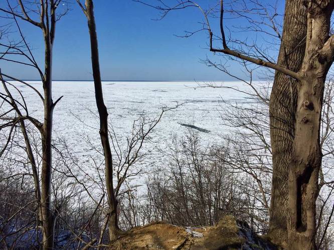
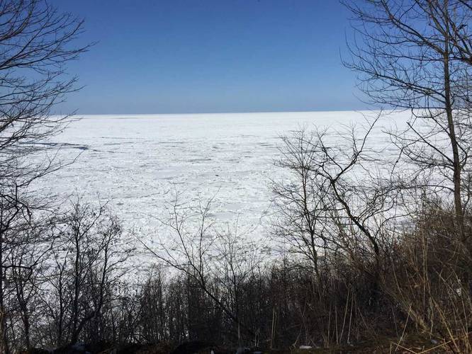
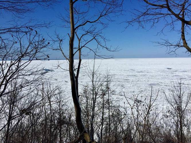
You'll find one lookout point just before the first right-hand turn before getting to the main lookout, about halfway through the hike. The trail slopes downhill on the eastern portion of the hike to lead to the Fisherman's Foot Path and the Wildflower Way Trail.
Dogs are allowed on this trail.
Know Before You Go
Interactive topographic map for Bluffs Edge Trail located in Lake City, PA. Click the "View Map" button to load GPS coordinates and trail markers.
View map
Get directions
- Distance
- 0.4 mi
- Difficulty
- Easy
- Type
- One-Way
- Est. Time
- 12 min
- Elev. Gain
- 20'
- Rating
- 0.0
- Added
- March 04, 2018
- Updated
- June 12, 2018
Weather Forecast
Don't let Google decide who you trust.


Loading...
<strong>Trail map and elevation chart not rendering in print mode?</strong> Simply scroll to the trail map section, then try printing again!
Total Change
75 ft.
23 m
23 m
Ascent
20 ft.
6 m
6 m
Descent
88 ft.
27 m
27 m
Loading...
Features
- Vista / Lookout Point
- Dogs
Points of interest
-
Parking
42.020426, -80.378281 -
Main Trailhead
42.020426, -80.378281 -
Vista of Lake Erie
42.021286, -80.379081 -
Vista of Lake Erie
42.021561, -80.378686
-
Parking
42.020426, -80.378281 -
Main Trailhead
42.020426, -80.378281
Safety information
For your own safety: plan ahead, let someone know where you'll be, and hike at your own risk.
Markers
Blaze Color
Yellow
e5e500
Availability
All seasons
Surface type
Dirt
Trip Reports (Reviews)
Ready to help fellow hikers? Add a trip report to share your experience!
No community routes found. To add your own hike as a Community Route for this Trail guide, leave a Trip Report with an attached GPX file.


You may also like

Explore
Pennsylvania's Grand Canyon
Explore Pennsylvania's Grand Canyon, officially named Pine Creek Gorge, including hiking trails, vistas, overlooks, waterfalls, backcountry campsites, backpacking trails.

Explore
New York's Best Waterfalls
Whether you're planning a day hike, roadside stop, or a leisurely short walk, this guide provides hikers, travelers, and locals alike with 63 different locations to over 100 scenic waterfalls to help plan your next adventure!

Explore
25 Best Day Hikes in West Virginia
Discover 25 of the best day hikes in West Virginia, from scenic overlooks to wilderness trails—perfect for every level of hiker.

Explore
Best of the Alps: Hiking, Adventure & Scenery
Plan your ultimate European Alps adventure! Discover the best hiking trails, epic scenery, and villages in the Swiss Alps, Dolomites, Chamonix, and Lake Como.
erie bluffs state park

