Loading...

🎉 Find content tailored to you in the For You tab! Learn More.

Thundermountain Equestrian Trail

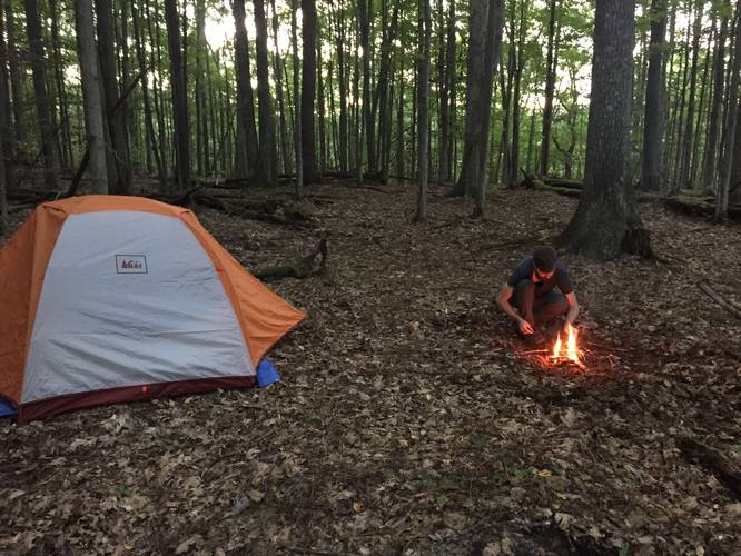
Thundermountain Equestrian Trail at Elk State Forest near Dents Run, Pennsylvania is a moderate backpacking trail that leads into the wilderness of Elk State Forest. The trail itself is much longer than the reported 1.2 mile out-and-back distance here, but we only hiked a small portion of this trail before setting up camp to test out some new gear. The trail is lightly-trafficked and is not very popular, but you may see other backpackers or horseback riders along the trail from time to time, especially during warmer months.

Wild elk are present in these woods and we did hear a male elk bugling at night near out campsite. Unfortunately we did not venture far enough to find any views or lookout points, but this is a great backpacking trail for north-central Pennsylvania.

Parking
Parking is located near the coordinates provided, just down the street from the trailhead.

Pets
Dogs are allowed if leashed and their waste should be carried out by the hiker.

Camping and Backpacking
Backpacking is allowed on this trail. Please follow all Elk State Forest rules and regulations when dispersed / primitive / backcountry camping.
Explore 58 trails near Dents Run, PA

Know Before You Go

  • Thundermountain Equestrian Trail in Elk State Forest (Dents Run, PA) is a lightly-trafficked backpacking trail, longer than the 1.2-mile segment described.
  • Expect to encounter wildlife like elk, and possibly other backpackers or horseback riders.
  • Leashed dogs are permitted, and backpacking is allowed, following Elk State Forest regulations.
Interactive topographic map for Thundermountain Equestrian Trail located in Dents Run, PA. Click the "View Map" button to load GPS coordinates and trail markers.
Get directions
Distance
1.2 mi
Difficulty
Moderate
Type
Out-and-Back
Est. Time
36 min
Elev. Gain
452'
Rating
0.0
Added
September 13, 2015
Updated
July 29, 2023

Weather Forecast

Loading...
Total Change
357'
Ascent
452'
Descent
448'
Loading...

Download the GPX Data for Offline Use

Supporters get exclusive access to download trail routes to the MyHikes app for offline use. Stay prepared on your adventure, even without an internet connection! Become a Supporter today to unlock this feature and hike with confidence.

Download Thundermountain Equestrian Trail GPX Data to the MyHikes Mobile App

Features

Dogs
Camping
PA Wilds logo PA Wilds

Points of interest

  1. Parking

    41.401661, -78.295551
  2. Main Trailhead

    41.401233, -78.298454

Safety information

For your own safety: plan ahead, let someone know where you'll be, and hike at your own risk.

Availability

Summer

Surface type

Dirt

Trip Reports (Reviews)

Your opinion matters! Be the first to rate this trail.

Ready to help fellow hikers? Add a trip report to share your experience and provide valuable insights for other hikers!

2.0 miles / 3.2 km
August 22, 2015
First ever camping trip with Jax.
Camping Dogs Hiking
No community routes found. To add your own hike as a Community Route for this Trail guide, leave a Trip Report with an attached GPX file.

Popular categories

Scenic mountain view representing vista trails
Vista trails
Scenic gorge of cascades representing waterfall trails
Waterfall hikes
Rugged mountain terrain representing summit trails
Summit trails
Scenic mountain view representing dog-friendly trails
Dog-friendly
Scenic campsite with a view representing camping trails
Camping trails
Appalachian Trail logo representing A.T. hikes
A.T. hikes

You May Also Like

New York's Best Waterfalls - Whether you're planning a day hike, roadside stop, or a leisurely short walk, this guide provides hikers, travelers, and locals alike with 63 different locations to over 100 scenic waterfalls to help plan your next adventure!
Explore

New York's Best Waterfalls

Whether you're planning a day hike, roadside stop, or a leisurely short walk, this guide provides hikers, travelers, and locals alike with 63 different locations to over 100 scenic waterfalls to help plan your next adventure!

Read
🍪 We use cookies to learn about site usage and to serve map tiles. You may block cookies manually in the browser. By continuing you agree. Learn more