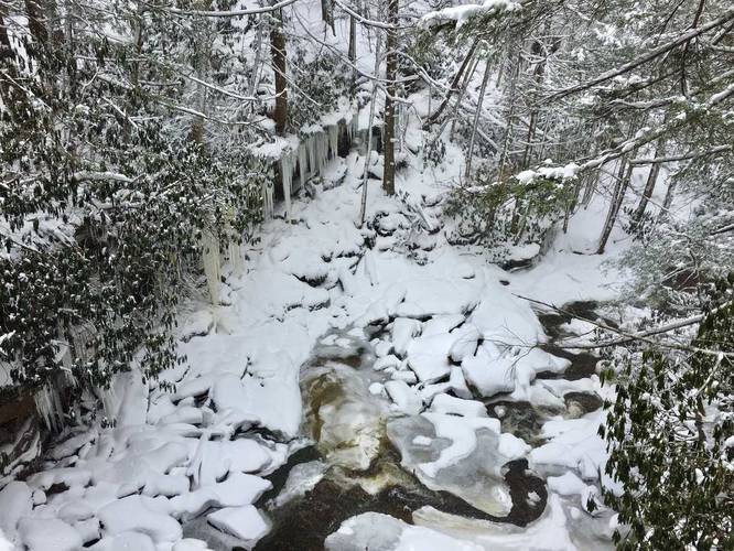
The Elakala Trail at Blackwater Falls State Park is a short 0.6 mile out-and-back trail that leads from the Blackwater Falls Lodge to Elakala Falls and back to Blackwater Lodge Road. The trail starts on the southern side of the parking lot next to Blackwater Lodge and heads gradually downhill to Elakala Falls.
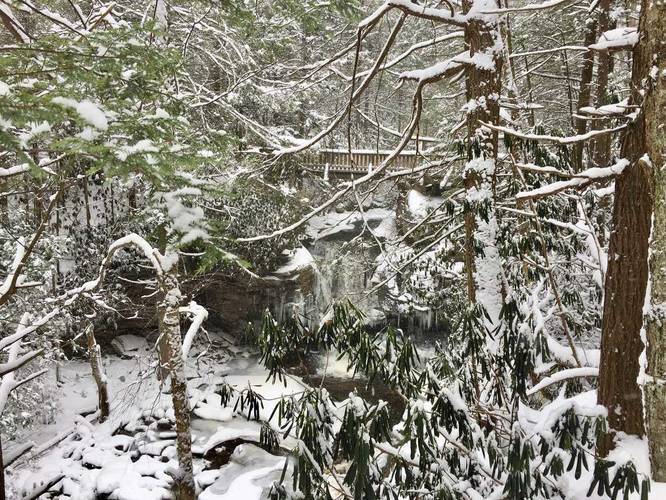
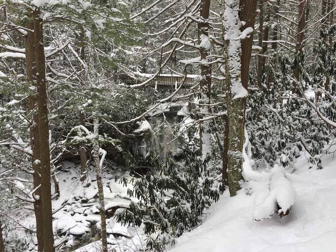
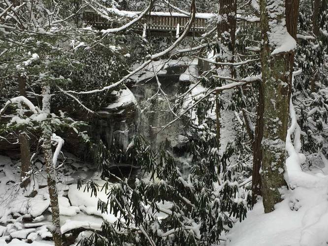
Elakala Falls is technically a series of four waterfalls; however, the first waterfall is the only one you can see from this trail and is 35 feet tall. Elakala is the 2nd most popular waterfall in the park, thus making this a really popular trail during warmer months. The trail sits directly next to the Blackwater Lodge, so if you're staying at the lodge, this trail is a must-do.
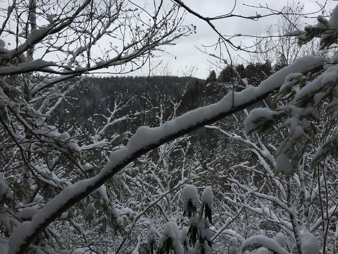
Lookout Points: Just beyond Elakala Falls are a few lookout points into the Blackwater Canyon below; however, these lookout points aren't all that interesting. You can only see glimpses of the hills across the canyon.
Trail Length: Listed here is 0.6 miles to cover a 'true-thru hike' of the trail, but this hike can be anywhere from 0.2 miles to 0.6 really. If you just want to see Elakala Falls, you can hike down to the viewing area, and hike back up to the parking lot. If you plan to see more of the trail and take it all the way to the road, you'll end up hiking about 0.6 miles back to parking - either by road or back on the trail.
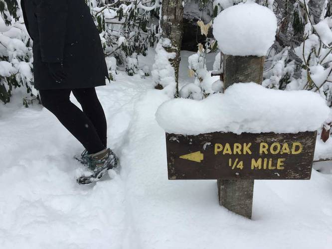
Note: The GPS for this data does not follow the Elakala Trail 100% near the end - we ended up taking a left-hand turn at the sign that says "Park Road 1/4 Mile"; however, this trail does continue on for about 0.2 to 0.3 miles beyond that sign. If you continue following the trail, to the right, it end at Blackwater Lodge Road, but slightly further west than where this ends.
Elakala Falls is technically a series of four waterfalls; however, the first waterfall is the only one you can see from this trail and is 35 feet tall. Elakala is the 2nd most popular waterfall in the park, thus making this a really popular trail during warmer months. The trail sits directly next to the Blackwater Lodge, so if you're staying at the lodge, this trail is a must-do.
Lookout Points: Just beyond Elakala Falls are a few lookout points into the Blackwater Canyon below; however, these lookout points aren't all that interesting. You can only see glimpses of the hills across the canyon.
Trail Length: Listed here is 0.6 miles to cover a 'true-thru hike' of the trail, but this hike can be anywhere from 0.2 miles to 0.6 really. If you just want to see Elakala Falls, you can hike down to the viewing area, and hike back up to the parking lot. If you plan to see more of the trail and take it all the way to the road, you'll end up hiking about 0.6 miles back to parking - either by road or back on the trail.
Note: The GPS for this data does not follow the Elakala Trail 100% near the end - we ended up taking a left-hand turn at the sign that says "Park Road 1/4 Mile"; however, this trail does continue on for about 0.2 to 0.3 miles beyond that sign. If you continue following the trail, to the right, it end at Blackwater Lodge Road, but slightly further west than where this ends.