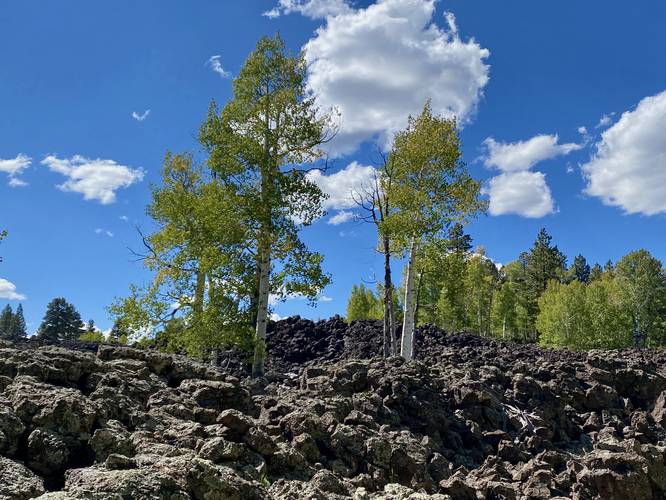
The Duck Creek Lava Flats at Dixie National Forest near Duck Creek Village, Utah is an easy 0.1-mile out-and-back walk that leads to a Birch Tree-filled black rock lava field.
This is not a hike but rather a short out-and-back walk that brings hikers through the Lava Flats Designated Dispersed Camping Area within Dixie National Forest to reach the oddity that is the mountain top lava field. Hikers will find plenty of Birch Trees growing through the dark black lava rock field where their white and black bark stands out. During Autumn, these Birch Trees bright yellow foliage adds to the scenery.
Parking
Hikers will find a large parking lot at the coordinates provided.
Pets
Dogs are allowed if leashed and should be cleaned up after.
Warning
Rattlesnakes: Utah is home to several different types of rattlesnakes. Due to the crags, crevasse, holes, tunnels, and caves in the lava rock there's a good chance that rattlesnakes live nearby. Be on the lookout for rattlers and if found, give them plenty of space.
Sun exposure: Hikers should be prepared when hiking in full desert sun exposure with minimal shade. Bring 1 gallon of water per hiker per day to hike in this desert ecosystem. Hiking in the early morning or evening helps reduce the risks of sun exposure.