Loading...

🎉 Enjoy a Free 7-Day Supporter Trial and Unlock Exclusive Perks — No Credit Card Required. Learn more.

Beaver Dam Trail

Directions
Map
Pictures
Send to App
Distance:
1.4 Miles / 2.3 km
Type:
Out-and-Back
Difficulty:
Easy
Time to Hike:
~42 minutes
Features:
Surface Type:
Dirt
Park:
Monongahela National Forest
Town:
Dolly Sods Wilderness, West Virginia
Directions:
39.053096, -79.309443
Added:
August 20, 2017
Updated:
October 25, 2018
Copy Trail Link Hiking this trail? Send a friend or family member a link to this trail guide for your own safety. Hike at your own risk (disclaimer)
Loading...
Loading...
298'

Total Change
257'

Ascent
283'

Descent

Download the Trail Route for Offline Use

Supporters get exclusive access to download trail routes to the MyHikes app for offline use. Stay prepared on your adventure, even without an internet connection! Become a Supporter today to unlock this feature and hike with confidence.

Send to App

Beaver Dam Trail

The Beaver Dam Trail at Dolly Sods Wilderness, is a 1.4 mile out-and-back trail that leads from FR75 down to the Dobbin Grade Trail.

The entire trail is downhill, so the hike back isn't the easiest, but the grade isn't steep. At the end of the trail (where it meets with Dobbin Grade), you'll find Red Creek cutting through the valley for a water source.

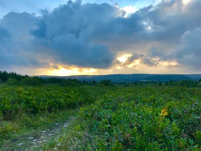
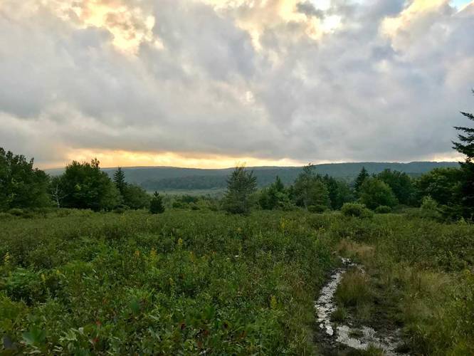
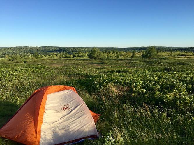
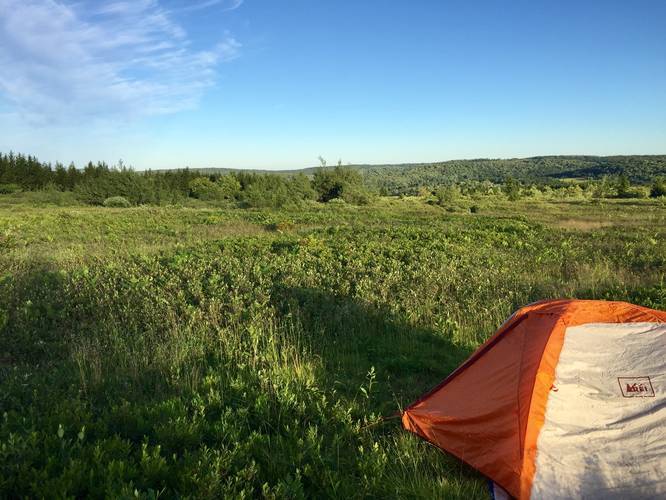
Camping: There are plenty of campsites along this trail, which make it an easy drive-up backpacking trail. Right as you head onto the trail, heading down into the Sods, you'll notice there's an open field on your right-hand side - this is a popular campsite. Halfway through the trail is yet another campsite that sites under a couple of trees on the left-hand side of the trail.

Warning: Dolly Sods was used for military bombing training during WWII and there are still unexploded ordinances in the ground out in the wilderness. Most of these trails and the areas around them have been combed and searched, but not everything has been found. If you find any strange metal objects, especially bomb-shaped, do not tamper with them. Make a note of where you found it and alert the proper authorities. More information can be found at the wilderness trailheads.

Dolly Sods trail map PDF
Explore 45 trails near Dolly Sods Wilderness, WV
  1. Parking

    39.053096, -79.309443
  2. Main Trailhead

    39.053056, -79.309595
  3. Vista of Dolly Sods Wilderness near the trailhead

    39.053239, -79.309897
    Vista of Dolly Sods Wilderness near the trailhead
  4. Vista of Dolly Sods Wilderness about half way down the trail

    39.054408, -79.316344
    Vista of Dolly Sods Wilderness about half way down the trail
  5. Campsite less than 1/10th a mile in

    39.053383, -79.310356
    Campsite less than 1/10th a mile in
No community routes found. To add your own hike as a Community Route for this Trail guide, leave a Trip Report with an attached GPX file.

Hazards

Ticks - Lyme Disease More Info (CDC)

Season

Summer

Trip Reports

Trail Guide By:
Admin user profile picture
1.4 miles / 2.3 km
0.5 miles / 0.8 km
July 06, 2018
Camping Hiking
0.5 miles / 0.8 km
July 06, 2018
Camping Hiking

Weather Forecast

In Dolly Sods Wilderness, WV

Explore Hiking Trails

You May Also Like

Colorado's Million Dollar Highway - Plan a day's drive adventure along the iconic Million Dollar Highway in Colorado. Explore the best short trails, roadside stops, waterfalls, vistas, ghost towns, and hot springs within a ~6 hour road trip.
Explore

Colorado's Million Dollar Highway

Plan a day's drive adventure along the iconic Million Dollar Highway in Colorado. Explore the best short trails, roadside stops, waterfalls, vistas, ghost towns, and hot springs within a ~6 hour road trip.

Read
New York's Best Waterfalls - Whether you're planning a day hike, roadside stop, or a leisurely short walk, this guide provides hikers, travelers, and locals alike with 63 different locations to over 100 scenic waterfalls to help plan your next adventure!
Explore

New York's Best Waterfalls

Whether you're planning a day hike, roadside stop, or a leisurely short walk, this guide provides hikers, travelers, and locals alike with 63 different locations to over 100 scenic waterfalls to help plan your next adventure!

Read

Before you boogie...

Find our trail guides useful? Consider becoming a Supporter to unlock perks!

MyHikes is an indie platform that makes exploring public trails easier for everyone. The platform has no investors, no ads, and is owned and operated by one person, Dave Miller. Dave has personally mapped and written over 1,800 trail guides on MyHikes for the public to explore. MyHikes has helped millions outdoor enthusiasts plan their next adventure.

But it takes a lot of time 🕦, money 💰, work, and espresso shots ☕ to run MyHikes, including hiking , mapping , writing , and publishing new trails with high-quality (accurate) information... along with software engineering (coding) the platform like building new features, website and mobile app development (iOS and Android), site maintainance . and much much more.

Supporters unlock website and mobile app perks with an annual one-time payment of $25 (you renew) 😎👍. Or you can simply make a Donation of your choice. Otherwise, you can support us by telling your friends about MyHikes - both quick and free 🎉

Admin user profile picture

Dave Miller
MyHikes Founder