The Dewey Hollow Trail to Summit at Tioga State Forest near Gaines, Pennsylvania is an easy 3.8-mile out-and-back hike that runs a mountain ridge out to a beautiful summit with views facing north to west.
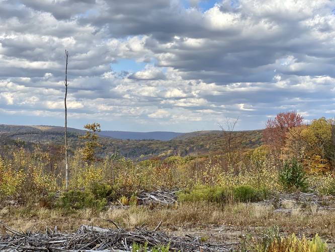
Note: These views will slowly be reclaimed by nature over time as this summit was logged in ~2015 (estimate).
This drive-able trail is only open to the public for motor vehicles during the hunting season from ~mid October through January each year. Otherwise, this trail has a closed yellow gate at the trailhead, hence foot traffic only all other times of the year. Please note that the Dewey Hollow Trail is technically a "loop" trail - this is just one section of that loop, which follows the service road portion.
Hikers will begin at the yellow gate where the trail will immediately ascend the mountain ridge. After this initial climb, the elevation gain heading up to the mountain summit is more gradual.
The trail winds the mountain ridge for 1.65-miles before reaching the return loop trail for the Dewey Hollow Trail. Continuing straight, hikers will reach the mountain summit around mile 1.9.
At the summit, as of October 2020, hikers will find beautiful views facing mostly north, northwest and west.
Parking
Hikers will find parking near the coordinates provided. The parking area in front of the gate can fit a couple of vehicles.
Pets
Dogs are allowed on this trail if leashed.
Camping and Backpacking
Backpackers will find there are no designated campsites along this trail, but due to state forest rules and regulations you can camp off-trail. Please follow all state forest rules and regulations regarding dispersed / primitive / backcountry camping.