The Denton Hill Doe Run VIsta hike at Denton Hill State Park in Ulysses, Pennsylvania is an easy 1-mile loop that follows old ski trails to a scenic vista point along the Doe Run ski trail.
Hike Description
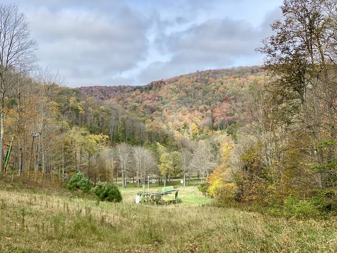
This trail starts at the main parking lot for the abandoned Denton Hill ski resort and heads toward the large green ski lift. At the ski lift, the track heads up the Elm Hollow ski trail. Our original plan was to reach the vista located at the end of the Sidewinder Trail (aka Denton Hill Lookout Trail), but a lot of these abandoned ski trails are completely overgrown during the Fall and Summer. The path we followed looked partially mowed or at least worn down by other people, likely on horseback as this is a popular horse riding area.
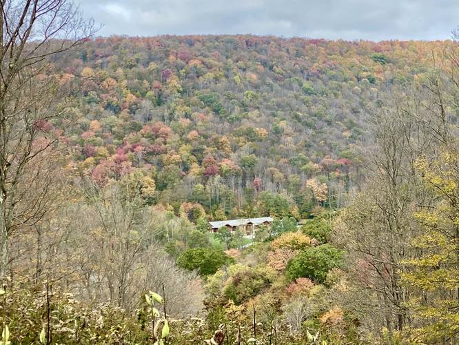
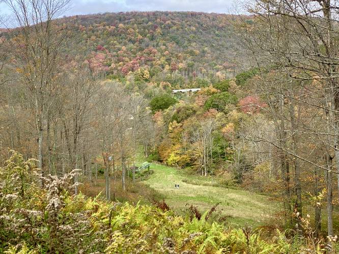
Regardless, once we reached the intersection with the Old Elm ski trail, we continued straight along the Elm Hollow ski trail before it reached a dead end of 4-foot tall overgrowth. At this point, we backtracked to a cleared unmarked trail which lead over to a junction with the Doe Run ski trail. At this junction is a really nice vista facing the Pennsylvania Logging museum down below.
From here, we followed the Doe Run ski trail downhill and over toward the ski lift area, close to what's labelled as the Buck Run ski trail. With the ski lift area totally overgrown, we then hiked through the woods to reach the Elm Hollow ski trail to reach the parking area to finish the hike.
Parking
There's a large parking lot at the coordinates provided. The lot is large enough for several dozen vehicles.
Pets
Dogs are allowed if leashed and their waste should be carried out by the hiker.
Biking
Biking is allowed along the trails at Denton Hill.
History
Denton Hill was developed as a ski resort in the 1950s and 1960s and was operated until late 2014 when the resort closed for downhill skiing. The state has a master plan for the park; however, it's unclear when the park may reopen for downhill skiiing. Until then, this is an amazing place to take a day hike and explore an abandoned ski resort. For those who are familiar with Western Massachusetts, this park reminded me a bit of the Mount Tom State Reservation that used to have a ski resort as well. Hikers will find plenty of remnants around the old ski slopes like grind pipes, wooden sign boards, and metal pipes leading up the hill that likely provided water for making snow.
Hike Description
This trail starts at the main parking lot for the abandoned Denton Hill ski resort and heads toward the large green ski lift. At the ski lift, the track heads up the Elm Hollow ski trail. Our original plan was to reach the vista located at the end of the Sidewinder Trail (aka Denton Hill Lookout Trail), but a lot of these abandoned ski trails are completely overgrown during the Fall and Summer. The path we followed looked partially mowed or at least worn down by other people, likely on horseback as this is a popular horse riding area.
Regardless, once we reached the intersection with the Old Elm ski trail, we continued straight along the Elm Hollow ski trail before it reached a dead end of 4-foot tall overgrowth. At this point, we backtracked to a cleared unmarked trail which lead over to a junction with the Doe Run ski trail. At this junction is a really nice vista facing the Pennsylvania Logging museum down below.
From here, we followed the Doe Run ski trail downhill and over toward the ski lift area, close to what's labelled as the Buck Run ski trail. With the ski lift area totally overgrown, we then hiked through the woods to reach the Elm Hollow ski trail to reach the parking area to finish the hike.
Parking
There's a large parking lot at the coordinates provided. The lot is large enough for several dozen vehicles.
Pets
Dogs are allowed if leashed and their waste should be carried out by the hiker.
Biking
Biking is allowed along the trails at Denton Hill.
History
Denton Hill was developed as a ski resort in the 1950s and 1960s and was operated until late 2014 when the resort closed for downhill skiing. The state has a master plan for the park; however, it's unclear when the park may reopen for downhill skiiing. Until then, this is an amazing place to take a day hike and explore an abandoned ski resort. For those who are familiar with Western Massachusetts, this park reminded me a bit of the Mount Tom State Reservation that used to have a ski resort as well. Hikers will find plenty of remnants around the old ski slopes like grind pipes, wooden sign boards, and metal pipes leading up the hill that likely provided water for making snow.