The Dennis Pond Trail (West Trailhead) at Dennis Pond Conservation Area in Yarmouth, Massachusetts is an easy 1-mile out-and-back hike that features several views of Dennis Pond.
Hike Description
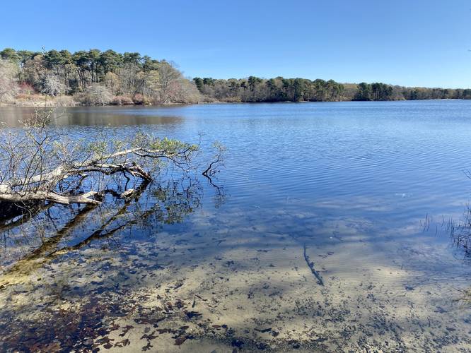
This hike begins at the western trailhead for Dennis Pond, located along Willow Street. Hikers can first stop at a small spur trail that leads down to the water, providing a view of Dennis Pond, before they hike down the red-blazed trail.
Once on the red-blazed trail, hikers will follow the edge of Dennis Pond as the trail skirts its way around the water, providing views along the way. There are several cutouts in the forest, located on-trail, where hikers can sit and enjoy the pond.
Spur Trail View - Mile 0.2
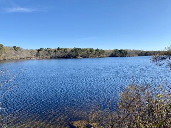
At mile 0.2 is a spur trail (if you keep left) that leads out to another view of the pond. Hikers can skip this if they wish as the views are pretty much the same as the rest of them; however, it's a nice little detour regardless.
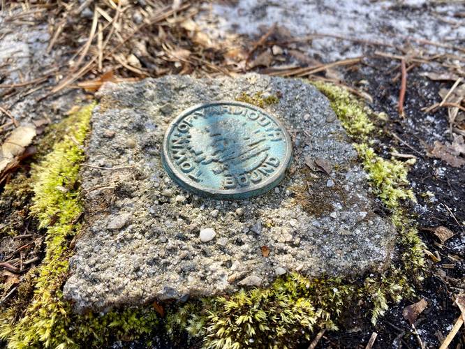
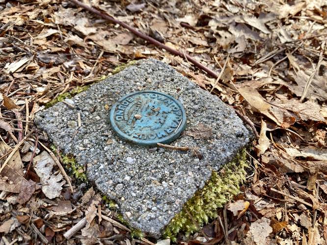
Boundary Markers - Mile 0.43 to 0.48
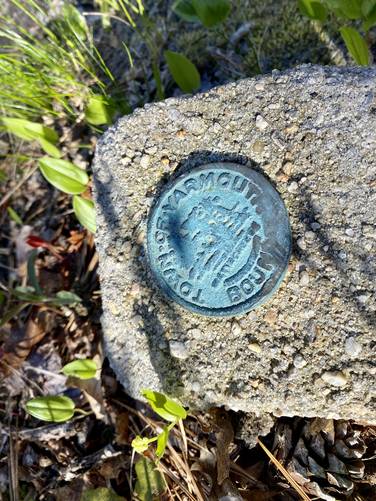
Around mile 0.43 to 0.48 are three Town of Yarmouth boundary markers that hikers can find cemented into the trail. These old boundary markers are likely outdated technology but are neat to find along the hike.
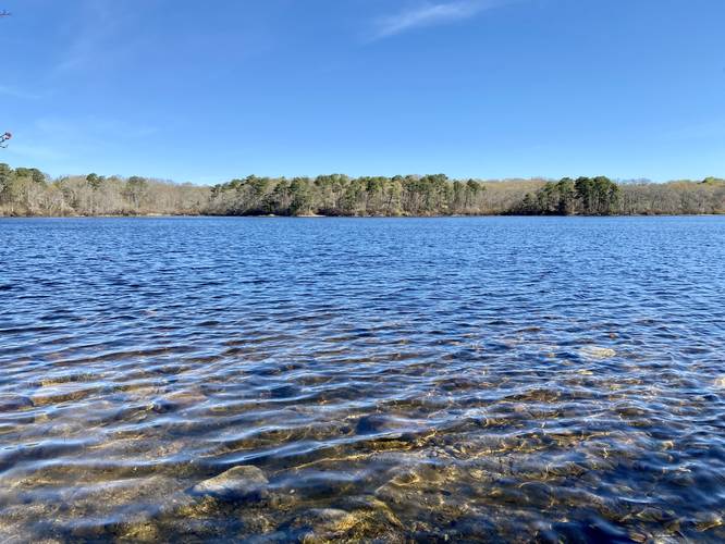
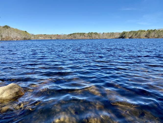
Pond View & Turn Around - Mile 0.5
At mile 0.5 this track ends with a nice view of Dennis Pond before hiking out. Hikers can continue heading east of here to explore the rest of Dennis Pond via the Dennis Pond Trail to reach a swimming hole at the end of the trail. The hike out from here is simple, just head back the way you came and skip the spur trail on your way out to save mileage.
Parking
Hikers will find a small parking lot at the coordinates provided along Willow Street. The lot is large enough to fit a few vehicles at most.
Pets
Dogs are allowed only if leashed and must be cleaned up after.
Warning
Buggy: Even during early May, the bugs can be pretty bad near the water's edge of Dennis Pond, so watch out.
Hunting: Hunting is allowed here mostly in the Fall through December and in the early Spring.
Hike Description
This hike begins at the western trailhead for Dennis Pond, located along Willow Street. Hikers can first stop at a small spur trail that leads down to the water, providing a view of Dennis Pond, before they hike down the red-blazed trail.
Once on the red-blazed trail, hikers will follow the edge of Dennis Pond as the trail skirts its way around the water, providing views along the way. There are several cutouts in the forest, located on-trail, where hikers can sit and enjoy the pond.
Spur Trail View - Mile 0.2
At mile 0.2 is a spur trail (if you keep left) that leads out to another view of the pond. Hikers can skip this if they wish as the views are pretty much the same as the rest of them; however, it's a nice little detour regardless.
Boundary Markers - Mile 0.43 to 0.48
Around mile 0.43 to 0.48 are three Town of Yarmouth boundary markers that hikers can find cemented into the trail. These old boundary markers are likely outdated technology but are neat to find along the hike.
Pond View & Turn Around - Mile 0.5
At mile 0.5 this track ends with a nice view of Dennis Pond before hiking out. Hikers can continue heading east of here to explore the rest of Dennis Pond via the Dennis Pond Trail to reach a swimming hole at the end of the trail. The hike out from here is simple, just head back the way you came and skip the spur trail on your way out to save mileage.
Parking
Hikers will find a small parking lot at the coordinates provided along Willow Street. The lot is large enough to fit a few vehicles at most.
Pets
Dogs are allowed only if leashed and must be cleaned up after.
Warning
Buggy: Even during early May, the bugs can be pretty bad near the water's edge of Dennis Pond, so watch out.
Hunting: Hunting is allowed here mostly in the Fall through December and in the early Spring.