Loading...

🎉 Claim your Free 7-Day Supporter Trial to Unlock Exclusive Perks. Learn more.

White Trail

The White Trail at Deer Lakes Park, Tarentum, PA, is a moderate 7.9 mile out-and-back hike that starts on the west side of the park and follows the southern and eastern perimeter to end at the Orange Loop Trail.

It's 3.75 - 3.9 miles one-way depending on if you continue hiking toward Kurn rd on the eastern side. You can create an alternative route by hiking from the Orange Loop down Kurn road to the parking lot for ~5.5 miles instead of 7.9.

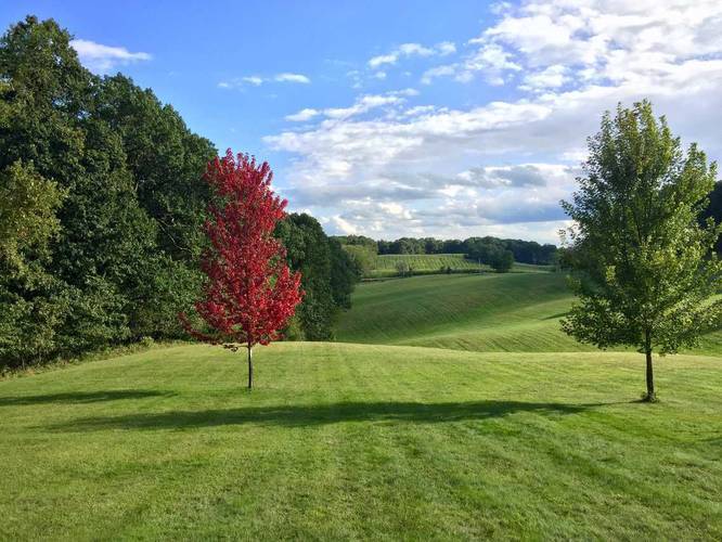
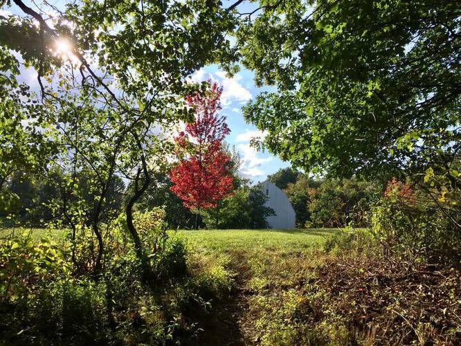
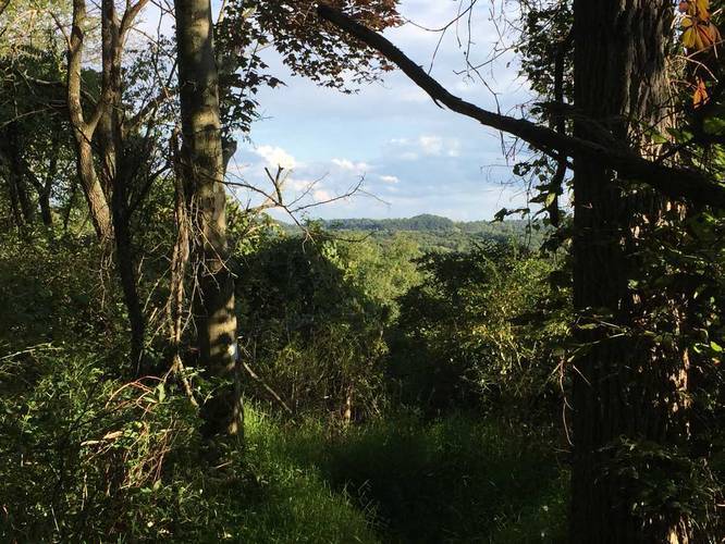
While this is one of the longer trails at Deer Lakes Park, it's likely one of the better trails there. The trail weaves in and out of different types of forests and cuts across a secluded field in the southern section of the park. You'll likely see deer and other animals on this trail since it's very lightly trafficked.
Explore 223 trails near Tarentum, PA

Know Before You Go

  • The White Trail in Deer Lakes Park, Tarentum, PA, is a 7.9-mile moderate hike.
  • It offers varied scenery including forests and a field, and is known for wildlife sightings due to low traffic.
  • An alternative, shorter route of ~5.5 miles is possible by using the Orange Loop and Kurn Road.
Interactive topographic map for White Trail located in Tarentum, PA. Click the "View Map" button to load GPS coordinates and trail markers.
Get directions
Distance
7.9 mi
Difficulty
Moderate
Type
Out-and-Back
Est. Time
4 hrs
Elev. Gain
1,533'
Rating
0.0
Added
March 25, 2017
Updated
March 10, 2019

Weather Forecast

Tonight
Low 42°F
Rain Showers Likely
Saturday
High 60°F
Mostly Sunny
Saturday Night
Low 41°F
Partly Cloudy
Sunday
High 76°F
Partly Sunny
Sunday Night
Low 60°F
Mostly Cloudy
Monday
High 75°F
Showers And Thunderstorms Likely
Monday Night
Low 60°F
Showers And Thunderstorms Likely
Tuesday
High 79°F
Chance Rain Showers
Tuesday Night
Low 63°F
Chance Showers And Thunderstorms
Wednesday
High 82°F
Chance Showers And Thunderstorms
Wednesday Night
Low 59°F
Chance Showers And Thunderstorms
Thursday
High 78°F
Slight Chance Rain Showers
Thursday Night
Low 57°F
Chance Rain Showers
Friday
High 79°F
Chance Rain Showers
Loading...
Total Change
317'
Ascent
1,533'
Descent
1,508'
Loading...

Download the GPX Data for Offline Use

Supporters get exclusive access to download trail routes to the MyHikes app for offline use. Stay prepared on your adventure, even without an internet connection! Become a Supporter today to unlock this feature and hike with confidence.

Download White Trail GPX Data to the MyHikes Mobile App

Features

Vista / Lookout Point
Dogs
Water Source
Biking

Points of interest

  1. Parking

    40.621714, -79.826317
  2. Main Trailhead

    40.620713, -79.826575
  3. View of rolling hills

    40.614814, -79.813431
    View of rolling hills
  4. Trail exits to a field behind maintenance barns

    40.614564, -79.813117
    Trail exits to a field behind maintenance barns

Safety information

For your own safety: plan ahead, let someone know where you'll be, and hike at your own risk.

Markers

Blaze Color

White

Availability

Spring

Surface type

Dirt

Trip Reports (Reviews)

Your opinion matters! Be the first to rate this trail.

Ready to help fellow hikers? Add a trip report to share your experience and provide valuable insights for other hikers!

4.4 miles / 7.1 km
September 21, 2020
Hiking
4.0 miles / 6.4 km
September 08, 2017
Dogs Hiking
7.8 miles / 12.6 km
March 25, 2017
Hiking
No community routes found. To add your own hike as a Community Route for this Trail guide, leave a Trip Report with an attached GPX file.

You May Also Like

Pennsylvania's Grand Canyon - Explore Pennsylvania's Grand Canyon, officially named Pine Creek Gorge, including hiking trails, vistas, overlooks, waterfalls, backcountry campsites, backpacking trails.
Explore

Pennsylvania's Grand Canyon

Explore Pennsylvania's Grand Canyon, officially named Pine Creek Gorge, including hiking trails, vistas, overlooks, waterfalls, backcountry campsites, backpacking trails.

Read
New York's Best Waterfalls - Whether you're planning a day hike, roadside stop, or a leisurely short walk, this guide provides hikers, travelers, and locals alike with 63 different locations to over 100 scenic waterfalls to help plan your next adventure!
Explore

New York's Best Waterfalls

Whether you're planning a day hike, roadside stop, or a leisurely short walk, this guide provides hikers, travelers, and locals alike with 63 different locations to over 100 scenic waterfalls to help plan your next adventure!

Read
🍪 We use cookies to learn about site usage and to serve map tiles. You may block cookies manually in the browser. By continuing you agree. Learn more