The Dead Horse Point Loop at Dead Horse Point State Park near Moab, Utah is an easy 0.3-mile loop walk that features stunning views of the Colorado River, adjacent to Canyonlands National Park.
Universal Access
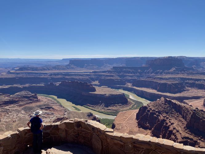
Note that this trail is universally accessible from the trailhead out to Dead Horse Point and the viewing platform located to the west. The path that leads back to parking (in this GPS track) is not universally accessible; however, visitors in need of a flat paved walkway will be able to enjoy the best parts of this trail via the universally-accessible path.
Walk
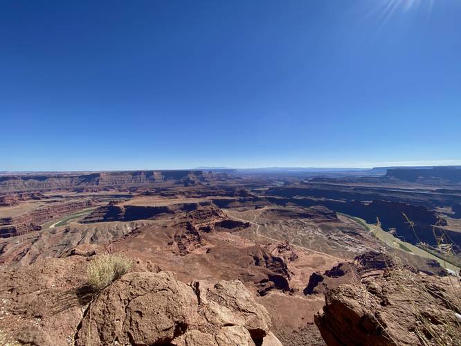
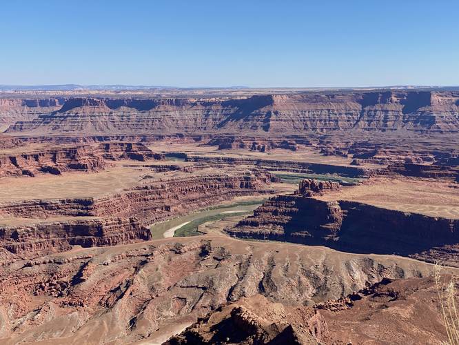
This short walk begins at the main trailhead and follows the paved pathway south to reach Dead Horse Point. Visitors will get stunning views of the Colorado River as it snakes its way through the cayonous landscape below your feet. Next, the path heads westward to reach another viewpoint of the Colorado River and nearby points-of-interest within Canyonlands National Park, located to the west. Visitors will reach the universally-accessible viewing platform, which also has an older stonework viewpoint below that provides more stunning views of the Colorado River. This viewpoint was our personal favorite as it includes more dramatic views of the rock cliffs and formations that surround the river below.
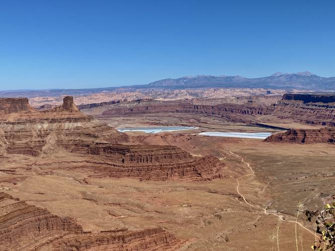
On the walk out, we decided to follow the trail that encompasses the cliff side -- following a non-accessible dirt pathway that leads eastward and then north to reach the parking lot. Along the way, hikers will get more views of the Colorado River in addition to views of a nearby potash evaporation site that harvests potash by using the power of the sun.
Parking & Fees
As of September 2023, there's a $20 entry fee to get into Dead Horse Point State Park. Hikers will find a large parking lot at the coordinates provided, large enough to fit a couple dozen vehicles at most.
Pets
Dogs are allowed only if leashed and cleaned up after.
Warnings
Sun exposure: This trail has very little shade and no water sources. Pack-in all water and wear sun screen and a hat to protect against sun exposure. It's smart to hike either in the early morning or late afternoon to avoid the intense desert sun.
No water: This trail has no water sources so you must pack-in all water. A general rule of thumb in the desert is 1 gallon of water per person per day.
Rattlesnakes: This is rattlesnake territory, so be on the lookout and give any rattlers you find plenty of space.
Cliffs: This hike follows sheer cliff sides that drop hundreds of feet.
Universal Access
Note that this trail is universally accessible from the trailhead out to Dead Horse Point and the viewing platform located to the west. The path that leads back to parking (in this GPS track) is not universally accessible; however, visitors in need of a flat paved walkway will be able to enjoy the best parts of this trail via the universally-accessible path.
Walk
This short walk begins at the main trailhead and follows the paved pathway south to reach Dead Horse Point. Visitors will get stunning views of the Colorado River as it snakes its way through the cayonous landscape below your feet. Next, the path heads westward to reach another viewpoint of the Colorado River and nearby points-of-interest within Canyonlands National Park, located to the west. Visitors will reach the universally-accessible viewing platform, which also has an older stonework viewpoint below that provides more stunning views of the Colorado River. This viewpoint was our personal favorite as it includes more dramatic views of the rock cliffs and formations that surround the river below.
On the walk out, we decided to follow the trail that encompasses the cliff side -- following a non-accessible dirt pathway that leads eastward and then north to reach the parking lot. Along the way, hikers will get more views of the Colorado River in addition to views of a nearby potash evaporation site that harvests potash by using the power of the sun.
Parking & Fees
As of September 2023, there's a $20 entry fee to get into Dead Horse Point State Park. Hikers will find a large parking lot at the coordinates provided, large enough to fit a couple dozen vehicles at most.
Pets
Dogs are allowed only if leashed and cleaned up after.
Warnings
Sun exposure: This trail has very little shade and no water sources. Pack-in all water and wear sun screen and a hat to protect against sun exposure. It's smart to hike either in the early morning or late afternoon to avoid the intense desert sun.
No water: This trail has no water sources so you must pack-in all water. A general rule of thumb in the desert is 1 gallon of water per person per day.
Rattlesnakes: This is rattlesnake territory, so be on the lookout and give any rattlers you find plenty of space.
Cliffs: This hike follows sheer cliff sides that drop hundreds of feet.