Loading...

WINTER SALE! 50% OFF Supporter Accounts — now through January 31st. Learn More.

Clay Mine Glass Chute Trail

The Clay Mine Glass Chute Trail at Tioga State Forest near Morris, Pennsylvania is an easy 0.4-mile out-and-back trail that leads out along a mountain ridge along Pine Creek Gorge / PA Grand Canyon to a site where an old glass-lined chute once stood to aid a local clay mine load railroad cars within the gorge.

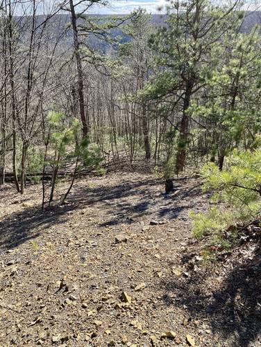
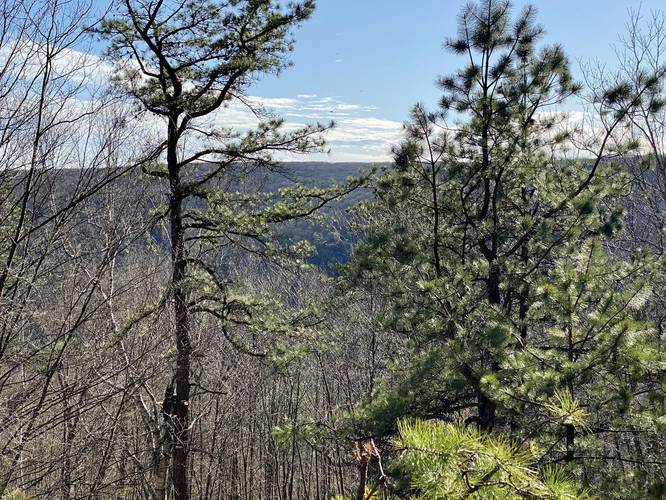
Today, this trail has nothing to see other than a very small glimpse of the mountains across Pine Creek Gorge and a make-shift campsite for car camping along the trail.

History
According to the information compiled by Peter Fleszar - the Mid State Trail Association VP - an old local clay mine company built glass-lined flumes or chutes at the tops of these hills. These old chutes were used to send material from the mine, at the top of the mountain, down to the railroad cars in the gorge below. From there, the trains used to make their way out of the gorge along the old railroad bed, which is now the Pine Creek Trail.

Parking
Hikers can find a small parking area in front of the yellow gate that is usually closed most of the year.

Pets
Dogs are allowed if leashed.

Camping
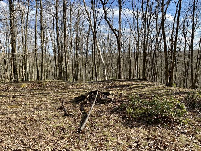
There's a make-shift campsite located along this trail. It's unclear if camping is permitted here, but considering the abundance of backcountry / primitive / dispersed camping at Tioga State Forest, campers can likely setup at this campsite without any issues -- making for a nice car camping site.
Explore 285 trails near Morris, PA

Know Before You Go

  • The Clay Mine Glass Chute Trail is a short, easy hike in Tioga State Forest with limited views of Pine Creek Gorge.
  • The trail leads to the site of a historical glass-lined chute used for transporting clay to railroad cars below.
  • A make-shift campsite exists along the trail, and dispersed camping is generally permitted in the area.
Interactive topographic map for Clay Mine Glass Chute Trail located in Morris, PA. Click the "View Map" button to load GPS coordinates and trail markers.
Get directions
Distance
0.4 mi
Difficulty
Easy
Type
Out-and-Back
Est. Time
12 min
Elev. Gain
45'
Rating
0.0
Added
December 31, 2020
Updated
April 08, 2021

Weather Forecast

Tonight
Low 0°F
Chance Snow Showers
Wednesday
High 12°F
Chance Snow Showers then Partly Sunny
Wednesday Night
Low -1°F
Mostly Cloudy
Thursday
High 13°F
Mostly Sunny
Thursday Night
Low -6°F
Partly Cloudy
Friday
High 10°F
Mostly Sunny
Friday Night
Low -8°F
Partly Cloudy
Saturday
High 12°F
Partly Sunny
Saturday Night
Low 3°F
Mostly Cloudy
Sunday
High 18°F
Slight Chance Snow Showers
Sunday Night
Low 7°F
Partly Cloudy
Monday
High 25°F
Mostly Sunny
Monday Night
Low 8°F
Mostly Cloudy
Tuesday
High 23°F
Partly Sunny
Loading...
Total Change
49'
Ascent
45'
Descent
49'
Loading...

Download the GPX Data for Offline Use

Supporters get exclusive access to download trail routes to the MyHikes app for offline use. Stay prepared on your adventure, even without an internet connection! Become a Supporter today to unlock this feature and hike with confidence.

Download Clay Mine Glass Chute Trail GPX Data to the MyHikes Mobile App

Features

Vista / Lookout Point
Dogs
Camping
PA Wilds logo PA Wilds

Points of interest

  1. Parking

    41.599605, -77.387986
  2. Main Trailhead

    41.599635, -77.388036
  3. Campsite with fire pit

    41.598781, -77.390511
    Campsite with fire pit
  4. Site of old glass chute - nothing left to see

    41.598714, -77.390853
    Site of old glass chute - nothing left to see

Safety information

For your own safety: plan ahead, let someone know where you'll be, and hike at your own risk.

Hazards

Snakes (Rattlesnakes, Copperheads, others)

Availability

All seasons

Surface type

Dirt

Trip Reports (Reviews)

Your opinion matters! Be the first to rate this trail.

Ready to help fellow hikers? Add a trip report to share your experience and provide valuable insights for other hikers!

No community routes found. To add your own hike as a Community Route for this Trail guide, leave a Trip Report with an attached GPX file.

Popular categories

Scenic mountain view representing vista trails
Vista trails
Scenic gorge of cascades representing waterfall trails
Waterfall hikes
Rugged mountain terrain representing summit trails
Summit trails
Scenic mountain view representing dog-friendly trails
Dog-friendly
Scenic campsite with a view representing camping trails
Camping trails
Appalachian Trail logo representing A.T. hikes
A.T. hikes

You May Also Like

New York's Best Waterfalls - Whether you're planning a day hike, roadside stop, or a leisurely short walk, this guide provides hikers, travelers, and locals alike with 63 different locations to over 100 scenic waterfalls to help plan your next adventure!
Explore

New York's Best Waterfalls

Whether you're planning a day hike, roadside stop, or a leisurely short walk, this guide provides hikers, travelers, and locals alike with 63 different locations to over 100 scenic waterfalls to help plan your next adventure!

Read
🍪 We use cookies to learn about site usage and to serve map tiles. You may block cookies manually in the browser. By continuing you agree. Learn more