Chittenango Falls Hike at Chittenango Falls State Park near Cazenovia, New York is a moderate 0.6-mile out-and-back hike that leads to the 167-foot tall waterfall, Chittenango Falls.
Hike Description
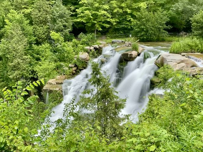
This hike begins at the main parking lot at Chittenango Falls State Park and heads to the staircase located on the northwest corner of the lot. The trail leads down the stairs and then heads east to reach a picnic area and the top of Chittenango Falls.
Lower Falls View - Mile 0.15 to 0.3
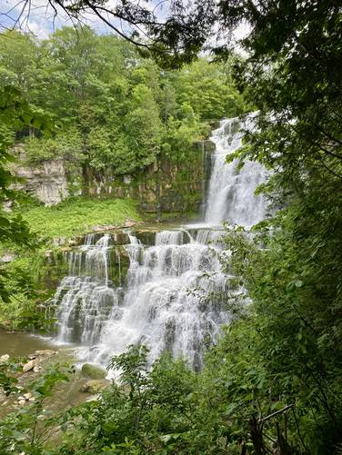
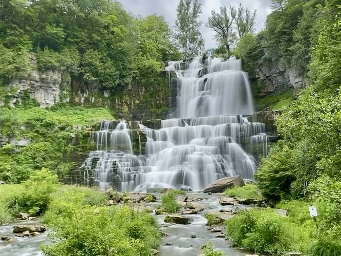
At mile 0.15, after heading west from the top of Chittenango Falls, hikers will reach a steep but short trail that leads down the canyon's hillsides to reach a bridge that crosses the creek. Please note that this trail is not accessible and requires several sets of stairs to reach the bottom. From the bridge, hikers will get a stunning view of the 167-foot tall Chittenango Falls. From here, you can extend your hike along more trails that pass through the park, but for folks just looking to check-out the waterfall, this is the halfway point. The hike out is difficult but very short, hence the moderate difficulty.
Parking & Fees
Hikers will find a large parking lot at the coordinates provided, which is large enough to fit a few dozen vehicles. As of July 2023, there's a $5 parking fee.
Pets
Dogs are allowed if leashed and must be cleaned up after.
Universal Accessibility
Please note that there's universal access to the top of Chittenango Falls; however, the paved universal access trail (as of July, 2023) is located on the east side of the parking lot. Do not follow this route if looking for the flat, universally accessible paved path.
Hike Description
This hike begins at the main parking lot at Chittenango Falls State Park and heads to the staircase located on the northwest corner of the lot. The trail leads down the stairs and then heads east to reach a picnic area and the top of Chittenango Falls.
Lower Falls View - Mile 0.15 to 0.3
At mile 0.15, after heading west from the top of Chittenango Falls, hikers will reach a steep but short trail that leads down the canyon's hillsides to reach a bridge that crosses the creek. Please note that this trail is not accessible and requires several sets of stairs to reach the bottom. From the bridge, hikers will get a stunning view of the 167-foot tall Chittenango Falls. From here, you can extend your hike along more trails that pass through the park, but for folks just looking to check-out the waterfall, this is the halfway point. The hike out is difficult but very short, hence the moderate difficulty.
Parking & Fees
Hikers will find a large parking lot at the coordinates provided, which is large enough to fit a few dozen vehicles. As of July 2023, there's a $5 parking fee.
Pets
Dogs are allowed if leashed and must be cleaned up after.
Universal Accessibility
Please note that there's universal access to the top of Chittenango Falls; however, the paved universal access trail (as of July, 2023) is located on the east side of the parking lot. Do not follow this route if looking for the flat, universally accessible paved path.