Castle Rocks at Ravensburg State Park near Jersey Shore, Pennsylvania is a difficult 0.2-mile out-and-back trail with rock scrambles to reach the top of a mountainous rock outcropping named Castle Rocks.
Hike Description
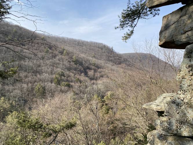
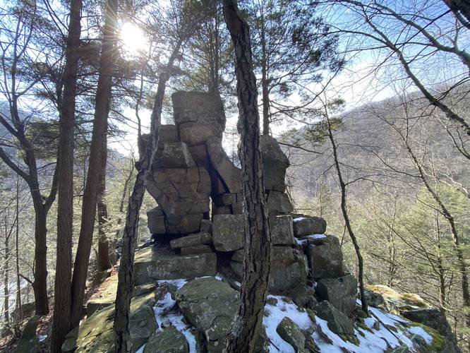
This trail follows an unofficial path that leads up to the base of Castle Rocks. There, hikers are faced with two 5-foot tall rock ledges that must be climbed to reach the top of the lower sections of Castle Rock. Once atop the lower rock outcropping, hikers get a nice view of the surrounding mountains. Just further up the trail, hikers will climb some similar-sized rock ledges, approximately 3 to 4 feet high, to reach the top of Castle Rocks. At the top, as of March 2022, there's some interesting graffiti, but more importantly, some nice views of the surrounding mountains. This is a gem of a spot as it's not officially mapped on the park map, but is a really fun place to explore. Hike, climb, and explore at your own risk.
Parking
Hikers will find a parking turnout by the coordinates provided on the west side of PA-880 / Rauchtown Rd at the southern end of Ravensburg State Park.
Pets
Dogs should not be allowed on this terrain due to the steep rock ledges and potential for falling.
Warnings
Steep ledges: Once hikers make their way up to the top of Castle Rocks, there's a massive drop-off to one side of this rock outcropping. Watch your steps and hike at your own risk.
Winter exploration: Castle Rocks should not be explored in the winter without hiking crampons or ice spikes. Depending on the conditions, an ice axe may be recommended.
Hike Description
This trail follows an unofficial path that leads up to the base of Castle Rocks. There, hikers are faced with two 5-foot tall rock ledges that must be climbed to reach the top of the lower sections of Castle Rock. Once atop the lower rock outcropping, hikers get a nice view of the surrounding mountains. Just further up the trail, hikers will climb some similar-sized rock ledges, approximately 3 to 4 feet high, to reach the top of Castle Rocks. At the top, as of March 2022, there's some interesting graffiti, but more importantly, some nice views of the surrounding mountains. This is a gem of a spot as it's not officially mapped on the park map, but is a really fun place to explore. Hike, climb, and explore at your own risk.
Parking
Hikers will find a parking turnout by the coordinates provided on the west side of PA-880 / Rauchtown Rd at the southern end of Ravensburg State Park.
Pets
Dogs should not be allowed on this terrain due to the steep rock ledges and potential for falling.
Warnings
Steep ledges: Once hikers make their way up to the top of Castle Rocks, there's a massive drop-off to one side of this rock outcropping. Watch your steps and hike at your own risk.
Winter exploration: Castle Rocks should not be explored in the winter without hiking crampons or ice spikes. Depending on the conditions, an ice axe may be recommended.