The California Coastal Trail at Lands End in San Francisco, California is a moderate 1.7 mile one-way hike that leads from the main parking lot to the eastern end of Lands End - Eagles Point.
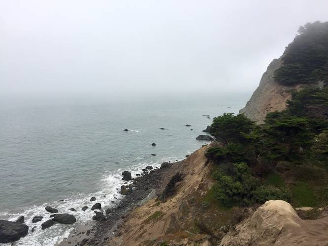
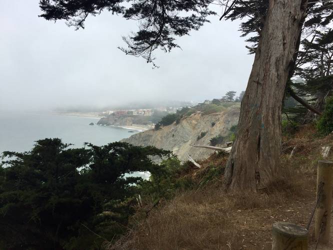
Throughout the trail you'll hike along huge cliffs with views of the Pacific and pass the Sutro Baths Upper Trail to Point Lobos, a part of the USS San Francisco, Lands End Lookout, Mile Rock Beach, and Lands End Labyrinth before reaching Eagles Point. On clear days you can see the Golden Gate Bridge and the Marin Headlands in the distance, but it can often be foggy.
The trail starts off by gradually heading uphill before it hits a trail junction (just beyond the Sutro Baths Upper Trail to Point Lobos junction) - take a left-hand turn here to continue. Shortly after the first turn, you'll see a part of the USS San Francisco perched on a hill to the right-hand side of the trail. Continue on to the Lands End Lookout after about 0.4 miles into the hike from the parking lot. From here it's another 0.4 miles or so before you hit the Mile Rock Beach / Lands End Labyrinth spur trail.
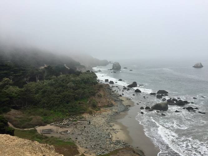
Hiking down the Mile Rock Beach spur trail is not easy - it's all stairs and the elevation gain (on the way back) can be taxing, but worth it for the views. This recording stays high above Mile Rock Beach, but leads out to the Labyrinth before heading back up to the main trail.
After hitting the Mile Rock Beach junction, you'll continue on for 0.7 more miles before reaching Eagles Point. Eagles Point can also be hit or miss depending on the weather, but it's another nice lookout point.
From Eagles Point, you can head back along the El Camino Del Mar Trail.
Cliffs: Almost the entire hike is along cliff edges, so it's recommended to stay on the trail at all times. The trail is usually wide enough that these cliffs aren't an issue, except for the Mile Rock Beach spur trail which is more narrow and has no railings or fences.
Trail traffic: This trail is moderately trafficked, but mostly from the parking lot up to Mile Rock Beach. From Mile Rock Beach to Eagle Point, the trail is lightly trafficked.
Throughout the trail you'll hike along huge cliffs with views of the Pacific and pass the Sutro Baths Upper Trail to Point Lobos, a part of the USS San Francisco, Lands End Lookout, Mile Rock Beach, and Lands End Labyrinth before reaching Eagles Point. On clear days you can see the Golden Gate Bridge and the Marin Headlands in the distance, but it can often be foggy.
The trail starts off by gradually heading uphill before it hits a trail junction (just beyond the Sutro Baths Upper Trail to Point Lobos junction) - take a left-hand turn here to continue. Shortly after the first turn, you'll see a part of the USS San Francisco perched on a hill to the right-hand side of the trail. Continue on to the Lands End Lookout after about 0.4 miles into the hike from the parking lot. From here it's another 0.4 miles or so before you hit the Mile Rock Beach / Lands End Labyrinth spur trail.
Hiking down the Mile Rock Beach spur trail is not easy - it's all stairs and the elevation gain (on the way back) can be taxing, but worth it for the views. This recording stays high above Mile Rock Beach, but leads out to the Labyrinth before heading back up to the main trail.
After hitting the Mile Rock Beach junction, you'll continue on for 0.7 more miles before reaching Eagles Point. Eagles Point can also be hit or miss depending on the weather, but it's another nice lookout point.
From Eagles Point, you can head back along the El Camino Del Mar Trail.
Cliffs: Almost the entire hike is along cliff edges, so it's recommended to stay on the trail at all times. The trail is usually wide enough that these cliffs aren't an issue, except for the Mile Rock Beach spur trail which is more narrow and has no railings or fences.
Trail traffic: This trail is moderately trafficked, but mostly from the parking lot up to Mile Rock Beach. From Mile Rock Beach to Eagle Point, the trail is lightly trafficked.