Buffam Falls is a 2.3 mile long loop trail on N Valley Rd in Pelham, Massachusetts that leads out to the convergence of two creeks and the waterfall, Buffam Falls. The trail crosses Amethyst and Buffam Brooks, but you have to find a way across each brook on your own, which may require hopping from rock to rock.
For an easier and faster hike to Buffam Falls, check out the Buffam Falls Blue Loop Trail.
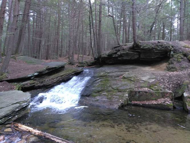
Buffam Falls consists of 3 main cascades which are no more than 10 feet tall each. The largest cascade is about 7 or 8 feet tall which spills down Buffam Brook before merging with Amethyst Brook. The town of Pelham maintains the trails leading to and around Buffam Falls and the trails are mostly flat with some uphill heading back to parking.
Close to the creek convergence, downstream from Buffam Falls, is a fairly large rock outcropping with a ledge that sits above the creek.
Trailheads: There's a trailhead on the right-hand side of the road, heading North on N Valley Rd, where the parking marker is located. Hop over the guardrail and you'll find the trail that runs along the creek. There's another trailhead about 200 feet south of where the road crosses the creek - this trailhead is not depicted on the map, but it joins the main trail shown here.
Parking: The main parking area for this trail can be found right next to where the road passes the creek - look for guardrails and parking turnouts nearby or click the Get Directions link. A second parking location can be found on the right side of the road if you're heading north on N Valley rd about 200 feet before the creek.
For an easier and faster hike to Buffam Falls, check out the Buffam Falls Blue Loop Trail.
Buffam Falls consists of 3 main cascades which are no more than 10 feet tall each. The largest cascade is about 7 or 8 feet tall which spills down Buffam Brook before merging with Amethyst Brook. The town of Pelham maintains the trails leading to and around Buffam Falls and the trails are mostly flat with some uphill heading back to parking.
Close to the creek convergence, downstream from Buffam Falls, is a fairly large rock outcropping with a ledge that sits above the creek.
Trailheads: There's a trailhead on the right-hand side of the road, heading North on N Valley Rd, where the parking marker is located. Hop over the guardrail and you'll find the trail that runs along the creek. There's another trailhead about 200 feet south of where the road crosses the creek - this trailhead is not depicted on the map, but it joins the main trail shown here.
Parking: The main parking area for this trail can be found right next to where the road passes the creek - look for guardrails and parking turnouts nearby or click the Get Directions link. A second parking location can be found on the right side of the road if you're heading north on N Valley rd about 200 feet before the creek.