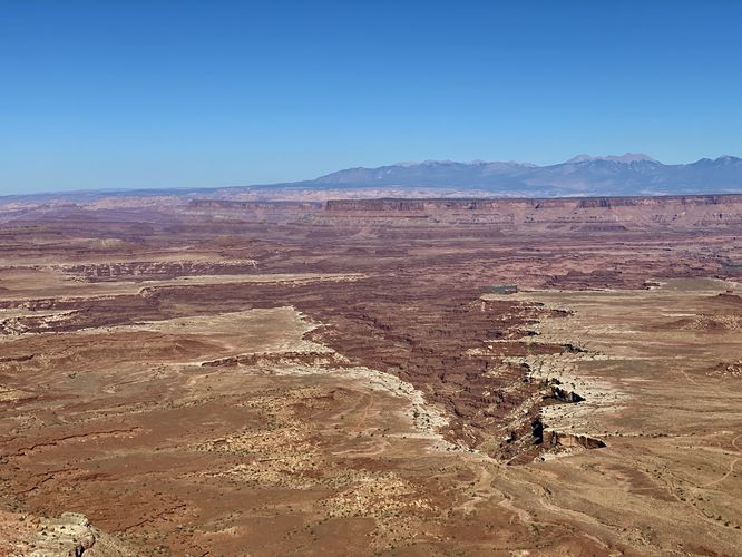
The Buck Canyon Overlook at Canyonlands National Park near Moab, Utah is an easy 0.1-mile out-and-back trail that leads to sweeping panoramic views of Buck Canyon and Gooseberry Canyon.
This is not a hike but rather a very short walk that leads a long a mostly-flat trail and out to a mesa cliff edge. Once at the edge of the mesa, hikers will get eastward views with Buck Canyon due-east below their feet. The massive cliffs of Canyonlands National Park's mesa drop hundreds of feet below you, so watch your step. To the southeast, adjacent to Buck Canyon is another (identical-looking) canyon named Gooseberry Canyon which can be seen from this overlook as well.
Parking
Visitors will find parking along the side of the road along the cul-de-sac for this overlook. There's enough parking to fit over a dozen vehicles as of September 2023.
Pets
Dogs are not allowed on any trails at Canyonlands National Park. Please do not bring your dog here.
Warning
Sun exposure: This trail has very little shade and no water sources. Pack-in all water and wear sun screen and a hat to protect against sun exposure. It's smart to hike either in the early morning or late afternoon to avoid the intense desert sun.
Lack of water: Hikers must pack-in all water as there are no potable or filterable water sources along this trail. Rule of thumb in the desert is to pack-in 1 gallon of water per person per day.
Steep cliffs: This trail leads to the edge of very tall and steep cliff with sheer drop-offs. Watch your step.
Rattlesnakes: This is rattlesnake territory, so be on the lookout and give any rattlers you find plenty of space.
Fees
Vehicle entry fees to Canyonlands National Park is $30 as of September 2023.