The Bourn Pond to Lye Brook Falls hike at Green Mountain National Forest near Sunderland, Vermont is a difficult 11.5-mile out-and-back hike that leads to the 125-foot tall waterfall known as Lye Brook Falls.
Trailhead
Note that this hike begins at Bourn Pond, so hikers must first hike there from the parking area via the Branch Pond Trail (aka Bourn Pond Trail).
Hike
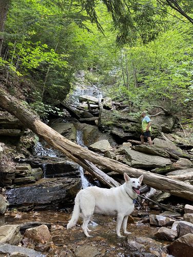
A scenic, quiet hike through a unique high plateau bog ecosystem, starting from the Bourn Pond Central tent site. In late summer, the bugs and people are minimal but the trail is quite muddy and after rain extremely muddy. Expect to get your feet wet, and beware the bog crossings. The Lye Brook trail is level until about midway, then steady downhill until you cross Lye Brook and then take a sharp left onto Lye Brook Falls Trail. Hikers will reach Lye Brook Falls around mile 5.75 where you'll find the 125-foot tall waterfall tumbling down multiple tiers of cascades. The hike back to Bourn Pond follows the same but opposite route with the hardest being the initial ascent back up from the waterfall. Hikers will complete the out-and-back 11.5-mile hike when they reach the campsite along the western shore of Bourn Pond.
Parking
Hikers will find a large parking lot at the end of Branch Pond Access Road. The lot is large enough to fit over a dozen vehicles.
Pets
Dogs are allowed and should be cleaned up after.
Camping and Backpacking
Backpackers will find several campsites along the shores of Bourn Pond. This hike begins at the central campsite along the western shore of the pond. If camping, please follow all national forest rules and regulations.
Warning
Lack of cell service: This hike leads to areas where cell service can be scarce especially down in the mountain hollows; however, even as early as 2012 there's always been cell service right at Bourn Pond.
Trailhead
Note that this hike begins at Bourn Pond, so hikers must first hike there from the parking area via the Branch Pond Trail (aka Bourn Pond Trail).
Hike
A scenic, quiet hike through a unique high plateau bog ecosystem, starting from the Bourn Pond Central tent site. In late summer, the bugs and people are minimal but the trail is quite muddy and after rain extremely muddy. Expect to get your feet wet, and beware the bog crossings. The Lye Brook trail is level until about midway, then steady downhill until you cross Lye Brook and then take a sharp left onto Lye Brook Falls Trail. Hikers will reach Lye Brook Falls around mile 5.75 where you'll find the 125-foot tall waterfall tumbling down multiple tiers of cascades. The hike back to Bourn Pond follows the same but opposite route with the hardest being the initial ascent back up from the waterfall. Hikers will complete the out-and-back 11.5-mile hike when they reach the campsite along the western shore of Bourn Pond.
Parking
Hikers will find a large parking lot at the end of Branch Pond Access Road. The lot is large enough to fit over a dozen vehicles.
Pets
Dogs are allowed and should be cleaned up after.
Camping and Backpacking
Backpackers will find several campsites along the shores of Bourn Pond. This hike begins at the central campsite along the western shore of the pond. If camping, please follow all national forest rules and regulations.
Warning
Lack of cell service: This hike leads to areas where cell service can be scarce especially down in the mountain hollows; however, even as early as 2012 there's always been cell service right at Bourn Pond.