The Bourn Pond Trail in the Green Mountain National Forest, Vermont is an amazing hidden gem in the middle of the Lye Brook Wilderness. It's a 6 mile out-and-back trail that leads from the Branch Pond Access Rd to Bourn Pond, technically following the Branch Pond Trail. Bourn Pond sits on the western side of Stratton Mountain so from its western banks you can see the top of Stratton. Oddly enough the cell signal from Stratton Mountain is strong enough for full 4G at Bourn Pond - which is nice, but when you're looking to disconnect, it can be a distraction.
The trail to Bourn Pond is a moderate hike, but you end up gaining and losing almost the same elevation multiple times throughout the hike, so it can feel longer than it is. If you're in good shape, you can usually make the one-way trip within an hour, even with gear. The trail has a couple of splits - the first split is close to the trailhead, take this left (there's a sign for Bourn Pond too).
Continuing further into the trail, after about a mile and a half, you'll reach the Lye Brook Wilderness sign. There's a logbook and it's encouraged that you sign it, just in case something happens while you're out there.
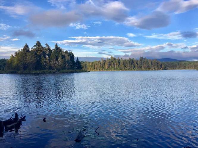
Bourn Pond is a decent sized body of water that feels larger than it is. it's not very deep, at about 35 feet maximum depth near the center of the pond. Fishing is allowed here, but can be challenging due to the shallow depth of the water and the abundance of fresh water weeds.
Camping: Once you make it to Bourn Pond, you can continue hiking north along the west side of the pond to find at least 3 decent sized camping areas. There's one large campsite right on the pond, a smaller site about 300 feet north of the large site, and then another large site on the spur trail that turns to the right about 1/4 mile north of the first site. These campsites are fairly secluded, even in the summer. In the fall and early spring, you usually cannot see campsite neighbors either. The downside is that most of the wood and dead trees have been wiped out, so finding firewood can be somewhat difficult.
Note: The GPS data provided here will get you to the first large campsite on the pond.
The trail to Bourn Pond is a moderate hike, but you end up gaining and losing almost the same elevation multiple times throughout the hike, so it can feel longer than it is. If you're in good shape, you can usually make the one-way trip within an hour, even with gear. The trail has a couple of splits - the first split is close to the trailhead, take this left (there's a sign for Bourn Pond too).
Continuing further into the trail, after about a mile and a half, you'll reach the Lye Brook Wilderness sign. There's a logbook and it's encouraged that you sign it, just in case something happens while you're out there.
Bourn Pond is a decent sized body of water that feels larger than it is. it's not very deep, at about 35 feet maximum depth near the center of the pond. Fishing is allowed here, but can be challenging due to the shallow depth of the water and the abundance of fresh water weeds.
Camping: Once you make it to Bourn Pond, you can continue hiking north along the west side of the pond to find at least 3 decent sized camping areas. There's one large campsite right on the pond, a smaller site about 300 feet north of the large site, and then another large site on the spur trail that turns to the right about 1/4 mile north of the first site. These campsites are fairly secluded, even in the summer. In the fall and early spring, you usually cannot see campsite neighbors either. The downside is that most of the wood and dead trees have been wiped out, so finding firewood can be somewhat difficult.
Note: The GPS data provided here will get you to the first large campsite on the pond.