Loading...

๐ŸŽ‰ Enjoy a Free 7-Day Supporter Trial and Unlock Exclusive Perks โ€” No Credit Card Required. Learn more.

Bone Hill Trail

Directions
Map
Pictures
Send to App
Distance:
0.4 Miles / 0.6 km
Type:
Loop
Difficulty:
Easy
Time to Hike:
~12 minutes
Features:
Surface Type:
Dirt
Park:
Mass Audubon Long Pasture Wildlife Sanctuary
Town:
Barnstable, Massachusetts
Directions:
41.7045, -70.273822
Added:
May 09, 2023
Updated:
May 16, 2023
Copy Trail Link Hiking this trail? Send a friend or family member a link to this trail guide for your own safety. Hike at your own risk (disclaimer)
Loading...
Loading...
16'

Total Change
18'

Ascent
18'

Descent

Download the Trail Route for Offline Use

Supporters get exclusive access to download trail routes to the MyHikes app for offline use. Stay prepared on your adventure, even without an internet connection! Become a Supporter today to unlock this feature and hike with confidence.

Send to App

Bone Hill Trail

The Bone Hill Trail at the Mass Audubon Long Pasture Wildlife Sanctuary in Barnstable, Massachusetts is an easy 0.4-mile loop trail that features meadow views.

Hike Description
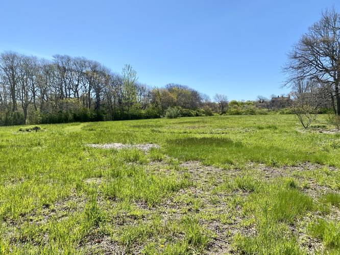
This trail is very short and has several trailhead locations, but this hike begins along the Long Pasture Trail before heading east. The Bone Hill Trail will follow Bone Hill Road north for 100-feet before taking a right-hand turn. The trail will then split into a loop as it encompasses an open meadow. The trail loops around the meadow and heads back to the trailhead along the Long Pasture Trail.

Fees
As of May 2023, there's a $5/adult fee to walk on the property. Hikers can pay at self-pay kiosks at other trailheads or they can pay inside at the Discovery Center.

Parking
Hikers will find a large parking lot at the coordinates provided along Bone Hill Road. The lot is small, but large enough to accommodate a half-dozen vehicles max.

Pets
Dogs are not allowed on trails here.

Water Source
If the Discovery Center is open, hikers can refill their water bottles inside.
Explore 46 trails near Barnstable, MA
  1. Parking

    41.7045, -70.273822
  2. Main Trailhead

    41.705336, -70.273945
  3. Meadow view

    41.70725, -70.273064
    Meadow view
No community routes found. To add your own hike as a Community Route for this Trail guide, leave a Trip Report with an attached GPX file.

Hazards

Ticks - Lyme Disease More Info (CDC)
Poison Ivy/Oak

Seasons

All

Weather Forecast

In Barnstable, MA

Explore Hiking Trails

You May Also Like

Colorado's Million Dollar Highway - Plan a day's drive adventure along the iconic Million Dollar Highway in Colorado. Explore the best short trails, roadside stops, waterfalls, vistas, ghost towns, and hot springs within a ~6 hour road trip.
Explore

Colorado's Million Dollar Highway

Plan a day's drive adventure along the iconic Million Dollar Highway in Colorado. Explore the best short trails, roadside stops, waterfalls, vistas, ghost towns, and hot springs within a ~6 hour road trip.

Read
Glacier's Going-to-the-Sun Road - Discover the breathtaking beauty of Glacier National Park along the iconic Going-to-the-Sun Road. From stunning roadside stops to picturesque waterfalls and vistas, this engineering marvel offers endless opportunities for exploration.
Explore

Glacier's Going-to-the-Sun Road

Discover the breathtaking beauty of Glacier National Park along the iconic Going-to-the-Sun Road. From stunning roadside stops to picturesque waterfalls and vistas, this engineering marvel offers endless opportunities for exploration.

Read
New York's Best Waterfalls - Whether you're planning a day hike, roadside stop, or a leisurely short walk, this guide provides hikers, travelers, and locals alike with 63 different locations to over 100 scenic waterfalls to help plan your next adventure!
Explore

New York's Best Waterfalls

Whether you're planning a day hike, roadside stop, or a leisurely short walk, this guide provides hikers, travelers, and locals alike with 63 different locations to over 100 scenic waterfalls to help plan your next adventure!

Read

Before you boogie...

Find our trail guides useful? Consider becoming a Supporter to unlock perks!

MyHikes is an indie platform that makes exploring public trails easier for everyone. The platform has no investors, no ads, and is owned and operated by one person, Dave Miller. Dave has personally mapped and written over 1,800 trail guides on MyHikes for the public to explore. MyHikes has helped millions outdoor enthusiasts plan their next adventure.

But it takes a lot of time ๐Ÿ•ฆ, money ๐Ÿ’ฐ, work, and espresso shots โ˜• to run MyHikes, including hiking , mapping , writing , and publishing new trails with high-quality (accurate) information... along with software engineering (coding) the platform like building new features, website and mobile app development (iOS and Android), site maintainance . and much much more.

Supporters unlock website and mobile app perks with an annual one-time payment of $25 (you renew) ๐Ÿ˜Ž๐Ÿ‘. Or you can simply make a Donation of your choice. Otherwise, you can support us by telling your friends about MyHikes - both quick and free ๐ŸŽ‰

Admin user profile picture

Dave Miller
MyHikes Founder