The Blackwell Vista via Schoolhouse Trail at Tioga State Forest near Blackwell, Pennsylvania is an easy to moderate 3.1-mile out-and-back hike that leads to an old and overgrown vista point along the Blackwell Trail.
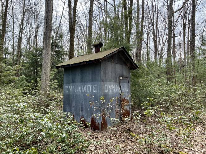
The hike out to this old, now obstructed, vista point is a bit tricky. First, hikers will follow the West Rim Trail until reaching the first main trail junction. Here, take a left-hand turn and hike down the wide service road, passing what looks like a weather station in the field off to the side.
Not too far after the first turn, hikers will reach a wildlife preservation fence. Use the small gate door off to the side of the main gate to enter this area. Continue hiking down the road, following yellow blazes, until you reach a larger opening where you'll find the yellow blazes make a right-hand turn.
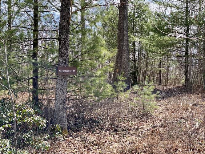
Hikers will need to look to the back-right corner of this large opening to find a very skinny trail that leads through some trees - there will be yellow blazes along this trail. Follow this trail, as this is the continuation of the Schoolhouse Trail. Just beyond the large forest opening and turn to get onto the skinny section of the trail, there will be another gate to exit the wildlife preservation area.
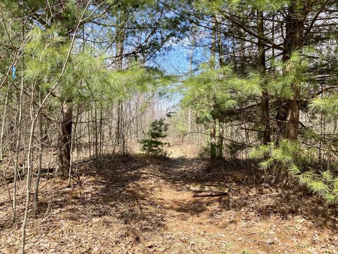
After exiting the gated-off wildlife area, continue straight and follow the yellow blazes as the trail narrowly passes along a forest of rhododendrons. Not too long after exiting the gate, hikers will pass a trail junction where the Schoolhouse Trail head south and down the mountain - there will be signage here - but do not follow those signs. Stay left at this junction and continue straight.
About 0.25-miles after the Schoolhouse Trail junction is the defunct Monkey Trail to the left-hand side, with yellow blazes that head northbound. Here, if you head east, there will be two trails that create a fork right next to the Monkey Trail. Stay left at this fork to continue along the yellow blazes. Technically, near this fork is where the Blackwell Trail begins.
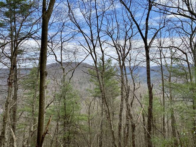
Not long after passing the Monkey Trail, the Blackwell Trail will head downhill slightly and begin to turn to head south and down the mountain. Here is where the old obstructed vista lies - and with no leaves on the trees, it's an interesting sight for day hikers and backpackers passing through.
Hikers can enjoy what remains of this old vista point before hiking back the same way. Please note that we intended to do this hike starting at the Monkey Trail, but that trail no longer exists along West Rim Road, hence why we ended up hiking in on the West Rim Trail instead.
Trails
This hike follows three different trails. First, the hike begins along the West Rim Trail and follows this trail for no longer than 0.3-miles before taking a left-hand turn along the Schoolhouse Trail. From the Schoolhouse Trail junction, this recording continues along that trail - passing the southern junction where the Schoolhouse Trail continues - and heads east to where the Blackwell Trail begins atop the mountain. Once on the Blackwell Trail, it's a short hike out to the old obstructed vista point.
Vista Point
Please note that this vista is no longer as nice as it probably once was. The Tioga State Forest trail map depicts a vista point here, but since the trail map was likely built years ago, the trees at this vista have grown too tall for there to be a real vista point anymore. During the older months, when no leaves are on the trees, hikers can get an obstructed view of the mountains across the Pine Creek Gorge / Grand Canyon of Pennsylvania. Please see the additional pictures to get an idea of what this area is like circa Spring 2020.
Parking
Hikers have two choices for parking - either at the coordinates provided, which will bring you to a parking turnout next to the West Rim Trail. Or hikers can park at the actual Schoolhouse Trail trailhead which is not too far down the road (see the map).
Blaze Color
Hikers will first follow the orange blazes of the West Rim Trail before finally following the yellow blazes of the Schoolhouse Trail for the rest of the hike out to the vista point. Please note that there are several other paths that follow yellow blazes - mainly where the Schoolhouse Trail heads south down the mountain (do not follow this path) and also where the Monkey Trail (does not have a northern trailhead anymore) heads off of the main path and heads north.
Warnings
This trail is not easy to follow. The trail follows a very skinny route through overgrowth, but the trail has not been well maintained in a very long time. During the Summer, portions of this trail are likely completely overgrown. It's recommended hikers bring a GPS system and physical maps since getting lost here can be easy. Ticks are also abundant in the eastern portion of the trail, closer to the old vista.
Pets
Dogs are allowed if leashed.
Camping and Backpacking
Backpackers will find camping is allowed off of these trails, but there are no designated sites. Please follow the Tioga State Forest rules and regulations regarding primitive/backcountry/dispersed camping.
Winter Road Conditions
Tioga State Forest does not maintain this road during the winter. Do not attempt driving on this road without proper equipment including snow tires and/or chains unless the road is clear. High wind storms may also cause trees to fall across the road, making the road impassible. If you plan to visit during the winter, plan accordingly.
The hike out to this old, now obstructed, vista point is a bit tricky. First, hikers will follow the West Rim Trail until reaching the first main trail junction. Here, take a left-hand turn and hike down the wide service road, passing what looks like a weather station in the field off to the side.
Not too far after the first turn, hikers will reach a wildlife preservation fence. Use the small gate door off to the side of the main gate to enter this area. Continue hiking down the road, following yellow blazes, until you reach a larger opening where you'll find the yellow blazes make a right-hand turn.
Hikers will need to look to the back-right corner of this large opening to find a very skinny trail that leads through some trees - there will be yellow blazes along this trail. Follow this trail, as this is the continuation of the Schoolhouse Trail. Just beyond the large forest opening and turn to get onto the skinny section of the trail, there will be another gate to exit the wildlife preservation area.
After exiting the gated-off wildlife area, continue straight and follow the yellow blazes as the trail narrowly passes along a forest of rhododendrons. Not too long after exiting the gate, hikers will pass a trail junction where the Schoolhouse Trail head south and down the mountain - there will be signage here - but do not follow those signs. Stay left at this junction and continue straight.
About 0.25-miles after the Schoolhouse Trail junction is the defunct Monkey Trail to the left-hand side, with yellow blazes that head northbound. Here, if you head east, there will be two trails that create a fork right next to the Monkey Trail. Stay left at this fork to continue along the yellow blazes. Technically, near this fork is where the Blackwell Trail begins.
Not long after passing the Monkey Trail, the Blackwell Trail will head downhill slightly and begin to turn to head south and down the mountain. Here is where the old obstructed vista lies - and with no leaves on the trees, it's an interesting sight for day hikers and backpackers passing through.
Hikers can enjoy what remains of this old vista point before hiking back the same way. Please note that we intended to do this hike starting at the Monkey Trail, but that trail no longer exists along West Rim Road, hence why we ended up hiking in on the West Rim Trail instead.
Trails
This hike follows three different trails. First, the hike begins along the West Rim Trail and follows this trail for no longer than 0.3-miles before taking a left-hand turn along the Schoolhouse Trail. From the Schoolhouse Trail junction, this recording continues along that trail - passing the southern junction where the Schoolhouse Trail continues - and heads east to where the Blackwell Trail begins atop the mountain. Once on the Blackwell Trail, it's a short hike out to the old obstructed vista point.
Vista Point
Please note that this vista is no longer as nice as it probably once was. The Tioga State Forest trail map depicts a vista point here, but since the trail map was likely built years ago, the trees at this vista have grown too tall for there to be a real vista point anymore. During the older months, when no leaves are on the trees, hikers can get an obstructed view of the mountains across the Pine Creek Gorge / Grand Canyon of Pennsylvania. Please see the additional pictures to get an idea of what this area is like circa Spring 2020.
Parking
Hikers have two choices for parking - either at the coordinates provided, which will bring you to a parking turnout next to the West Rim Trail. Or hikers can park at the actual Schoolhouse Trail trailhead which is not too far down the road (see the map).
Blaze Color
Hikers will first follow the orange blazes of the West Rim Trail before finally following the yellow blazes of the Schoolhouse Trail for the rest of the hike out to the vista point. Please note that there are several other paths that follow yellow blazes - mainly where the Schoolhouse Trail heads south down the mountain (do not follow this path) and also where the Monkey Trail (does not have a northern trailhead anymore) heads off of the main path and heads north.
Warnings
This trail is not easy to follow. The trail follows a very skinny route through overgrowth, but the trail has not been well maintained in a very long time. During the Summer, portions of this trail are likely completely overgrown. It's recommended hikers bring a GPS system and physical maps since getting lost here can be easy. Ticks are also abundant in the eastern portion of the trail, closer to the old vista.
Pets
Dogs are allowed if leashed.
Camping and Backpacking
Backpackers will find camping is allowed off of these trails, but there are no designated sites. Please follow the Tioga State Forest rules and regulations regarding primitive/backcountry/dispersed camping.
Winter Road Conditions
Tioga State Forest does not maintain this road during the winter. Do not attempt driving on this road without proper equipment including snow tires and/or chains unless the road is clear. High wind storms may also cause trees to fall across the road, making the road impassible. If you plan to visit during the winter, plan accordingly.