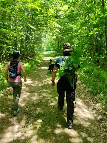
The Big Rocks Loop at Tioga State Forest near Westfield, Pennsylvania is an easy 2.3-mile trail that passes a beautiful swamp-turned-beaver-pond called Bear Wallows and leads to the rocky summit of Big Rocks mountain.
Hike Description
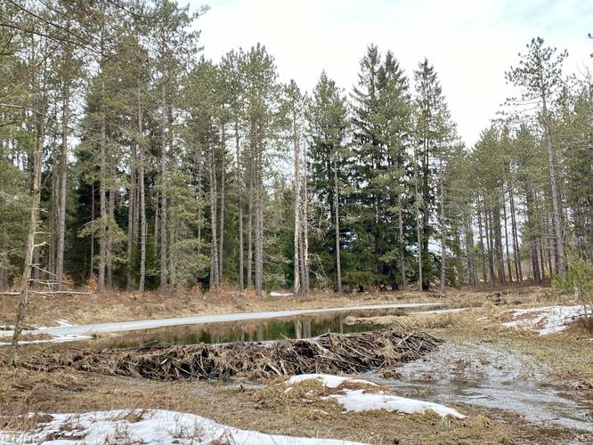
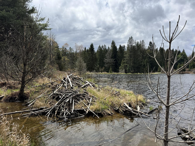
Note that despite this being a "mountain summit" hike, the "ascent" is simply an easy uphill walk. This trail begins along Sand Rd near the parking coordinates provided and immediately crosses Bear Wallow Branch which flows from the swampy ponds formed by beaver dams upstream. Right after the creek crossing is a small beaver pond in Bear Wallow Branch that features towering evergreens that line the edge of the water, princess pines growing along the forest floor, and the beaver dam that blocks water flow, providing a home for them.
Unblazed Trail to Big Rocks Summit
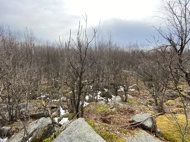
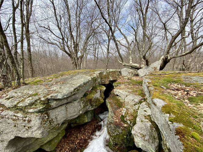
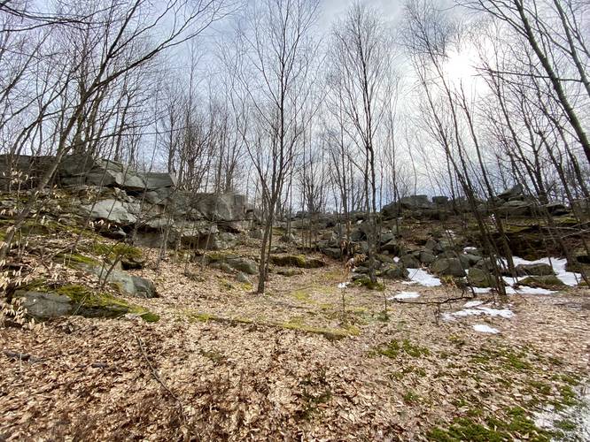
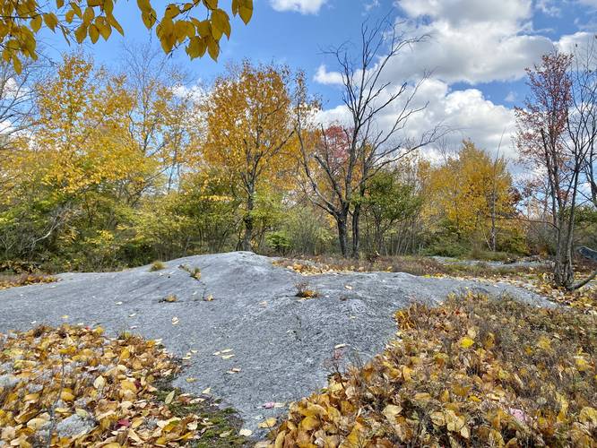
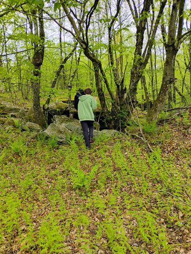
After passing the pond, the trail begins its ascent up to Big Rocks by following an unblazed path (as of March 2022) that winds its way up the mountain. If hiking in the winter or in colder months, it's best to bring an offline app to help aid in finding your way. Around mile 0.6, hikers may notice a large rock outcropping in the middle of the woods - this is the summit of Big Rocks mountain. Here, the hike leads off-trail and through a somewhat swampy area to reach the summit. Hikers can make their way up this 15-foot rock outcropping to reach several "high" points on the rock. This mountain summit is unique for the area since most mountain peaks/summits in this region do not have rocky outcroppings. Due to this, a unique ecosystem has formed on Big Rocks summit which includes mosses, princess pines, ferns, and other "alpine-like" plants. This GPS track meanders the top of Big Rocks summit, which includes a couple of small caves that can be explored with caution. Note that during warmer months, this summit is probably a rattlesnake habitat with dens likely nearby, if not in the rocks themselves.
Easy Parking Area - Mile 1.1
After visiting Big Rocks, this GPS recording heads back to the trail to complete the loop. Around mile 1.1 is another parking area with a service road gate that hikers can use to reach Big Rocks summit within just a few-hundred feet of walking. Here, this GPS recording leads into a cutout within Big Rocks (potentially an old quarry site) before it follows the service road heading northeast.
Service Road to Pipeline
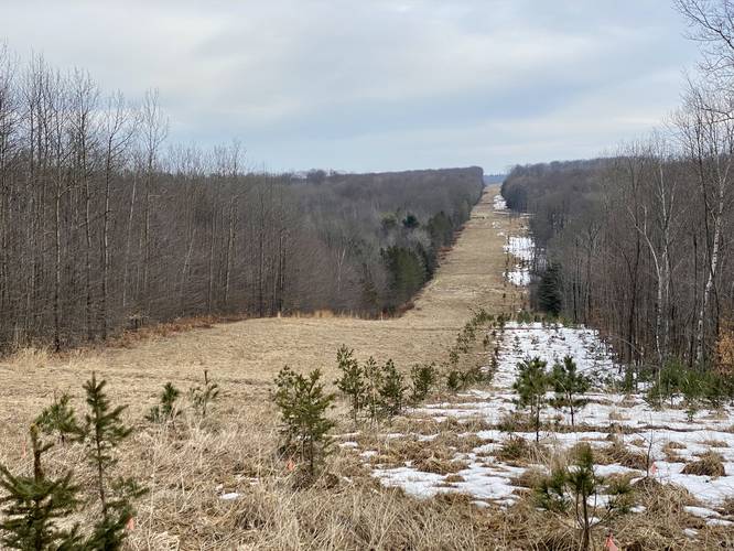
Hikers will continue along the service road for about 0.5-miles (stay right at the first junction near Big Rocks outcropping) before reaching a natural gas pipeline. At the pipeline are red blazes of the Quarry Trail that can be found on the eastern side of the pipeline. Follow the red blazes of the Quarry Trail east - passing the upper Bear Wallows swamp area - before the trail heads south.
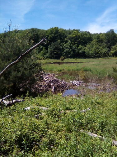
Bear Wallows
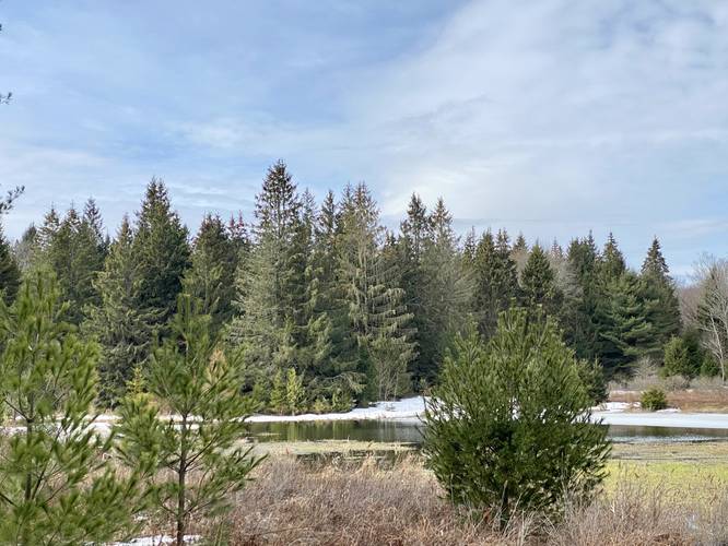
Hikers will pass the official Bear Wallows swamp area along the last section of this hike which follows the Quarry Trail. Here, beaver slides can be found along the shores of the pond with beaver-cut tree trunks scattered about. Bear Wallows makes for another view point to stop at and take some photos before ending the hike.
After passing Bear Wallows, the Quarry Trail will end along Sand Rd. Hikers will then head south along Sand Road for several-hundred feet, passing through an old CCC pine plantation (circa 1930s) to then reach the parking area to complete the loop.
Lookout Point / Views
This trail only has one actual view point which is located along the gas pipeline. I also included two additional "views" - both located along the ponds of Bear Wallows / Bear Wallow Branch. There are no views from the summit of Big Rocks mountain, unfortunately.
Bouldering
This trail has plenty of spots where boulderers may find meaningful terrain to climb. The best spot for bouldering is likely near the "easy to access" section of Big Rocks - located a stone's throw from Right Asaph Rd (see the map).
Parking
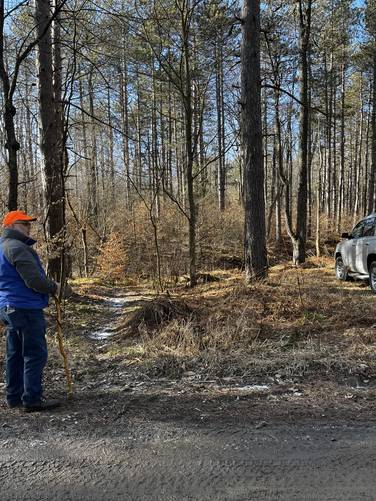
Hikers will find a very small parking turnout at the coordinates provided. It's large enough to fit 1 vehicle. There's a much larger parking turnout at the trailhead along Right Asaph Rd, closer to Big Rocks summit.
Pets
Dogs are allowed if leashed and their waste should be carried out by the hiker.
Warnings
Rattlesnakes: During warm months (between late April and early October), hikers could encounter the Timber Rattlesnake in this area, especially at or near Big Rocks summit. The snakes will use the rocky outcropping to sun themselves during the daytime, but they can also be found hiding in the brush off-trail.
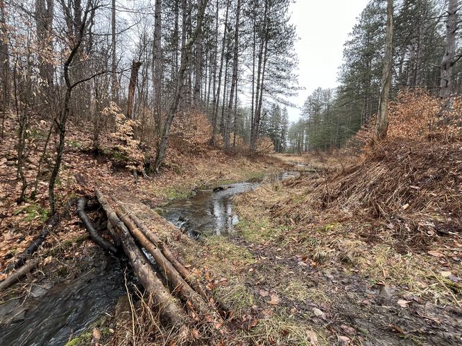
Creek crossings: Depending on the time of year, hikers may need to cross some small creeks - especially north of Bear Wallows where the water flows in and along the eastern side of the swamp. You may have to get your feet wet.
Limited cell service: For most of this hike, there's no cell phone service; however, using Verizon I noticed I had some 3G in spots near the summit of Big Rocks.
Winter Access
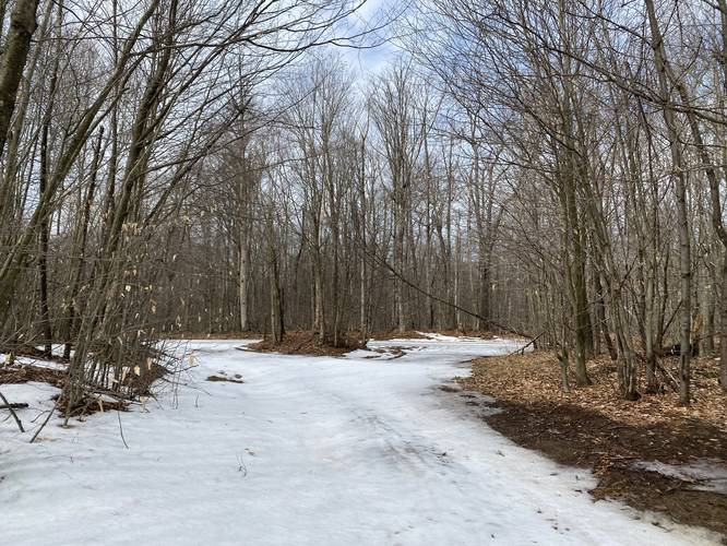
Note that this trail is not easy to access in the winter, even after several 60-degree days in a row. Do not attempt to drive to this trailhead if the road is full of snow unless your vehicle is built for that type of exploration.
Pine Creek Pinnacles (PCP20)
This hike is part of the Pine Creek Pinnacles hiking challenge. For more information, details, and FAQs, please visit our Pine Creek Pinnacles (PCP20) page.
Hike Description
Note that despite this being a "mountain summit" hike, the "ascent" is simply an easy uphill walk. This trail begins along Sand Rd near the parking coordinates provided and immediately crosses Bear Wallow Branch which flows from the swampy ponds formed by beaver dams upstream. Right after the creek crossing is a small beaver pond in Bear Wallow Branch that features towering evergreens that line the edge of the water, princess pines growing along the forest floor, and the beaver dam that blocks water flow, providing a home for them.
Unblazed Trail to Big Rocks Summit
After passing the pond, the trail begins its ascent up to Big Rocks by following an unblazed path (as of March 2022) that winds its way up the mountain. If hiking in the winter or in colder months, it's best to bring an offline app to help aid in finding your way. Around mile 0.6, hikers may notice a large rock outcropping in the middle of the woods - this is the summit of Big Rocks mountain. Here, the hike leads off-trail and through a somewhat swampy area to reach the summit. Hikers can make their way up this 15-foot rock outcropping to reach several "high" points on the rock. This mountain summit is unique for the area since most mountain peaks/summits in this region do not have rocky outcroppings. Due to this, a unique ecosystem has formed on Big Rocks summit which includes mosses, princess pines, ferns, and other "alpine-like" plants. This GPS track meanders the top of Big Rocks summit, which includes a couple of small caves that can be explored with caution. Note that during warmer months, this summit is probably a rattlesnake habitat with dens likely nearby, if not in the rocks themselves.
Easy Parking Area - Mile 1.1
After visiting Big Rocks, this GPS recording heads back to the trail to complete the loop. Around mile 1.1 is another parking area with a service road gate that hikers can use to reach Big Rocks summit within just a few-hundred feet of walking. Here, this GPS recording leads into a cutout within Big Rocks (potentially an old quarry site) before it follows the service road heading northeast.
Service Road to Pipeline
Hikers will continue along the service road for about 0.5-miles (stay right at the first junction near Big Rocks outcropping) before reaching a natural gas pipeline. At the pipeline are red blazes of the Quarry Trail that can be found on the eastern side of the pipeline. Follow the red blazes of the Quarry Trail east - passing the upper Bear Wallows swamp area - before the trail heads south.
Bear Wallows
Hikers will pass the official Bear Wallows swamp area along the last section of this hike which follows the Quarry Trail. Here, beaver slides can be found along the shores of the pond with beaver-cut tree trunks scattered about. Bear Wallows makes for another view point to stop at and take some photos before ending the hike.
After passing Bear Wallows, the Quarry Trail will end along Sand Rd. Hikers will then head south along Sand Road for several-hundred feet, passing through an old CCC pine plantation (circa 1930s) to then reach the parking area to complete the loop.
Lookout Point / Views
This trail only has one actual view point which is located along the gas pipeline. I also included two additional "views" - both located along the ponds of Bear Wallows / Bear Wallow Branch. There are no views from the summit of Big Rocks mountain, unfortunately.
Bouldering
This trail has plenty of spots where boulderers may find meaningful terrain to climb. The best spot for bouldering is likely near the "easy to access" section of Big Rocks - located a stone's throw from Right Asaph Rd (see the map).
Parking
Hikers will find a very small parking turnout at the coordinates provided. It's large enough to fit 1 vehicle. There's a much larger parking turnout at the trailhead along Right Asaph Rd, closer to Big Rocks summit.
Pets
Dogs are allowed if leashed and their waste should be carried out by the hiker.
Warnings
Rattlesnakes: During warm months (between late April and early October), hikers could encounter the Timber Rattlesnake in this area, especially at or near Big Rocks summit. The snakes will use the rocky outcropping to sun themselves during the daytime, but they can also be found hiding in the brush off-trail.
Creek crossings: Depending on the time of year, hikers may need to cross some small creeks - especially north of Bear Wallows where the water flows in and along the eastern side of the swamp. You may have to get your feet wet.
Limited cell service: For most of this hike, there's no cell phone service; however, using Verizon I noticed I had some 3G in spots near the summit of Big Rocks.
Winter Access
Note that this trail is not easy to access in the winter, even after several 60-degree days in a row. Do not attempt to drive to this trailhead if the road is full of snow unless your vehicle is built for that type of exploration.
Pine Creek Pinnacles (PCP20)
This hike is part of the Pine Creek Pinnacles hiking challenge. For more information, details, and FAQs, please visit our Pine Creek Pinnacles (PCP20) page.