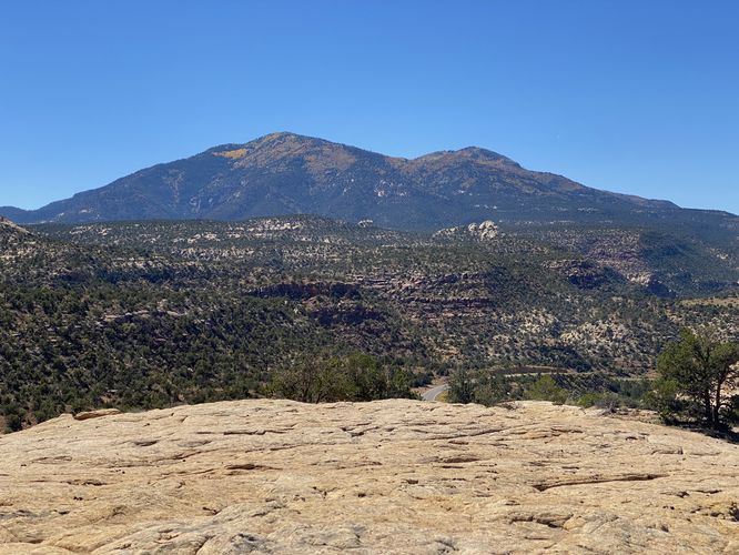
The Bears Ears Lookout at Bears Ears National Monument near Monticello, Utah is a moderate 0.2-mile out-and-back off-trail hike that reaches a beautiful vista point of Shay Mountain and the surrounding area.
This short hike begins at the parking turnout, at the coordinates provided, and follows bedrock, heading uphill, to reach the vista. Hikers will not follow any defined path but will rather be hiking off-trail to reach the lookout. Once at the top of the bedrock, hikers will get views facing south and southwest -- both views include mountains. Upon our hike here in late September 2023, the Birch trees in the mountains had turned a bright yellow, causing the mountain ranges around to be peppered with yellow foliage -- a beautiful sight to see in this vast desert. From the lookout, hikers will find the large Shay Mountain to the southwest. To the south is another mountain range that includes a handful of peaks.
Parking
Hikes will find a single-car parking turnout at the coordinates provided. The turnout is large enough to fit one vehicle. There are other turnouts located along this road -- most of which are large enough to fit one or two cars.
Pets
Dogs are allowed if leashed and should be cleaned up after.
Warnings
Sun exposure: This trail has very little shade and no water sources. Pack-in all water and wear sun screen and a hat to protect against sun exposure. It's smart to hike either in the early morning or late afternoon to avoid the intense desert sun.
No water: This trail has no water sources so you must pack-in all water. A general rule of thumb in the desert is 1 gallon of water per person per day.
Rattlesnakes: This is rattlesnake territory, so be on the lookout and give any rattlers you find plenty of space. Note that with this being an off-trail hike, and there being plenty of bushes, it's smart to stay away from the bushes and hike in the open spaces to avoid any coiled snaked that might be catching a bit of shade.