Discover the magic of the Dolomites on this unforgettable loop hike through the Alpe di Siusi (Seiser Alm), Europe's largest high-altitude alpine meadow. Accessible directly from the charming village of Ortisei, Italy, this route transports you into a postcard-perfect landscape defined by sprawling Alpine meadows and traditional chalets that dot the hillsides. Whether you are an avid photographer hunting for the perfect golden hour shot or a traveler seeking immersion in South Tyrol’s natural beauty, this accessible trail offers easy access to the UNESCO World Heritage site in the Italian Alps.
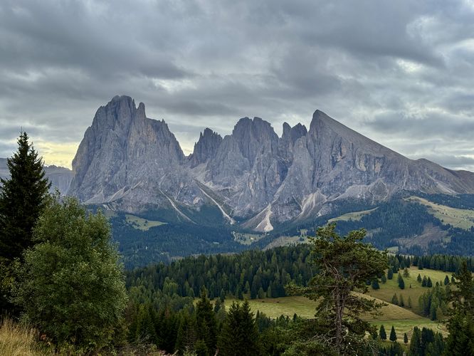
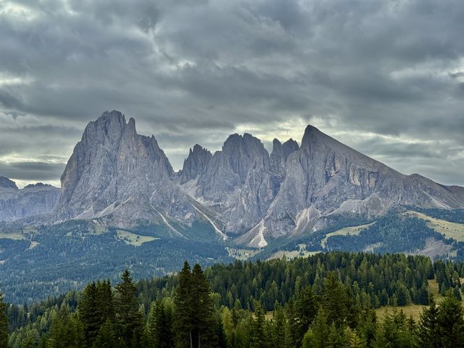
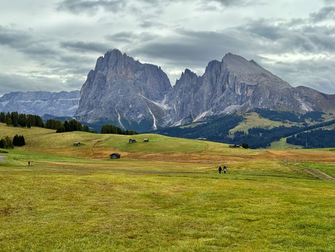
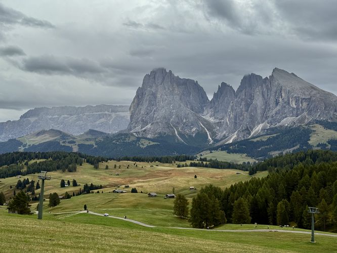
Starting from the summit station of the Mont Sëuc cable car, this moderate 6.5 km (4 mile) loop hike features a breathtaking payoff for minimal effort. As you walk public roads and trails, the Alpine views are dominated by the jagged, limestone peaks of the Langkofel Group massif (Gruppo del Sassolungo) like the towering Grohmannspitze (Punta Grohmann). This trail guide will lead you through a journey where every turn reveals a new perspective of towering rock faces contrasting against picturesque alpine meadows, making it one of the most rewarding day hikes in the Val Gardena region.
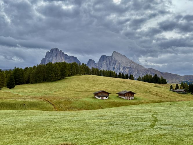
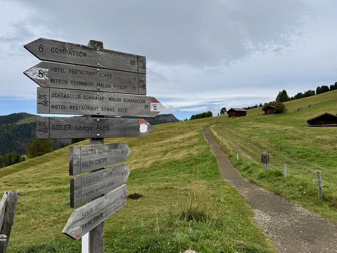
You'll pass more quaint, charming alpine chalets and views of the rolling pastures before reaching a right-hand turn at 3.6 km. After taking this turn, you'll start to hike up a steeper road that traverses higher into the Aple di Siusi meadows. Simply follow trail signs toward St. Ulrich - Ortisei. Along the way uphill, you'll find more of the same views you found earlier but from a different perspective. Personally, these views never got old for me!
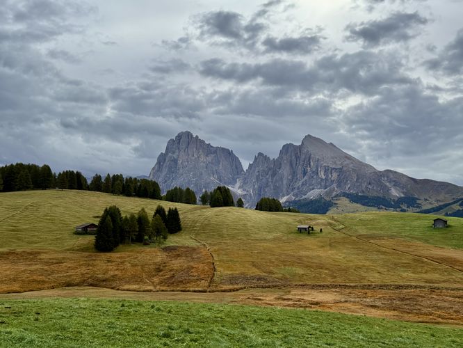
After hiking up the road, you can take a more scenic route to reach the cable car station by taking a left-hand turn (head straight) near the 4.6 km marker where you'll find a dirt trail that runs higher into the alpine meadows. This unnamed trail leads hikers straight to the cable car station, but along the way are even more breathtaking views of Europe's largest high-elevation meadow. I can't stress this enough that despite the abundant views from different perspectives along this loop, even the views from this unnamed trail are spectacular enough to where you'll continue to be aw-struck by the beauty of the Dolomites. I took way too many pictures here as well as earlier in the loop and you likely will too!
Last the, hike ends back at the cable car station after you pass through a small section of forest where you lose the views for a few minutes. Once back at the cable car station, consider stopping at the Almgasthof Mont Sëuc (Mont Sëuc Restaurant) for a bite to eat or another espresso to refuel. The restaurant features outdoor seating where you can enjoy more of the same Alpine views before riding the cable car back down to Ortisei!
Starting from the summit station of the Mont Sëuc cable car, this moderate 6.5 km (4 mile) loop hike features a breathtaking payoff for minimal effort. As you walk public roads and trails, the Alpine views are dominated by the jagged, limestone peaks of the Langkofel Group massif (Gruppo del Sassolungo) like the towering Grohmannspitze (Punta Grohmann). This trail guide will lead you through a journey where every turn reveals a new perspective of towering rock faces contrasting against picturesque alpine meadows, making it one of the most rewarding day hikes in the Val Gardena region.
Mont Sëuc Summit: Accessible Panoramas & Dining
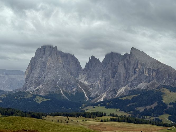
After hopping off of the Mont Sëuc cable car, you'll be standing at a stunning view of the vast Alpe di Siusi alpine meadows. For visitors who don't plan to hike or can't physically navigate the 6.6 km loop, simply showing up to view the the Langkofel Group massif and Alpe di Siusi meadows is worth the cable car ride. Additionally, there's a restaurant on site where you can grab a bite to eat or grab an espresso to refuel.Winding Through the Pastures: Following the Alpine Loop
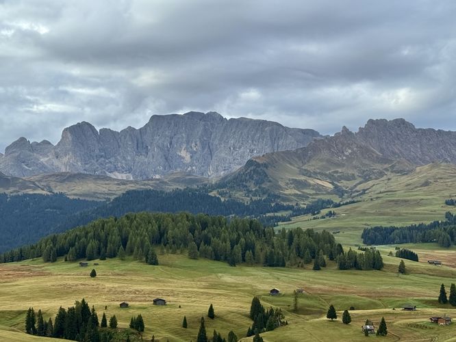
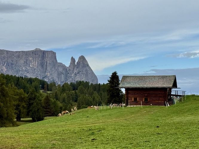
The hike begins after exploring the first views located just outside of the cable car station. If you enjoy solitude, you'll first skip those views and its crowds and simply start hiking eastward along the public, dirt road as it begins to descend into the Alpe di Siusi pastures. Following the dirt road downhill, hikers will eventually reach a hairpin turn as the road starts to curve to southwest. Along the way, you'll find views of the jagged Alpine mountains in the Langkofel Group. As the road continues to descend, you'll pass a small farm with donkeys and llamas that hang out leisurely by the trail side. Views to the southwest feature the Alpine slopes of Roterdspitze (Cima di Terrarossa) and the Schlern (Schiliar) which stretch across the far side of Alpe di Siusi's sprawling meadows.Reaching Belvedere Aple di Siusi - 1.6 km (1 Mile)
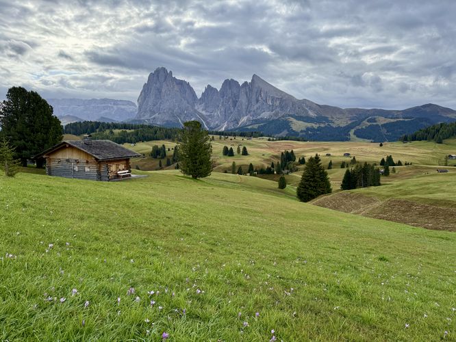
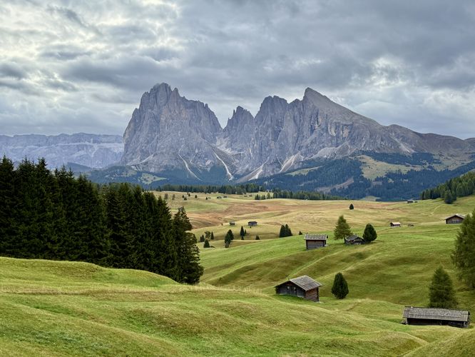
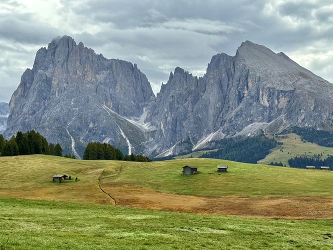
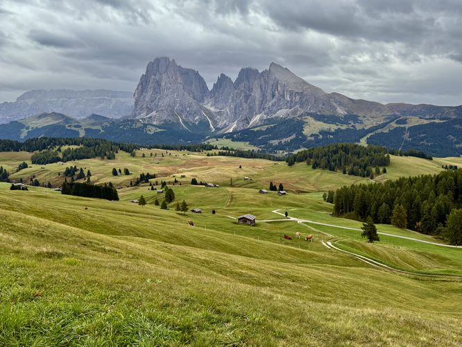
One of the best views along the loop can be found near 1.6 km from the trailhead, the Belvedere dell'Alpe di Siusi (Viewpoint of the Alpe di Siusi). While the view is similar to the vistas found earlier in the hike, it features more charming Alpine chalets that dot the rolling hillsides of Europe's largest high-elevation meadow. Honestly this viewpoint is likely one of the best along the hike and one of the best views in all of the Dolomites, so be sure to stop here for photos!Hiking to the Sanon-Hütte - 1.6 km to 2.6 km (1 to 1.65 Miles)
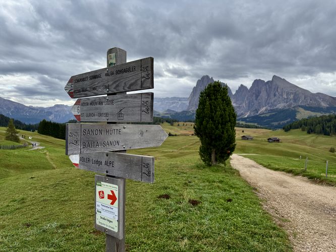
The next stop along this loop hike leads to the restaurant, Sanon-Hütte (Malga Sanon), which is a great place to stop for a bite to eat or an espresso. To get there from the Belvedere dell'Aple di Siusi, simply follow the road west until you reach a trail junction near the 2 km mark, then take a left-hand turn to hike downhill. The views along the way will continue to amaze you with more quaint chalets, cows with clanging cowbells, and breathtaking Dolomites Alps views despite more downhill hiking. On our hike, we stopped at the Sanon-Hütte (Malga Sanon) so I could grab an excellent espresso to keep my day rolling. I highly recommend paying this restaurant a short visit on your hike too! With a hot coffee in hand, you can sit outside to enjoy some of the best views of the Dolomites.Returning to the Lift: Completing the Loop - 2.6 km to 6.5 km (1.65 to 4 Miles)
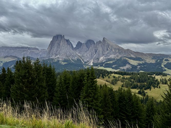
After passing or leaving Sanon-Hütte (Malga Sanon), this route leads hikers westward as the trail begins to head back uphill. Note that the trail will continue to climb all the way back to the cable car. Along the way, you'll find more stunning Dolomites views like the sprawling Alpine meadows of Alpe di Siusi, the dramatic backdrop of the peaks in the Langkofel Group massif to the southeast, and the broad alpine peaks of Roterdspitze (Cima di Terrarossa) and the Schlern (Schiliar) to the southwest.You'll pass more quaint, charming alpine chalets and views of the rolling pastures before reaching a right-hand turn at 3.6 km. After taking this turn, you'll start to hike up a steeper road that traverses higher into the Aple di Siusi meadows. Simply follow trail signs toward St. Ulrich - Ortisei. Along the way uphill, you'll find more of the same views you found earlier but from a different perspective. Personally, these views never got old for me!
After hiking up the road, you can take a more scenic route to reach the cable car station by taking a left-hand turn (head straight) near the 4.6 km marker where you'll find a dirt trail that runs higher into the alpine meadows. This unnamed trail leads hikers straight to the cable car station, but along the way are even more breathtaking views of Europe's largest high-elevation meadow. I can't stress this enough that despite the abundant views from different perspectives along this loop, even the views from this unnamed trail are spectacular enough to where you'll continue to be aw-struck by the beauty of the Dolomites. I took way too many pictures here as well as earlier in the loop and you likely will too!
Last the, hike ends back at the cable car station after you pass through a small section of forest where you lose the views for a few minutes. Once back at the cable car station, consider stopping at the Almgasthof Mont Sëuc (Mont Sëuc Restaurant) for a bite to eat or another espresso to refuel. The restaurant features outdoor seating where you can enjoy more of the same Alpine views before riding the cable car back down to Ortisei!