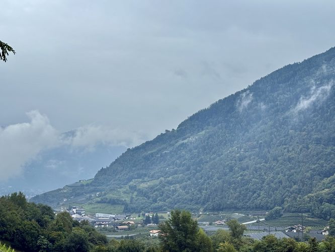
Looking for an easy stroll through scenic Italian vineyards and orchards in the heart of the Italian Alps near Lagundo, Italy? The hike along Algunder Waalweg (Italian: Roggia di Lagundo), is one of South Tyrol's best vineyard walks. Located just minutes from the town of Lagundo, this historic irrigation channel trail offers a relaxing escape, winding gently through a mesmerizing sea of apple orchards and terraced vineyards that stretch as far as the eye can see.
You don't need to commit to a strenuous mountain trek to experience the region's Alpine-Mediterranean charm. This trail guide focuses on an easy 1.4 km (0.9 mile) out-and-back walk, capturing the most picturesque section of the trail right in the heart of the valley. Perfect for photographers, families, or anyone seeking a peaceful breath of fresh air, this short route immerses you in the vibrant colors and scents of Northern Italy’s famous fruit farms.
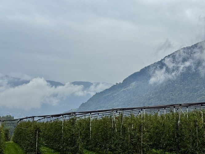
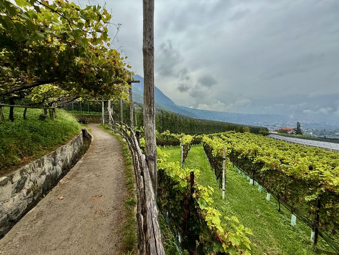
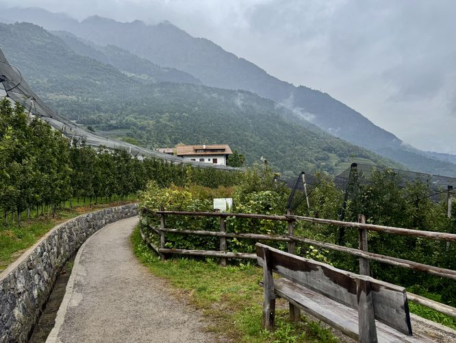
Passing under the "Algunder Waalweg" arched trail sign, hikers will immediately be immersed in the valley's vineyards with grape trellises that hang overhead, views of the apple orchards that sprawl through the valley, and views of the towering Alpine mountains of South Tyrol.
Near 0.75 km, after passing the most-scenic orchard and vineyard views of the trail, this route turns around to head back to parking. Note that at 0.75 km, biking is no longer permitted and the trail is only for foot traffic!
The return hike to parking follows the same, but opposite route, as it leads back through the quaint, charming Italian vineyards and orchards with views of the towering Alpine mountains overhead. Return back at the parking lot near 1.4 km (0.9 miles) to wrap up this easy, short vineyard stroll.
You don't need to commit to a strenuous mountain trek to experience the region's Alpine-Mediterranean charm. This trail guide focuses on an easy 1.4 km (0.9 mile) out-and-back walk, capturing the most picturesque section of the trail right in the heart of the valley. Perfect for photographers, families, or anyone seeking a peaceful breath of fresh air, this short route immerses you in the vibrant colors and scents of Northern Italy’s famous fruit farms.
Hiking the Scenic Algunder Waalweg
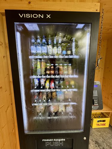
This short hike begins at the western trailhead, located on Alte Landstrasse (Strada Vecchia) where visitors will find an accommodating parking lot with the trailhead located on the north side. The trail starts out by passing a natural spring and, as of September 2025, features a vending machine with drinks, snacks, and Alpine cheese!Passing under the "Algunder Waalweg" arched trail sign, hikers will immediately be immersed in the valley's vineyards with grape trellises that hang overhead, views of the apple orchards that sprawl through the valley, and views of the towering Alpine mountains of South Tyrol.
Explore Apple Orchards and Vineyards of South Tyrol
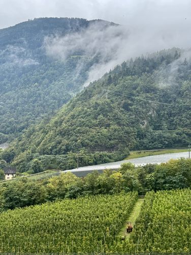
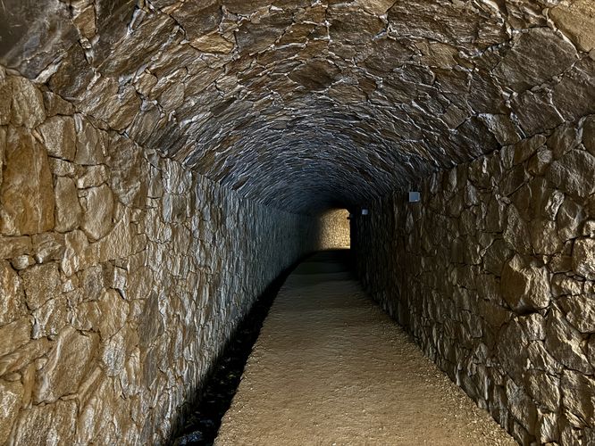
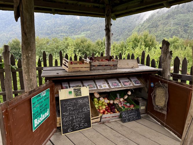
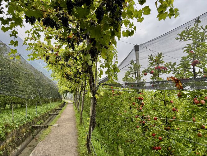
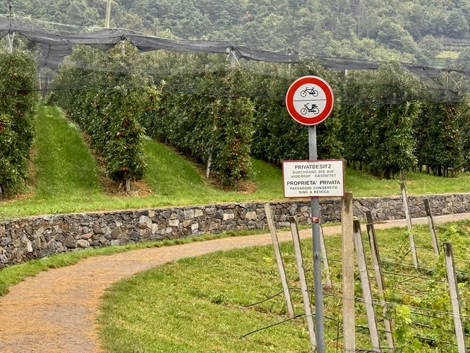
The trail leads visitors through a tunnel where motion sensor lights illuminate the path as you walk. After you exit the tunnel, the Algunder Waalweg turns away from the main road and passes directly through a beautiful apple orchard with more grape vine trellises that hang over the trail, filled with grapes of different varieties! Views begin to open up as you make your way through scenic orchards and vineyards. Near 0.46 km from the trailhead sits a self-serve fruit stand where you can purchase apples and other locally grown fruits.Near 0.75 km, after passing the most-scenic orchard and vineyard views of the trail, this route turns around to head back to parking. Note that at 0.75 km, biking is no longer permitted and the trail is only for foot traffic!
The return hike to parking follows the same, but opposite route, as it leads back through the quaint, charming Italian vineyards and orchards with views of the towering Alpine mountains overhead. Return back at the parking lot near 1.4 km (0.9 miles) to wrap up this easy, short vineyard stroll.