The Yellow Loop at the West Glenwood Preserve in Scotts Valley, California is a moderate 0.5-mile loop trail that passes through an ancient old-growth redwood grove.
Hike Description
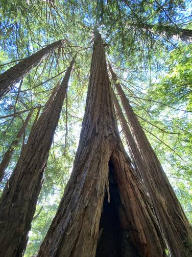
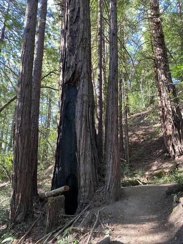
The Yellow Loop has several trailhead locations found along the Magenta Loop and Green Loop trails at the park. This recording begins at the middle junction and heads in a counter-clockwise direction. The redwood grove sits in the eastern section of the trail - hikers will not be able to miss their presence. Hikers can walk up to the base of most of these redwoods, but watch out for poison oak as it's almost everywhere off-trail.
Parking
Hikers will find a small parking lot at the coordinates provided. It's large enough to fit about 6 vehicles.
Pets
Dogs are allowed if leashed and their waste must be carried out by the hiker.
Warnings
Rattlesnakes, mountain lion, wasps, poison oak, and ticks may all be found within this park.
Prohibited
No camping, no plant/animal/mineral collecting, no motorized vehicles or horses. No smoking, no alcohol.
Hike Description
The Yellow Loop has several trailhead locations found along the Magenta Loop and Green Loop trails at the park. This recording begins at the middle junction and heads in a counter-clockwise direction. The redwood grove sits in the eastern section of the trail - hikers will not be able to miss their presence. Hikers can walk up to the base of most of these redwoods, but watch out for poison oak as it's almost everywhere off-trail.
Parking
Hikers will find a small parking lot at the coordinates provided. It's large enough to fit about 6 vehicles.
Pets
Dogs are allowed if leashed and their waste must be carried out by the hiker.
Warnings
Rattlesnakes, mountain lion, wasps, poison oak, and ticks may all be found within this park.
Prohibited
No camping, no plant/animal/mineral collecting, no motorized vehicles or horses. No smoking, no alcohol.