The Wolf Creek Falls Loop at Wolf Creek Falls Preserve near Altamont, New York is a moderate 1.5-mile loop hike that features about 9 different seasonal waterfalls that range between 1 and 10-feet tall.
Trails
This hike follows several blazed trails in a counter-clockwise circle from the trailhead as follows: White Trail, Green Trail, Red Trail, White Trail, Blue Trail, Yellow Trail, and finally the White Trail. Please see the park map to understand where these trail junctions are location.
Hike Description
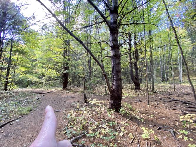
This hike begins at the main parking lot for Wolf Creek Falls Preserve and heads in on the White Trail to start. As mentioned, this hike follows several named trails in a counter-clockwise circle, so around mile 0.05, hikers will reach their first left-hand turn to reach the Green Trail.
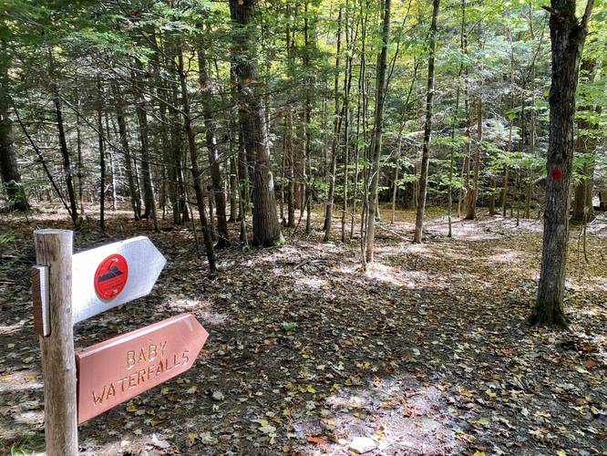
Right-Hand Turn to Baby Waterfalls - Mile 0.18
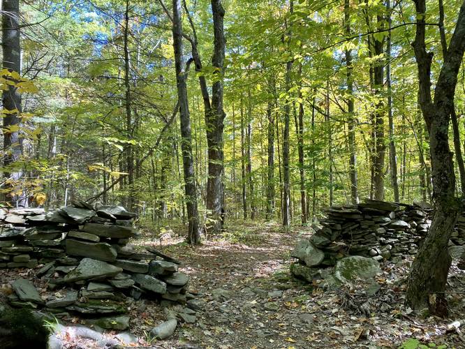
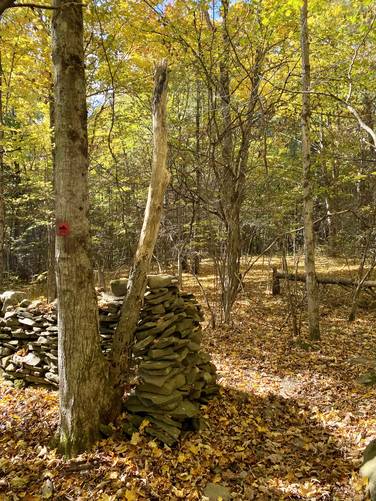
Around mile 0.18, hikers will reach a right-hand turn onto the Red Trail and heads toward the Baby Waterfalls. Along the way, hikers will pass an old rock wall that once defined a farmer's property.
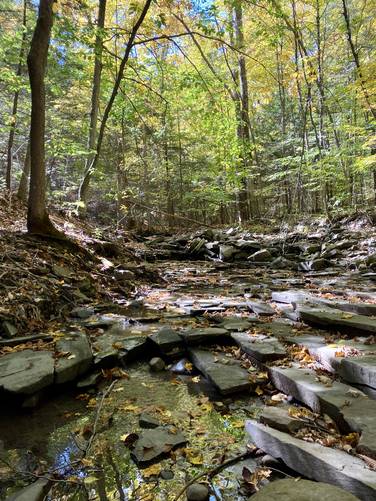
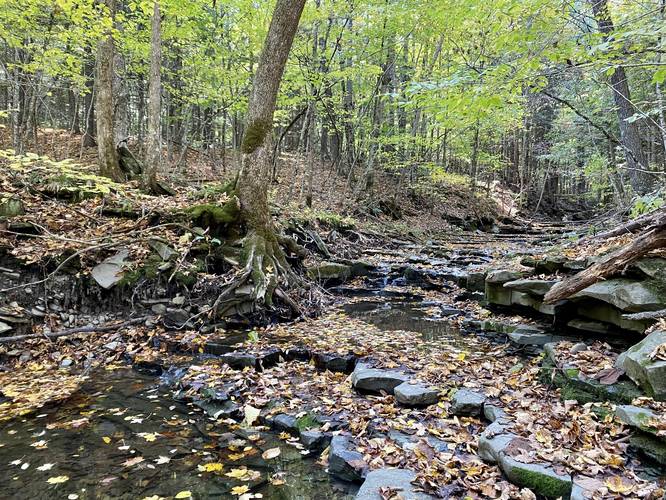
Baby Waterfalls - Mile 0.2 to 0.25
From miles 0.2 to 0.25, hikers will walk past an unnamed creek where the creekbed is simply cascading bedrock in very very short steps (less than 1-foot each), which creates the "Baby Waterfalls".
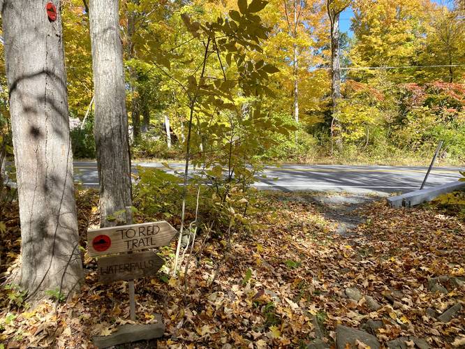
Road Crossing - Head Right (East) - Mile 0.3
Around mile 0.3, hikers will reach a road crossing where the Red Trail crosses the road and heads east slightly to head back into the woods. Not too long before this road crossing is another section, of what appears to be, the same rock wall you hiked past earlier.
10-foot Waterfall - Mile 0.45
At mile 0.45, hikers will reach an off-trail waterfall (requires a tricky walk) down to a 6-foot and ~15-foot wide seasonal waterfall.
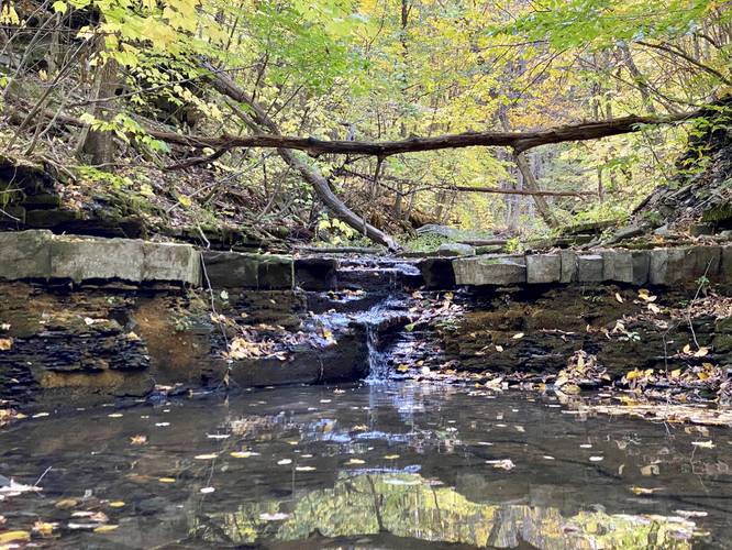
2-foot Waterfall - Mile 0.5
Just downstream from the larger 6-foot cascade lies a 2-foot tall seasonal waterfall that spans about 15-20 feet across the creek, located off-trail.
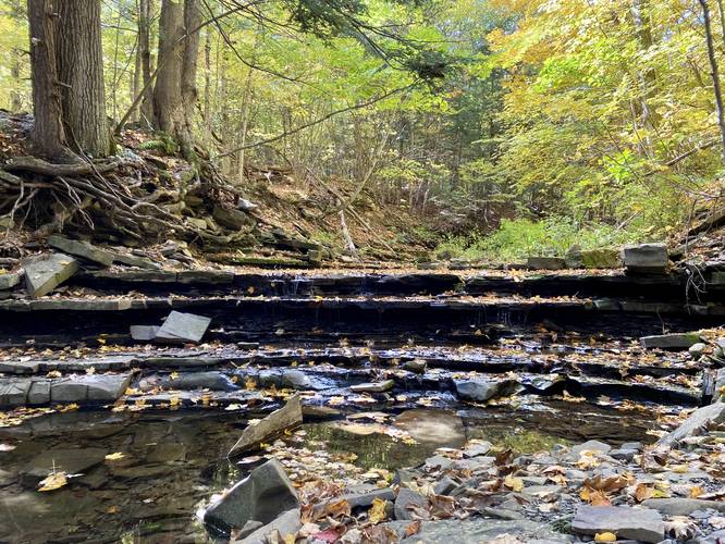
More 2-foot Waterfalls - Mile 0.65
At mile 0.65, hikers will find a creek crossing with a wooden bridge to help keep your feet dry, if the water level is high. At this crossing is a 2-foot tall and 20-foot wide seasonal cascade that spills down Wolf Creek. Just upstream from this waterfall, technically off-trail, is another 2-foot tall and 20-foot wide waterfall that cascades down Wolf Creek.
Left-Hand Turn to White Trail - Mile 0.7
At mile 0.7, or just beyond the wooden bridge crossing, is the left-hand turn to the White Trail.
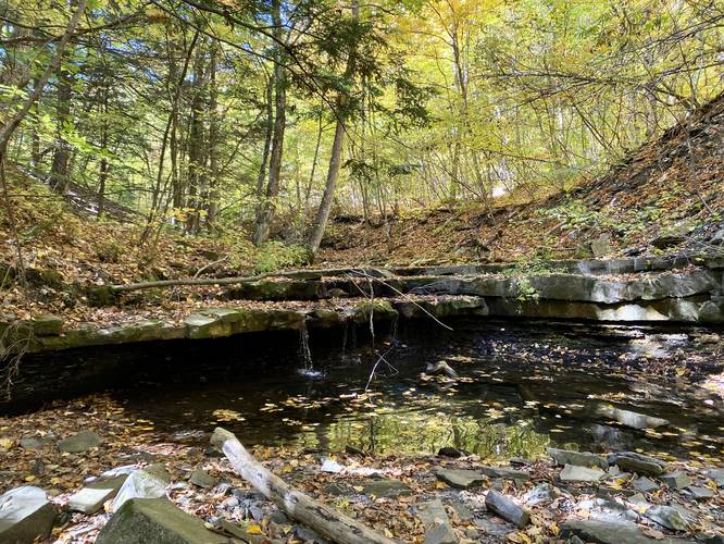
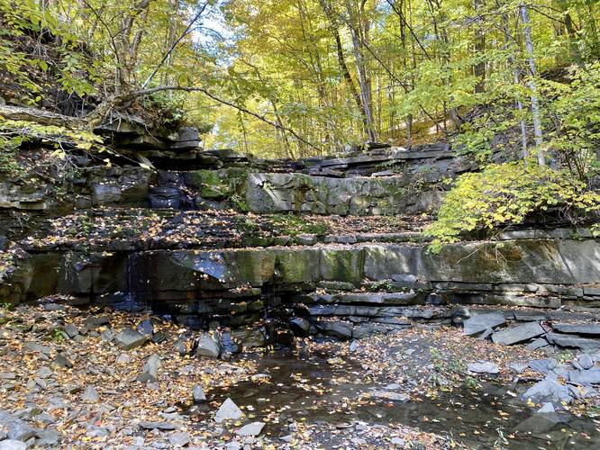
3-feet Waterfall - Mile 0.75
At mile 0.75, hikers will reach another seasonal waterfall along Wolf Creek that cascades down at about 3-feet tall and 10-feet wide.
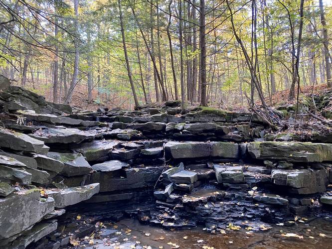
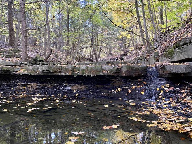
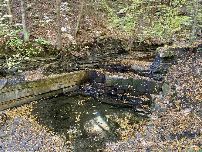
Quarry Waterfall (10-feet tall) - Mile 0.85
At mile 0.85, hikers will find a large seasonal waterfall, approximately 10-feet tall, that cascades down Wolf Creek and into a deeper pool of water below. The flat-cut rock on the south side of the gorge indicates that this area was likely quarried to resell the stone.
Wolf Creek Falls (10-foot waterfall) - Mile 0.9
At mile 0.9 lies the last waterfall that hikers can explore and is likely the largest and easiest to hike to, but is technically located off-trail. Here, hikers can make their way down the path that leads to the base of this 10-foot tall seasonal waterfall.
Left-Hand Turn to Blue Trail - Mile 1
At mile 1, hikers will take a left-hand turn onto the Blue Trail.
Left-Hand Turn to Yellow Trail - Mile 1.13
At mile 1.13, hikers will take a left-hand turn onto the Yellow Trail.
Road Crossing - Mile 1.23
At mile 1.23, hikers will cross the road once again to continue following the Yellow Trail.
Left-Hand Turn to White Trail - Mile 1.3
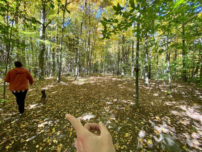
At mile 1.3, hikers will take a left-hand turn onto the White Trail which leads back to parking. Make sure to keep left at mile 1.45 which leads along the spur trail to the parking lot.
Seasonal Waterfalls
Both creeks along this hike provide waterfalls, but they're best to visit in the Spring when the snow melt is rushing down these creek beds. When visiting in early October 2022, the water was basically dried up.
Parking
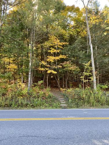
Hikers will find parking at the coordinates provided. The lot is large enough to fit less than 10 cars. If this lot is full, please find another hike as there's no roadside parking here.
Pets
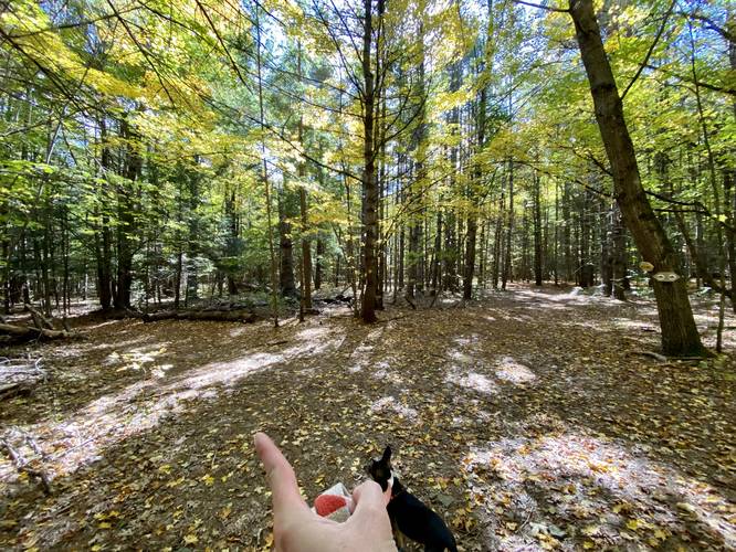
Dogs are allowed if leashed and their waste must be carried out by the hiker.
Trails
This hike follows several blazed trails in a counter-clockwise circle from the trailhead as follows: White Trail, Green Trail, Red Trail, White Trail, Blue Trail, Yellow Trail, and finally the White Trail. Please see the park map to understand where these trail junctions are location.
Hike Description
This hike begins at the main parking lot for Wolf Creek Falls Preserve and heads in on the White Trail to start. As mentioned, this hike follows several named trails in a counter-clockwise circle, so around mile 0.05, hikers will reach their first left-hand turn to reach the Green Trail.
Right-Hand Turn to Baby Waterfalls - Mile 0.18
Around mile 0.18, hikers will reach a right-hand turn onto the Red Trail and heads toward the Baby Waterfalls. Along the way, hikers will pass an old rock wall that once defined a farmer's property.
Baby Waterfalls - Mile 0.2 to 0.25
From miles 0.2 to 0.25, hikers will walk past an unnamed creek where the creekbed is simply cascading bedrock in very very short steps (less than 1-foot each), which creates the "Baby Waterfalls".
Road Crossing - Head Right (East) - Mile 0.3
Around mile 0.3, hikers will reach a road crossing where the Red Trail crosses the road and heads east slightly to head back into the woods. Not too long before this road crossing is another section, of what appears to be, the same rock wall you hiked past earlier.
10-foot Waterfall - Mile 0.45
At mile 0.45, hikers will reach an off-trail waterfall (requires a tricky walk) down to a 6-foot and ~15-foot wide seasonal waterfall.
2-foot Waterfall - Mile 0.5
Just downstream from the larger 6-foot cascade lies a 2-foot tall seasonal waterfall that spans about 15-20 feet across the creek, located off-trail.
More 2-foot Waterfalls - Mile 0.65
At mile 0.65, hikers will find a creek crossing with a wooden bridge to help keep your feet dry, if the water level is high. At this crossing is a 2-foot tall and 20-foot wide seasonal cascade that spills down Wolf Creek. Just upstream from this waterfall, technically off-trail, is another 2-foot tall and 20-foot wide waterfall that cascades down Wolf Creek.
Left-Hand Turn to White Trail - Mile 0.7
At mile 0.7, or just beyond the wooden bridge crossing, is the left-hand turn to the White Trail.
3-feet Waterfall - Mile 0.75
At mile 0.75, hikers will reach another seasonal waterfall along Wolf Creek that cascades down at about 3-feet tall and 10-feet wide.
Quarry Waterfall (10-feet tall) - Mile 0.85
At mile 0.85, hikers will find a large seasonal waterfall, approximately 10-feet tall, that cascades down Wolf Creek and into a deeper pool of water below. The flat-cut rock on the south side of the gorge indicates that this area was likely quarried to resell the stone.
Wolf Creek Falls (10-foot waterfall) - Mile 0.9
At mile 0.9 lies the last waterfall that hikers can explore and is likely the largest and easiest to hike to, but is technically located off-trail. Here, hikers can make their way down the path that leads to the base of this 10-foot tall seasonal waterfall.
Left-Hand Turn to Blue Trail - Mile 1
At mile 1, hikers will take a left-hand turn onto the Blue Trail.
Left-Hand Turn to Yellow Trail - Mile 1.13
At mile 1.13, hikers will take a left-hand turn onto the Yellow Trail.
Road Crossing - Mile 1.23
At mile 1.23, hikers will cross the road once again to continue following the Yellow Trail.
Left-Hand Turn to White Trail - Mile 1.3
At mile 1.3, hikers will take a left-hand turn onto the White Trail which leads back to parking. Make sure to keep left at mile 1.45 which leads along the spur trail to the parking lot.
Seasonal Waterfalls
Both creeks along this hike provide waterfalls, but they're best to visit in the Spring when the snow melt is rushing down these creek beds. When visiting in early October 2022, the water was basically dried up.
Parking
Hikers will find parking at the coordinates provided. The lot is large enough to fit less than 10 cars. If this lot is full, please find another hike as there's no roadside parking here.
Pets
Dogs are allowed if leashed and their waste must be carried out by the hiker.