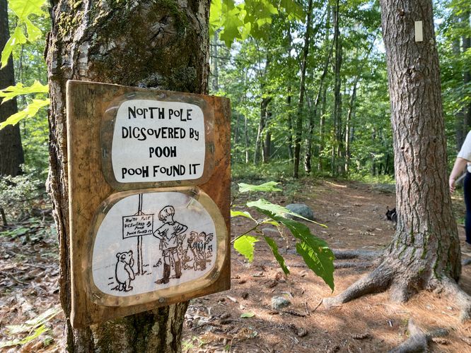
The Winnie-the-Pooh Trail at Goodwill Conservation Area near Barrington, new Hampshire is an easy 0.8-mile out-and-back hike that leads through the forest to Winnie-the-Pooh's house, passing "houses" of the characters from the book along the way. This trail provides a great way for readers (past and present), especially little kids, to connect the real-world with fictional characters from the book.
Hike
This short hike begins at the main trailhead for Goodwill Conservation Area and follows the main path as it leads into the forest. Hikers will find trail signs with arrows to stay on-trail for the Winnie-the-Pooh Trail as it winds its way south through the conservation area. To begin, hikers will pass Richardson Pond where you'll find scenic views of the water before the trail skirts away from the pond and into the woods. The views of the pond are best near the main trailhead and parking lot.
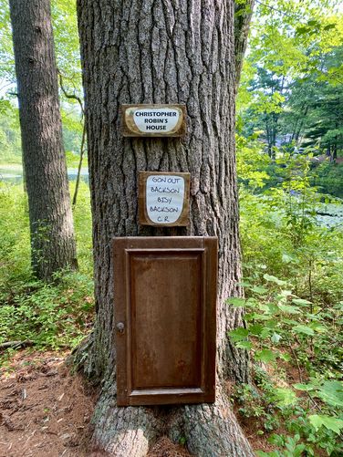
Christopher Robin's House - Mile 0.05
Just a few-hundred feet into the hike lies Christopher Robin's house -- a doorway attached to a tree, located around mile 0.05 on the south side of Richardson Pond.
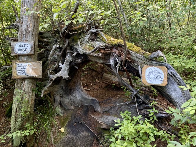
Rabbit's House - Mile 0.1
Just down the trail lies Rabbit's House around mile 0.1, located within the thick forest on the south side of the pond.
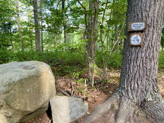
Kanga Roo and Tigger's House - Mile 0.18
The trail leads around a bend before reaching Kanga Roo and Tigger's house, located around mile 0.18.
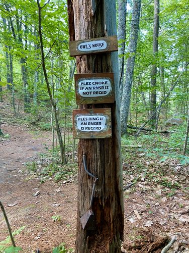
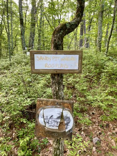
Owl's House - Mile 0.2
Owl's House can be found at mile 0.2, just south of Kanga Roo and Tigger's house. The trail continues south from Owl's House where you'll find a Sandy Pit where Roo Plays and Piglet's house down trail.
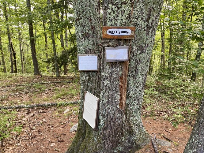
Piglet's House - Mile 0.25
At mile 0.25, hikers will pass Piglet's house.
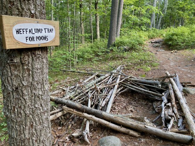
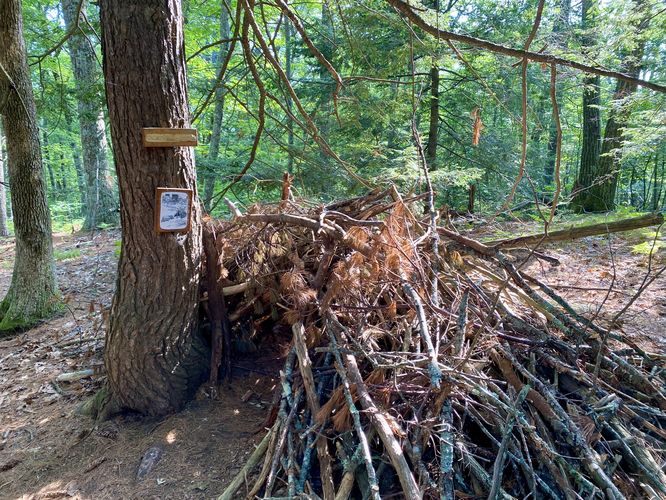
Heffalump Trap for Poohs - Mile 0.3
The trail continues southward still, passing a Heffalump Trap for Poohs around mile 0.3.
Left-Hand Turn - Mile 0.35
The Winnie-the-Pooh Trail continues at a left-hand turn around mile 0.35. You can also hike straight downhill from this junction to reach Pooh's house.
Eeyore's House - Mile 0.38
Around mile 0.38, in the small loop at the southern end of the trail, lies Eeyore's house tucked away in the woods near Pooh's house.
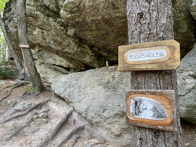
Winnie-the-Pooh's House - Mile 0.5
After hiking down a hillside, hikers will reach the very bottom of the lowlands along the trail where a large ~30-foot cliff and ledge sits. This is Pooh's house, located under the rocky ledge. During our hike here in July 2024, we found empty honey bottles left at Pooh's house - surprisingly untouched by the local wildlife - in a tribute to the lovable bear. The cliff is by-far the most interesting part of the trail, aside from Richarson's Pond, if you're not too interested in the fun storybook locations found along the trail.
Hiking Out - Mile 0.5 to 0.8
The hike back to parking follows the same trail that lead down to Pooh's house with the exception of taking some short-cut paths instead of following the same exact path. The hike back is a short 0.3-mile walk with a small amount of uphill hiking from Pooh's house.
Parking
Hikers will find a medium-sized parking lot at the coordinates provided, located on the south side of Richardson Road in Barrington, New Hampshire. The lot is large enough to fit a dozen vehicles as of July 2024.
Pets
Dogs are allowed only if leashed and must be cleaned up after.
Warning
Buggy: This trail was super buggy during our hike here in July. Best to bring bug spray.
Hike
This short hike begins at the main trailhead for Goodwill Conservation Area and follows the main path as it leads into the forest. Hikers will find trail signs with arrows to stay on-trail for the Winnie-the-Pooh Trail as it winds its way south through the conservation area. To begin, hikers will pass Richardson Pond where you'll find scenic views of the water before the trail skirts away from the pond and into the woods. The views of the pond are best near the main trailhead and parking lot.
Christopher Robin's House - Mile 0.05
Just a few-hundred feet into the hike lies Christopher Robin's house -- a doorway attached to a tree, located around mile 0.05 on the south side of Richardson Pond.
Rabbit's House - Mile 0.1
Just down the trail lies Rabbit's House around mile 0.1, located within the thick forest on the south side of the pond.
Kanga Roo and Tigger's House - Mile 0.18
The trail leads around a bend before reaching Kanga Roo and Tigger's house, located around mile 0.18.
Owl's House - Mile 0.2
Owl's House can be found at mile 0.2, just south of Kanga Roo and Tigger's house. The trail continues south from Owl's House where you'll find a Sandy Pit where Roo Plays and Piglet's house down trail.
Piglet's House - Mile 0.25
At mile 0.25, hikers will pass Piglet's house.
Heffalump Trap for Poohs - Mile 0.3
The trail continues southward still, passing a Heffalump Trap for Poohs around mile 0.3.
Left-Hand Turn - Mile 0.35
The Winnie-the-Pooh Trail continues at a left-hand turn around mile 0.35. You can also hike straight downhill from this junction to reach Pooh's house.
Eeyore's House - Mile 0.38
Around mile 0.38, in the small loop at the southern end of the trail, lies Eeyore's house tucked away in the woods near Pooh's house.
Winnie-the-Pooh's House - Mile 0.5
After hiking down a hillside, hikers will reach the very bottom of the lowlands along the trail where a large ~30-foot cliff and ledge sits. This is Pooh's house, located under the rocky ledge. During our hike here in July 2024, we found empty honey bottles left at Pooh's house - surprisingly untouched by the local wildlife - in a tribute to the lovable bear. The cliff is by-far the most interesting part of the trail, aside from Richarson's Pond, if you're not too interested in the fun storybook locations found along the trail.
Hiking Out - Mile 0.5 to 0.8
The hike back to parking follows the same trail that lead down to Pooh's house with the exception of taking some short-cut paths instead of following the same exact path. The hike back is a short 0.3-mile walk with a small amount of uphill hiking from Pooh's house.
Parking
Hikers will find a medium-sized parking lot at the coordinates provided, located on the south side of Richardson Road in Barrington, New Hampshire. The lot is large enough to fit a dozen vehicles as of July 2024.
Pets
Dogs are allowed only if leashed and must be cleaned up after.
Warning
Buggy: This trail was super buggy during our hike here in July. Best to bring bug spray.