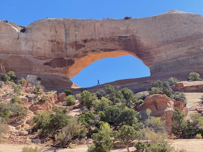
The Wilson Arch Trail at the Bureau of Land Management's Wilson Arch near Moab, Utah is an easy 0.1-mile out-and-back walk that features views of the very-large natural rock formation known as the Wilson Arch.
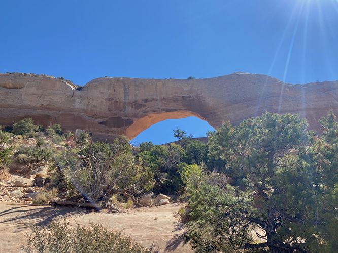
This is not a hike but rather a short walk that leads uphill along bedrock to reach a viewpoint of the Wilson Arch. Hikers can, if they wish, hike up to the bottom of the arch to get a view from under the rock formation; however, the best view of the arch is located below. If you wish to hike to the bottom of the arch, the trail is likely more "moderate" in difficulty as the trail heads straight uphill.
The Wilson Arch is approximately 91-feet long and 46-feet tall and was named after a local pioneer named Joe Wilson.
Parking
Hikers will find a large parking turnout on each side of the road, near the coordinates provided. The lot is large enough to fit a couple dozen vehicles as of September, 2023.
Pets
Dogs are allowed only if leashed and must be cleaned up after.
Warnings
Sun exposure: This trail has very little shade and no water sources. Pack-in all water and wear sun screen and a hat to protect against sun exposure. It's smart to hike either in the early morning or late afternoon to avoid the intense desert sun.
No water: This trail has no water sources so you must pack-in all water. A general rule of thumb in the desert is 1 gallon of water per person per day.
Rattlesnakes: This is rattlesnake territory, so be on the lookout and give any rattlers you find plenty of space.
Rockfall: This trail passes under a rock cliff that can occasionally have rockfall activity.