Whispering Pines Lake via Stone Hollow Trail at State Game Lands 64 near Galeton, Pennsylvania is a moderate 2.4-mile out-and-back hike that features the lake, a view of the rolling hills and wind turbines from a logged area, and remnants of long-abandoned homes like an old cellar hole and stone bridge pillars.
Hike Description
This hike begins at the brown service road gate located at the trailhead, adjacent to the parking lot.
Abandoned Cellar Hole - Mile 0
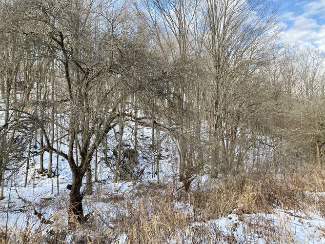
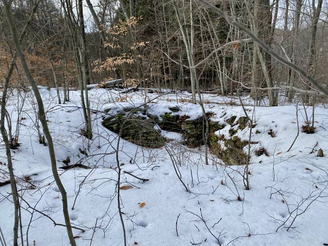
At the trailhead is an abandoned home cellar hole located to the west of the trail almost directly next to the brown service road gate (as of December 2022). The cellar was built of large rocks and stone that were harvested locally - the cellar looks to be over 100-years old, so circa late 1800s or early 1900s. This is a neat find along the hike and is not the last indication that people used to live here long ago.
After passing the abandoned cellar hole the trail will climb the mountain at a mostly gradual grade as it follows the service road.
Old Apple Orchard - Mile 0.15
At mile 0.15, hikers will find old apple trees lining the trail - another sign that people used to live in this mountain hollow.
Abandoned Bridge Pillars - Mile 0.22
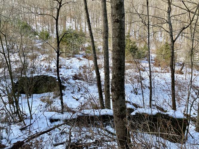
At mile 0.22, hikers will find two large stone pillars sitting adjacent to Stone Hollow Creek. As of December 2022, there's nothing that remains of the old bridge except these stone pillars/walls. They're about 5-feet tall and maybe 10-feet wide each that sit opposite each other with a gap of about 15-feet in between. Note there's a nice conifer plantation along the trail at this mile marker too, which makes for a scenic stop along the hike.
Moderate Climb - Mile 0.4 to 0.8
From miles 0.4 to 0.8, hikers will head up the steepest part of the trail which should be considered no more difficult than moderate grade. Along the way, hikers can take short breaks as they work up a sweat - look behind you for a decent view of the neighboring mountain tops.
Stone Hollow Vista - Mile 0.85
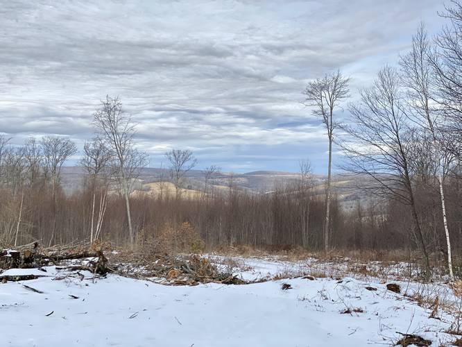
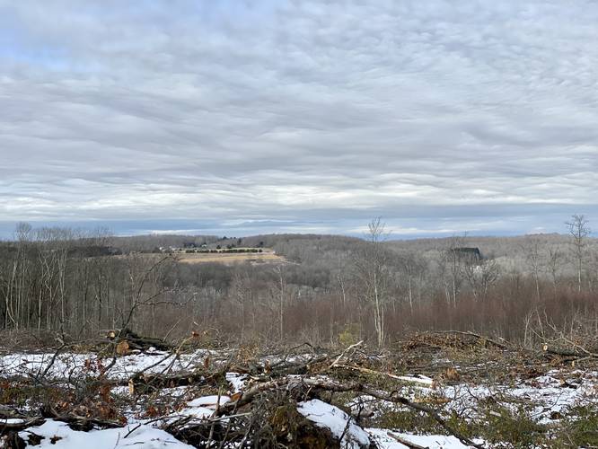
At mile 0.85, hikers will reach the top of the mountain and, as of December 2022, a brand new clear-cut logged area with a view. This view won't last forever, but as of December 2022, hikers can get a decent view of the mountain tops north of Galeton, PA - including wind turbines on the ridge in the distance. Note that some of these views are better when the leaves are off of the trees. Within ~10-years this view will likely be reclaimed by nature.
Right-Hand Turn - Mile 1.25
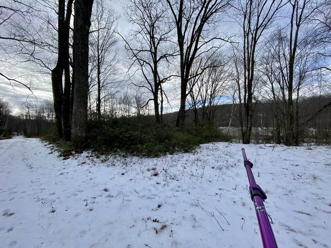
At mile 1.25, after hiking along the flat service road / trail from the view, hikers will want to take a right-hand turn toward a thin patch of forest that leads out to the northern shores of Whispering Pines Lake / Bristol Swamp. Note that on the left-hand side you may notice large piles of shale rock - these piles of rock are leftover from when the swamp was made by the PA Game Commission.
Whispering Pines Lake - Mile 1.27
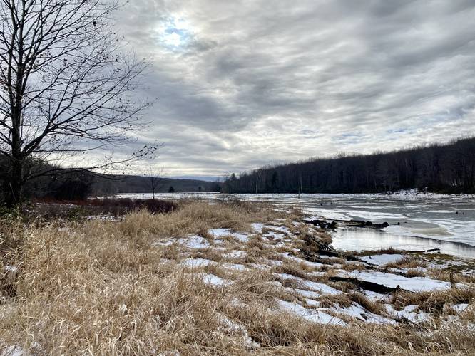
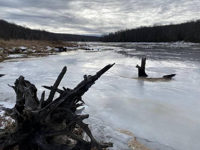
At mile 1.27, after bushwhacking through a small section of forest, hikers will finally be on the northern shores of Whispering Pines Lake / Bristol Swamp. The ground is usually a bit saturated here, hence the swamp, so watch your step. In the winter, the ground is harder and thus a bit easier to reach the shore for some photos of the ice. During warmer months, hikers might want to stay back from the waterline a bit to keep from getting their feet too wet. From here, the hike out is identical, but opposite to the hike in.
Parking
Hikers will find a large parking lot at the coordinates provided. The lot is large enough to fit a couple dozen vehicles or about a dozen vehicles with trailers. Note that this trail is technically a snowmobile trail; however, due to the gate being closed in late-December 2022, it's hard to see how snowmobiles can even enter the trail system here. As of December 2022, this road is maintained during the winter with plows and cinder.
Pets
Dogs are allowed if leashed and their waste should be carried out by the hiker.
Biking
Mountain biking is permitted along this trail.
Horseback Riding
Horseback riding is permitted along this trail.
Warning
Hunting: State Game Lands allow hunting and exist almost solely for the purpose of hunting, despite the fact that hikers can and do explore these public lands. Hunters wear blaze orange to stay safe and so should you.
Timer Rattlesnake: This area is known to inhabit the Timber Rattlesnake and while there may or may not be any rattler dens located nearby, hikers may encounter one on the trail - sunning itself in the tall grass or near bodies of water to hunt. Be on the lookout between the end of April and early October to ensure you don't step on one.
Lake/Swamp Names
The swamp is also called Bristol Swamp in Chuck Dillon's book, Short Hikes in God's Country (1995).
Hike Description
This hike begins at the brown service road gate located at the trailhead, adjacent to the parking lot.
Abandoned Cellar Hole - Mile 0
At the trailhead is an abandoned home cellar hole located to the west of the trail almost directly next to the brown service road gate (as of December 2022). The cellar was built of large rocks and stone that were harvested locally - the cellar looks to be over 100-years old, so circa late 1800s or early 1900s. This is a neat find along the hike and is not the last indication that people used to live here long ago.
After passing the abandoned cellar hole the trail will climb the mountain at a mostly gradual grade as it follows the service road.
Old Apple Orchard - Mile 0.15
At mile 0.15, hikers will find old apple trees lining the trail - another sign that people used to live in this mountain hollow.
Abandoned Bridge Pillars - Mile 0.22
At mile 0.22, hikers will find two large stone pillars sitting adjacent to Stone Hollow Creek. As of December 2022, there's nothing that remains of the old bridge except these stone pillars/walls. They're about 5-feet tall and maybe 10-feet wide each that sit opposite each other with a gap of about 15-feet in between. Note there's a nice conifer plantation along the trail at this mile marker too, which makes for a scenic stop along the hike.
Moderate Climb - Mile 0.4 to 0.8
From miles 0.4 to 0.8, hikers will head up the steepest part of the trail which should be considered no more difficult than moderate grade. Along the way, hikers can take short breaks as they work up a sweat - look behind you for a decent view of the neighboring mountain tops.
Stone Hollow Vista - Mile 0.85
At mile 0.85, hikers will reach the top of the mountain and, as of December 2022, a brand new clear-cut logged area with a view. This view won't last forever, but as of December 2022, hikers can get a decent view of the mountain tops north of Galeton, PA - including wind turbines on the ridge in the distance. Note that some of these views are better when the leaves are off of the trees. Within ~10-years this view will likely be reclaimed by nature.
Right-Hand Turn - Mile 1.25
At mile 1.25, after hiking along the flat service road / trail from the view, hikers will want to take a right-hand turn toward a thin patch of forest that leads out to the northern shores of Whispering Pines Lake / Bristol Swamp. Note that on the left-hand side you may notice large piles of shale rock - these piles of rock are leftover from when the swamp was made by the PA Game Commission.
Whispering Pines Lake - Mile 1.27
At mile 1.27, after bushwhacking through a small section of forest, hikers will finally be on the northern shores of Whispering Pines Lake / Bristol Swamp. The ground is usually a bit saturated here, hence the swamp, so watch your step. In the winter, the ground is harder and thus a bit easier to reach the shore for some photos of the ice. During warmer months, hikers might want to stay back from the waterline a bit to keep from getting their feet too wet. From here, the hike out is identical, but opposite to the hike in.
Parking
Hikers will find a large parking lot at the coordinates provided. The lot is large enough to fit a couple dozen vehicles or about a dozen vehicles with trailers. Note that this trail is technically a snowmobile trail; however, due to the gate being closed in late-December 2022, it's hard to see how snowmobiles can even enter the trail system here. As of December 2022, this road is maintained during the winter with plows and cinder.
Pets
Dogs are allowed if leashed and their waste should be carried out by the hiker.
Biking
Mountain biking is permitted along this trail.
Horseback Riding
Horseback riding is permitted along this trail.
Warning
Hunting: State Game Lands allow hunting and exist almost solely for the purpose of hunting, despite the fact that hikers can and do explore these public lands. Hunters wear blaze orange to stay safe and so should you.
Timer Rattlesnake: This area is known to inhabit the Timber Rattlesnake and while there may or may not be any rattler dens located nearby, hikers may encounter one on the trail - sunning itself in the tall grass or near bodies of water to hunt. Be on the lookout between the end of April and early October to ensure you don't step on one.
Lake/Swamp Names
The swamp is also called Bristol Swamp in Chuck Dillon's book, Short Hikes in God's Country (1995).