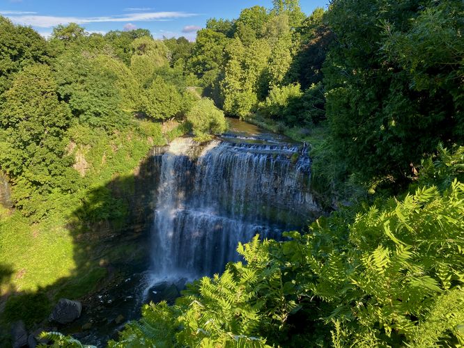
The Webster Falls Trail at Spencer Gorge Conservation Area in Hamilton, Ontario is an easy 0.2 km out-and-back universally-accessible trail that leads to a viewpoint of the 22m / 72-foot tall waterfall, Webster Falls.
Walk
This very short out-and-back walk begins at the main parking lot for the Webster Falls section of the park. It's a bit tricky to find given the trail map's false entrances, but visitors will find a large parking lot at the coordinates provided along the south side of Fallsview Road.
The trail begins on the west side of the parking lot -- for universal access, you'll find an easy to follow path. For folks who don't need universal access, you can follow a short-cut path that connects to the main trail. Visitors simply need to walk 0.1 km to reach the lookout point which sits high above Webster Falls from a steep cliff. As of August 2024, the vegetation at the lookout point made it difficult to view the waterfall, but this 22m / 72-foot tall cascade is a beautiful sight if you can get a decent view.
If you have extra time, you can walk the trail as it leads westward, crossing old stone footbridges that span Spencer Creek. These stone footbridges, in addition to the view of Webster Falls, provides some of the most scenic views around Hamilton. Unfortunately, during our visit here in August, there was too much vegetation to fully capture the footbridges and the waterfall in one photo; however, they can be better appreciated in-person.
Parking & Fees
Hikers will find a large parking lot at the Webster Falls entrance for Spencer Gorge Conservation Area, located on the south side of Fallsview Road in Hamilton, Ontario. The lot is large enough to fit a couple dozen vehicles as of August 2024. Note that there's an entrance fee per park within the Hamilton Conservation Authority. For the most updated information, please check out the park's website for entrance fee information. During our visit in August 2024, we purchased a day pass good for all of HCA's properties, which cost ~$35 or so.
Pets
Dogs are allowed only if leashed and must be cleaned up after.
Warning
Steep cliffs: This hike leads to steep cliffs with sheer drop-offs. Stay back from the ledges and stay on-trail for your own safety.