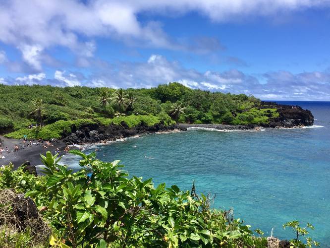
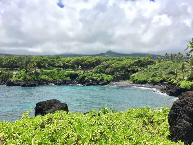
The Waianapanapa Black Sand Beach Trail at Waianapanapa State Park in Hana, Maui, Hawaii, is an easy 0.7 mile out-and-back hike to the Black Sand Beach and beyond, with amazing views from anywhere on the trail.
The trailhead starts along any of the paved paths that lead from the parking lot. Follow the paths over to the nearby stairs that lead down to the beach. Before you take the stairs down, there's a great lookout point of the beach. Once you make it down to the beach, you'll find a lava tube that you can explore - you need to hunch over to get inside and there does not appear to be a way out near the back of the lava tube.
If you wish to hike the trail further, you can find it continues along the northern end of the beach. Follow the trail east to another lookout point of the Black Sand Beach. If you go just another quarter mile east/north from the 2nd lookout point, you'll find even more views of the lush greenery, turquoise waters, black volcanic rock, and yet another small black sand beach - the GPS data ends here, but the Ke Ala Loa O Maui / Piilani Trail continues on from here.
Trail name: This trail is technically called Ke Ala Loa O Maui or the Piilani Trail and runs the coast east and west from this park. The trail recording here is just a small out-and-back section that encompasses the black sand beach area.
Swimming: The Black Sand Beach is an amazing and popular place to go swimming if you're staying in Hana or just driving through. Show up early to ensure you can get a parking spot.
Camping: Camping is allowed at designated areas, not on this trail, but at Waianapanapa State Park. Please check out their website for more details.
Respecting the Land
Hawaiian land is considered sacred to native Hawaiians and many locals, so please stay on-trail, take nothing but photos, and leave nothing but footprints. Respect the locals - don't stay for long and have a backup hike planned in case the parking lot is full.