The Ute Trail (Tombstone Ridge) at Rocky Mountain National Park near Estes Park, Colorado is an easy 2-mile out-and-back hike that follows the Tombstone Ridge portion of the Ute Trail and features breathtaking views of alpine mountains.
Trails
This hike follows a very short section of the Ute Trail as it runs along Tombstone Ridge.
Hike
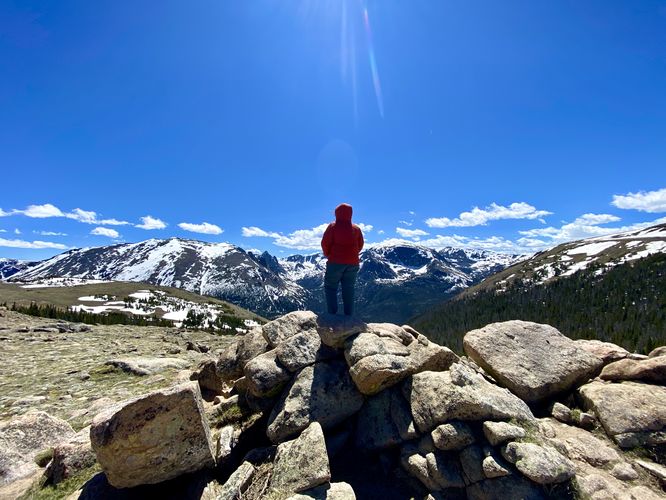
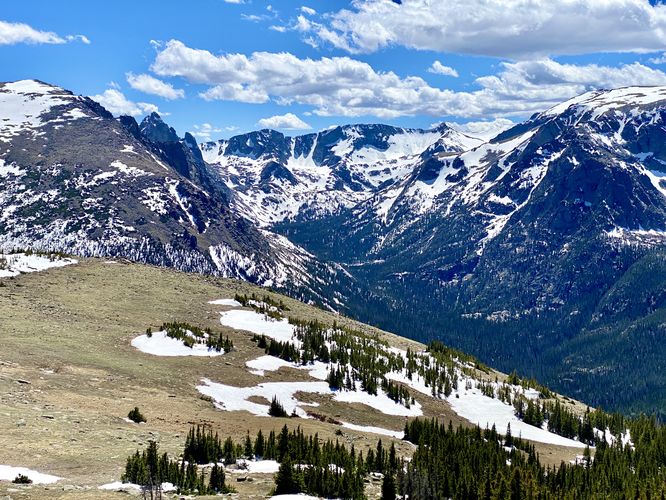
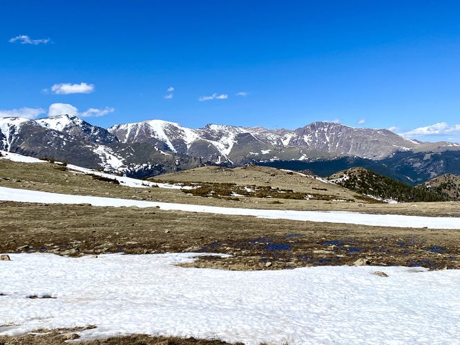
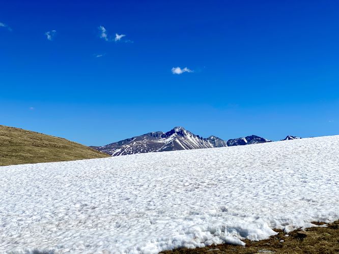
This hike begins along Trail Ridge Road and follows the Ute Trail as it leads eastward along Tombstone Ridge. The trail has views for the entire hike, which allows the hiker to choose how far they want to venture. Our original goal was to hike out to Timberline Pass; however, the excessive winds caused us to turn around about halfway there just up the mountain above Hidden Valley.
The trail itself is mostly flat with gradual uphill climbs that ascend the side of a hill atop Tombstone Ridge. The substrate is dirt, but also very rocky, which slowed us down for a good portion of the hike. Near where we turned around (end of the GPS track), the trail became a bit less rocky with a smoother dirt surface; however, that likely changes as the trail leads out toward Timberline Pass.
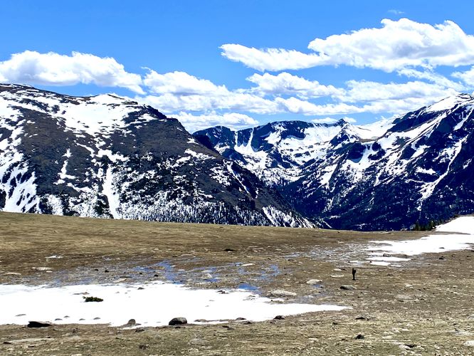
Hidden Valley Below - Mile 1
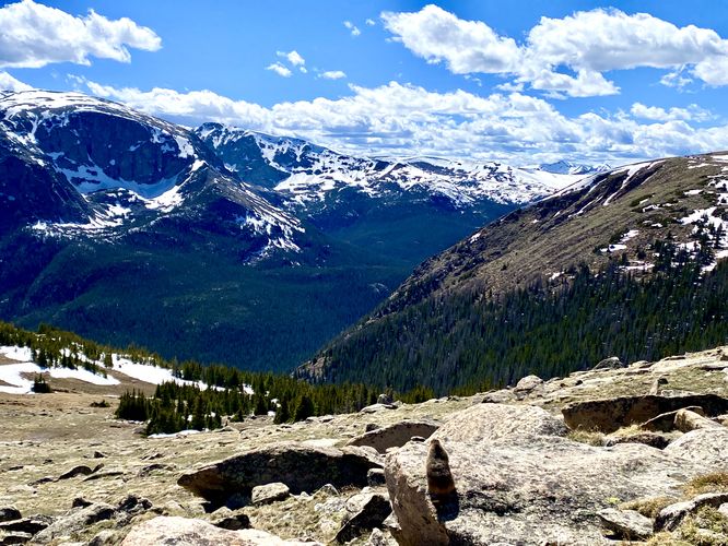
Around mile 1, hikers will reach the end of this GPS track, but your adventure doesn't have to stop here. Just below, facing north, is Hidden Valley below your feet where the Hidden Valley Nature Trail can be found. Due to excessive wind and headaches we decided to turn back here for an easy 2-mile out-and-back hike.
Potential Seclusion at Rocky Mountain National Park
The Ute Trail is far-less popular than other hikes nearby like the Forest Canyon Overlook Trail or the Tundra Communities Trail, both located at higher altitudes up the road. Due to the lack of interest and popularity, this trail should be considered by hikers as a way to escape the crowds (potentially, season-dependent) and to find some seclusion. When we hiked this trail in early June 2024, we saw just three other hikers and only had 4 cars in the parking lot when we started the hike. When we ended, there were 3 cars in the lot -- again, your mileage may vary based on the season, time of day, or influx of hikers on busy days or weekends.
Pets
Dogs are not allowed on this trail.
Parking
Hikers will find a small parking turnout at the coordinates provided, located on Trail Ridge Road. The lot is large enough to fit about 8 vehicles max as of June 2024.
Wildlife Viewing
This trail can be good to view wildlife like the yellow-bellied marmot as they love the alpine tundra landscape. On our hike here, we almost stepped on a marmot as it was totally blended into the rocks - it moved just before we stepped then started posing on rocks around us. Check out some of the photos in the attached album to see if you can spot the yellow-bellied marmot!
An Ancient Pathway
As described from the park's pamphlet: Ancestral people relied on traditional knowledge to navigate the landscape as they followed migrating animals and seasonal plant growth. They left behind tools, pottery, rock structures, and trail corridors. The Ute Trail and what is now known as Trail Ridge Road represent early evidence of human travel over the mountains--the start of a continuum of human visitation that continues today. Native people continue to care for this land and are working to ensure the younger generation maintains the connection to their homeland. These mountains remain their homeland and continue to be a sacred place to visit.
When hiking the Ute Trail, please be respectful of the land, nature, and remember that this path was built by ancient people eons before we knew the area as Rocky Mountain National Park.
Timed-Entry Reservations
Between the months of late May through early October you must purchase a timed-entry pass to visit Rocky Mountain National Park. If you wish to visitor and hike anything off of the Bear Lake Road, you must purchase a dedicated Bear Lake timed-entry pass. You can find more information about timed entry on the park's website.
Warnings
Elevation sickness: This trail brings hikers through terrain that ascends up to 11,600-feet above sea level. Around the 7,000-foot mark above sea level, hikers may start to experience symptoms of elevation sickness including headache, muscle aches, shortness of breath, among other warning signs. In order to avoid elevation sickness it's recommended to ascend to higher elevations and take short walks to acclimate over the course of several days before taking a long or physically-demanding hike. At any time you feel elevation sickness kicking in, that's the time to turn back and head for lower altitude or the parking lot.
Wild animals: While rare, hikers may encounter bears or mountain lion along the trail. Again, this is rare due to the insane amount of people who hike these trails each day; however, it's smart to know that these wild animals could be on-trail. Please read-up on how to properly handle a bear or mountain lion encounter before hitting the trails.
High exposure: This alpine trail is fully exposed with very little, if any shade along the trail. Due to the lack of shade and the combination of altitude at 11,600-feet above sea level, the UV index is significantly higher on this trail than on lower-altitude trails at the park. Sun exposure should be taken seriously and hikers should apply sunscreen or hike when the UV index is not as high. Additionally, due to the lack of trees and shrubs, the trail can be extremely windy. When we did this hike, the wind was almost constant at about 40mph or more, which pushed us around a bit. This can be dangerous due to all of the large rocks and boulders that line the trail - don't get blown over and knock your head on a rock. Bringing trekking poles is smart to help balance or battle the wind, if necessary.
Fragile tundra ecosystem: This trail passes through an alpine tundra, which see freezing temperatures 5 months out of the year. Due to the cold weather and harsh wind conditions, tundras see very slow growth and plants can take a very-long time to mature. Additionally, foot steps and trampling can cause plants to take decades to recover. For these reasons, please stay on-trail at all times while hiking in Rocky Mountain's alpine tundra landscapes.
Trails
This hike follows a very short section of the Ute Trail as it runs along Tombstone Ridge.
Hike
This hike begins along Trail Ridge Road and follows the Ute Trail as it leads eastward along Tombstone Ridge. The trail has views for the entire hike, which allows the hiker to choose how far they want to venture. Our original goal was to hike out to Timberline Pass; however, the excessive winds caused us to turn around about halfway there just up the mountain above Hidden Valley.
The trail itself is mostly flat with gradual uphill climbs that ascend the side of a hill atop Tombstone Ridge. The substrate is dirt, but also very rocky, which slowed us down for a good portion of the hike. Near where we turned around (end of the GPS track), the trail became a bit less rocky with a smoother dirt surface; however, that likely changes as the trail leads out toward Timberline Pass.
Hidden Valley Below - Mile 1
Around mile 1, hikers will reach the end of this GPS track, but your adventure doesn't have to stop here. Just below, facing north, is Hidden Valley below your feet where the Hidden Valley Nature Trail can be found. Due to excessive wind and headaches we decided to turn back here for an easy 2-mile out-and-back hike.
Potential Seclusion at Rocky Mountain National Park
The Ute Trail is far-less popular than other hikes nearby like the Forest Canyon Overlook Trail or the Tundra Communities Trail, both located at higher altitudes up the road. Due to the lack of interest and popularity, this trail should be considered by hikers as a way to escape the crowds (potentially, season-dependent) and to find some seclusion. When we hiked this trail in early June 2024, we saw just three other hikers and only had 4 cars in the parking lot when we started the hike. When we ended, there were 3 cars in the lot -- again, your mileage may vary based on the season, time of day, or influx of hikers on busy days or weekends.
Pets
Dogs are not allowed on this trail.
Parking
Hikers will find a small parking turnout at the coordinates provided, located on Trail Ridge Road. The lot is large enough to fit about 8 vehicles max as of June 2024.
Wildlife Viewing
This trail can be good to view wildlife like the yellow-bellied marmot as they love the alpine tundra landscape. On our hike here, we almost stepped on a marmot as it was totally blended into the rocks - it moved just before we stepped then started posing on rocks around us. Check out some of the photos in the attached album to see if you can spot the yellow-bellied marmot!
An Ancient Pathway
As described from the park's pamphlet: Ancestral people relied on traditional knowledge to navigate the landscape as they followed migrating animals and seasonal plant growth. They left behind tools, pottery, rock structures, and trail corridors. The Ute Trail and what is now known as Trail Ridge Road represent early evidence of human travel over the mountains--the start of a continuum of human visitation that continues today. Native people continue to care for this land and are working to ensure the younger generation maintains the connection to their homeland. These mountains remain their homeland and continue to be a sacred place to visit.
When hiking the Ute Trail, please be respectful of the land, nature, and remember that this path was built by ancient people eons before we knew the area as Rocky Mountain National Park.
Timed-Entry Reservations
Between the months of late May through early October you must purchase a timed-entry pass to visit Rocky Mountain National Park. If you wish to visitor and hike anything off of the Bear Lake Road, you must purchase a dedicated Bear Lake timed-entry pass. You can find more information about timed entry on the park's website.
Warnings
Elevation sickness: This trail brings hikers through terrain that ascends up to 11,600-feet above sea level. Around the 7,000-foot mark above sea level, hikers may start to experience symptoms of elevation sickness including headache, muscle aches, shortness of breath, among other warning signs. In order to avoid elevation sickness it's recommended to ascend to higher elevations and take short walks to acclimate over the course of several days before taking a long or physically-demanding hike. At any time you feel elevation sickness kicking in, that's the time to turn back and head for lower altitude or the parking lot.
Wild animals: While rare, hikers may encounter bears or mountain lion along the trail. Again, this is rare due to the insane amount of people who hike these trails each day; however, it's smart to know that these wild animals could be on-trail. Please read-up on how to properly handle a bear or mountain lion encounter before hitting the trails.
High exposure: This alpine trail is fully exposed with very little, if any shade along the trail. Due to the lack of shade and the combination of altitude at 11,600-feet above sea level, the UV index is significantly higher on this trail than on lower-altitude trails at the park. Sun exposure should be taken seriously and hikers should apply sunscreen or hike when the UV index is not as high. Additionally, due to the lack of trees and shrubs, the trail can be extremely windy. When we did this hike, the wind was almost constant at about 40mph or more, which pushed us around a bit. This can be dangerous due to all of the large rocks and boulders that line the trail - don't get blown over and knock your head on a rock. Bringing trekking poles is smart to help balance or battle the wind, if necessary.
Fragile tundra ecosystem: This trail passes through an alpine tundra, which see freezing temperatures 5 months out of the year. Due to the cold weather and harsh wind conditions, tundras see very slow growth and plants can take a very-long time to mature. Additionally, foot steps and trampling can cause plants to take decades to recover. For these reasons, please stay on-trail at all times while hiking in Rocky Mountain's alpine tundra landscapes.