The Upper Falls Trail at Upper Falls Park in Provo, Utah is a moderate 0.7-mile out-and-back hike that leads to the 40-foot tall waterfall known as Upper Falls.
Hike Description
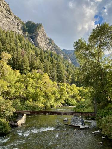
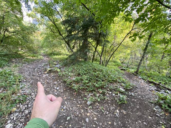
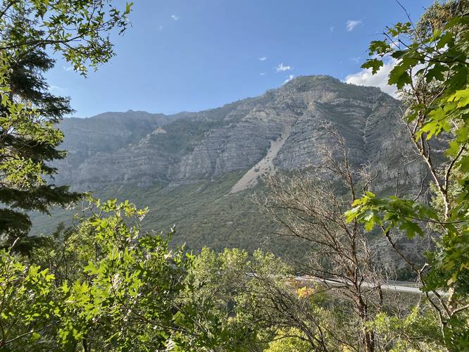
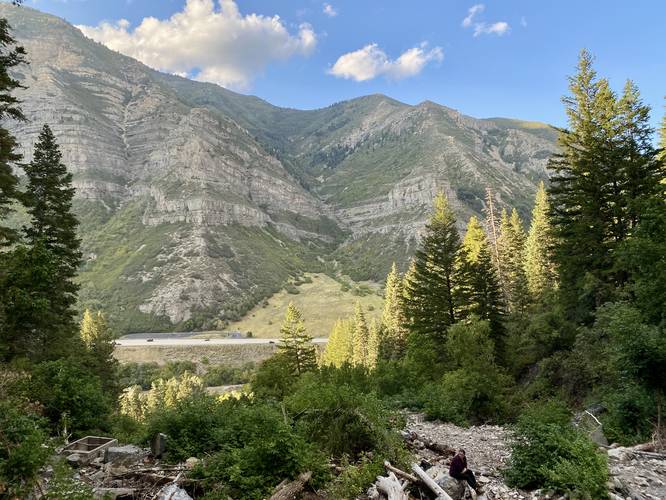
This hike begins at the main parking lot at Upper Falls Park, located just off of Provo Canyon Road at the parking coordinates provided. Hikers will cross the bridge that spans the Provo River, then hike up the short embankment to reach the Provo River Parkway (bike trail). Once on the bike trail, hikers will head south for ~50 feet to find a dirt path that leads southwest and up the mountainside. Here, the hike follows a moderate rocky trail that leads to the base of Upper Falls. Hikers will want to keep left on their way up this trail to stay on-course. Along the way, there are a couple of viewpoints of the Provo Canyon with the foothills of Mt. Timpanogos in the foreground.
Upper Falls - Mile 0.35
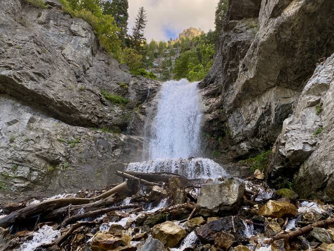
Finally, around mile 0.35, hikers will come around a rocky bend in the trail to find Upper Falls cascading down the cliff. Upper Falls is approximately 40-feet tall with a short upper cascade located upstream behind the main cascade (aka Upper Upper Falls?). Thus Upper Falls' height is likely much taller than 40-feet when combining both cascades. Hikers can enjoy the waterfall from downstream; however, I decided to hike closer to the base of the waterfall for a better photo. Note that this can be dangerous due to the random and sudden rockfalls that can and do happen from these mountain cliffs.
Parking
Hikers can find parking at the coordinates provided, located along Provo Canyon Road.
Hours
As of September 2023, Upper Falls Park is closed from 11PM to 5AM daily. Thus is open from 5AM to 10:59PM.
Pets
Dogs are allowed only if leashed and cleaned up after.
Warnings
Rockfalls: The cliffs surrounding Upper Falls calve off and cause rockfalls to happen randomly and suddenly - these could happen at any time so be mindful and watch out.
Snow-melt undermining: In the Spring, snow melt can cause undermining of snowfields which can be dangerous to hike on as the hiker doesn't know how thin the snow is or how far down it might plunge below. Sometimes this area is closed in early Spring due to avalanches and snow-melt undermining.
Hike Description
This hike begins at the main parking lot at Upper Falls Park, located just off of Provo Canyon Road at the parking coordinates provided. Hikers will cross the bridge that spans the Provo River, then hike up the short embankment to reach the Provo River Parkway (bike trail). Once on the bike trail, hikers will head south for ~50 feet to find a dirt path that leads southwest and up the mountainside. Here, the hike follows a moderate rocky trail that leads to the base of Upper Falls. Hikers will want to keep left on their way up this trail to stay on-course. Along the way, there are a couple of viewpoints of the Provo Canyon with the foothills of Mt. Timpanogos in the foreground.
Upper Falls - Mile 0.35
Finally, around mile 0.35, hikers will come around a rocky bend in the trail to find Upper Falls cascading down the cliff. Upper Falls is approximately 40-feet tall with a short upper cascade located upstream behind the main cascade (aka Upper Upper Falls?). Thus Upper Falls' height is likely much taller than 40-feet when combining both cascades. Hikers can enjoy the waterfall from downstream; however, I decided to hike closer to the base of the waterfall for a better photo. Note that this can be dangerous due to the random and sudden rockfalls that can and do happen from these mountain cliffs.
Parking
Hikers can find parking at the coordinates provided, located along Provo Canyon Road.
Hours
As of September 2023, Upper Falls Park is closed from 11PM to 5AM daily. Thus is open from 5AM to 10:59PM.
Pets
Dogs are allowed only if leashed and cleaned up after.
Warnings
Rockfalls: The cliffs surrounding Upper Falls calve off and cause rockfalls to happen randomly and suddenly - these could happen at any time so be mindful and watch out.
Snow-melt undermining: In the Spring, snow melt can cause undermining of snowfields which can be dangerous to hike on as the hiker doesn't know how thin the snow is or how far down it might plunge below. Sometimes this area is closed in early Spring due to avalanches and snow-melt undermining.