Upper Carpenter Falls at Carpenter Falls Unique Area in Moravia, New York is a 0.5-mile out-and-back universally-accessible boardwalk hike that leads to the 100-foot tall waterfall, Carpenter Falls.
Trails & Accessibility
Please note that this GPS data include two different trails - first, the universally-accessible boardwalk trail and then the non-accessible staircase trail that leads down to the bottom of the 100-foot tall gorge.
Hike Description
This hike begins at the main parking lot for Carpenter Falls and leads down the universally-accessible boardwalk trail. At the end of the boardwalk is a stunning view of Upper Carpenter Falls as it spills over the 100-foot tall gorge in a free falling cascade. From here, visitors have a choice to either turn back or explore the gorge a bit below by taking the non-accessible staircase trail that leads down the gorge.
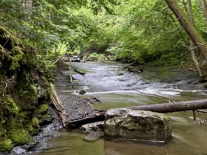
The staircase trail is not easy but has several scenic spots along the way - including another view point of Upper Carpenter Falls (note that there was a crowd on this hike, hence no photo from that view). At the bottom of the trail, hikers will reach Bear Swamp Creek where you'll find some very small slide waterfalls that the creek cascades down.
Hiking back is fairly difficult from the gorge, but it's a short climb out, hence the moderate difficulty. If you skip the gorge hike, this is a very easy walk to the main view point.
Parking
Hikers will find a small parking lot at the coordinates provided along Appletree Point Road in Moravia.
Pets
Dogs are allowed only if leashed and must be cleaned up after.
Trails & Accessibility
Please note that this GPS data include two different trails - first, the universally-accessible boardwalk trail and then the non-accessible staircase trail that leads down to the bottom of the 100-foot tall gorge.
Hike Description
This hike begins at the main parking lot for Carpenter Falls and leads down the universally-accessible boardwalk trail. At the end of the boardwalk is a stunning view of Upper Carpenter Falls as it spills over the 100-foot tall gorge in a free falling cascade. From here, visitors have a choice to either turn back or explore the gorge a bit below by taking the non-accessible staircase trail that leads down the gorge.
The staircase trail is not easy but has several scenic spots along the way - including another view point of Upper Carpenter Falls (note that there was a crowd on this hike, hence no photo from that view). At the bottom of the trail, hikers will reach Bear Swamp Creek where you'll find some very small slide waterfalls that the creek cascades down.
Hiking back is fairly difficult from the gorge, but it's a short climb out, hence the moderate difficulty. If you skip the gorge hike, this is a very easy walk to the main view point.
Parking
Hikers will find a small parking lot at the coordinates provided along Appletree Point Road in Moravia.
Pets
Dogs are allowed only if leashed and must be cleaned up after.