Umpachene Falls Trail at Umpachene Falls Park in New Marlborough is an easy 0.2-mile out-and-back walk that leads to the scenic 20-foot tall multi-tiered waterfall, Umpachene Falls.
Walk Description
This short walk begins at the main parking lot at Umpachene Falls Park and heads due-South to reach the Umpachene River. Once at the river, you'll be right at Umpachene Falls. There's a small dirt footpath that runs the length of the waterfall from the top down to the base.
Umpachene Falls - Mile 0.1
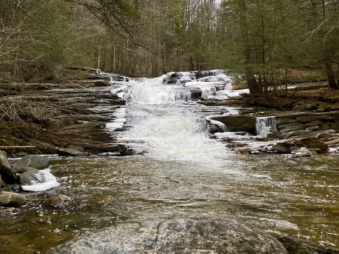
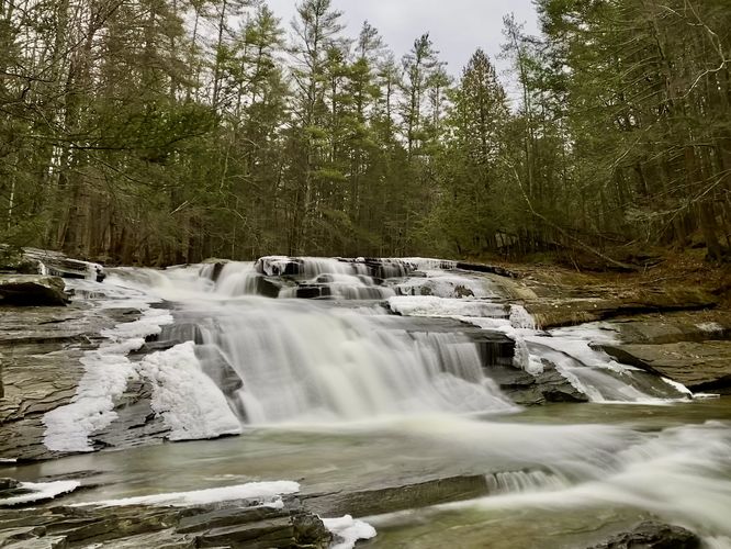
At mile 0.1, visitors will reach the 20-foot tall, 60-foot long multi-tiered waterfall known as Umpachene Falls. This waterfall can be enjoyed from different sections of the dirt footpath that runs the length of the cascade. Hikers can also setup a picnic on the bedrock during warm months or hang out along the banks of the river. The waterfall is not massive but the cascades and the surrounding evergreen forest make for beautiful scenery.
Parking
Visitors will find a large parking lot at the coordinates provided, the lot is large enough to fit a couple dozen vehicles as of December 2023. Note that during our hike here in late December 2023, the parking lot gate was closed. Due to this, the parking lot size is reduced to ~2 vehicles max when the gate is closed.
Pets
Dogs are allowed only if leashed and must be cleaned up after.
Walk Description
This short walk begins at the main parking lot at Umpachene Falls Park and heads due-South to reach the Umpachene River. Once at the river, you'll be right at Umpachene Falls. There's a small dirt footpath that runs the length of the waterfall from the top down to the base.
Umpachene Falls - Mile 0.1
At mile 0.1, visitors will reach the 20-foot tall, 60-foot long multi-tiered waterfall known as Umpachene Falls. This waterfall can be enjoyed from different sections of the dirt footpath that runs the length of the cascade. Hikers can also setup a picnic on the bedrock during warm months or hang out along the banks of the river. The waterfall is not massive but the cascades and the surrounding evergreen forest make for beautiful scenery.
Parking
Visitors will find a large parking lot at the coordinates provided, the lot is large enough to fit a couple dozen vehicles as of December 2023. Note that during our hike here in late December 2023, the parking lot gate was closed. Due to this, the parking lot size is reduced to ~2 vehicles max when the gate is closed.
Pets
Dogs are allowed only if leashed and must be cleaned up after.