The Two Lights Loop Trail at Two Lights State Park in Cape Elizabeth, Maine is an easy 0.6-mile loop hike that features stunning views of Maine's coastline along with an abandoned military fort.
Hike
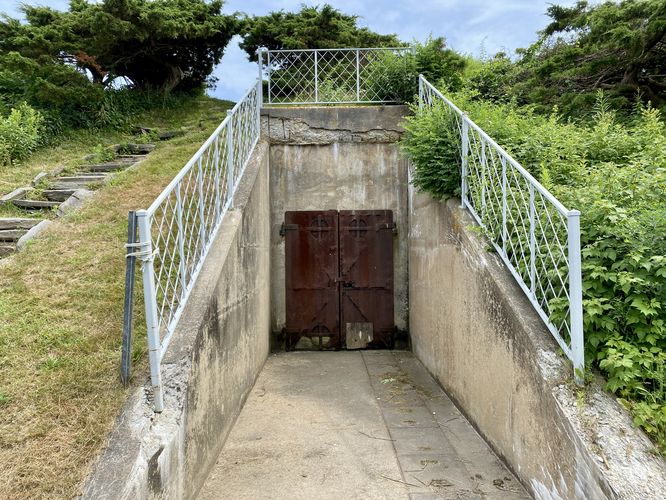
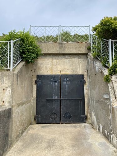
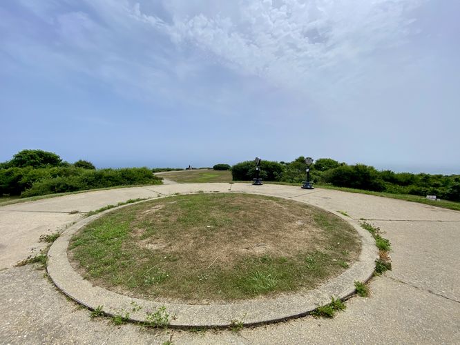
This hike begins at the main parking lot and starts by first heading to the trailhead information kiosk. From the kiosk, we explored the abandoned military fort bunkers at the trailhead before walking-in along the paved, universally-accessible path. The route leads visitors to the old fort battery location (large circular patch of grass) that sits in front of yet another large bunker door. Despite the reason we came here, for the ocean views, these old military forts are pretty cool to check out along the trail.
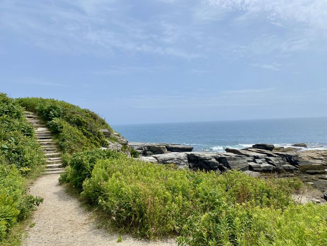
This route then leads visitors downhill and away from the paved universal-access trail to reach the coastline views. The route takes a left-hand turn before heading up a series of scenic stairs that sit alongside a view of the ocean.
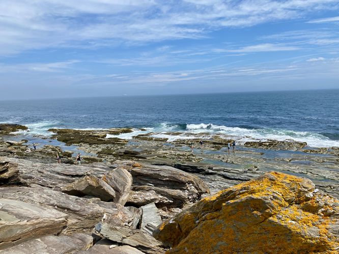
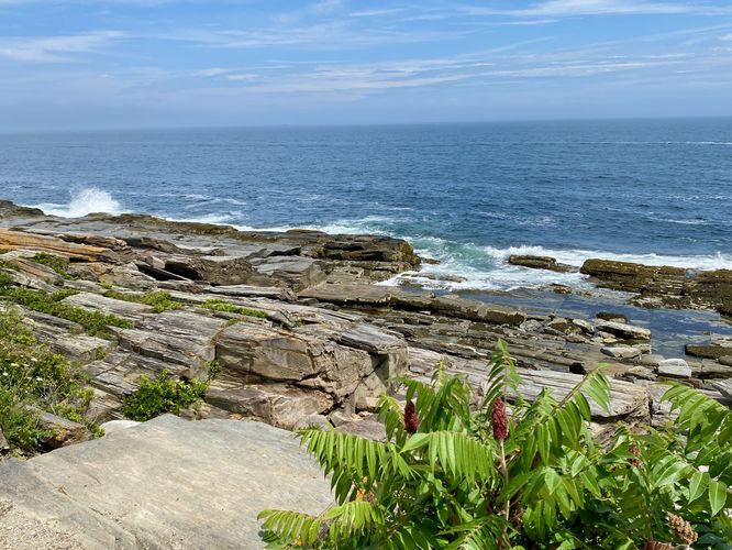
Coastline Views - Mile 0.15 to 0.35
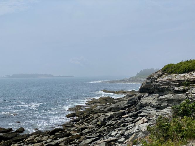
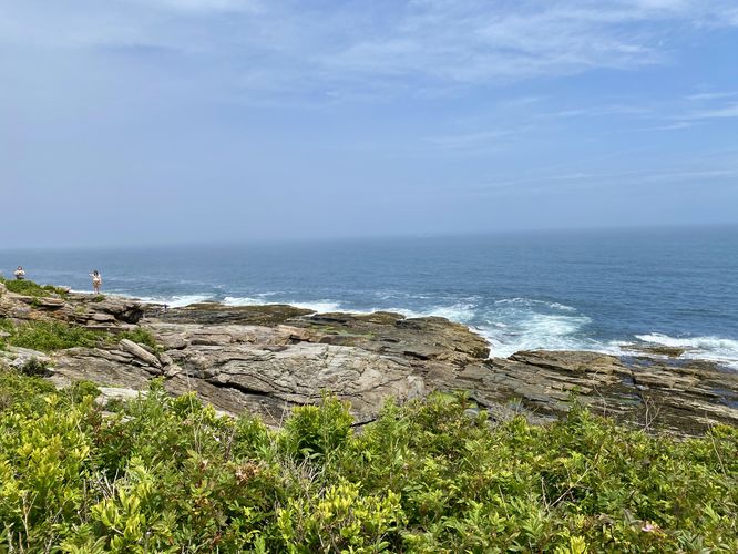
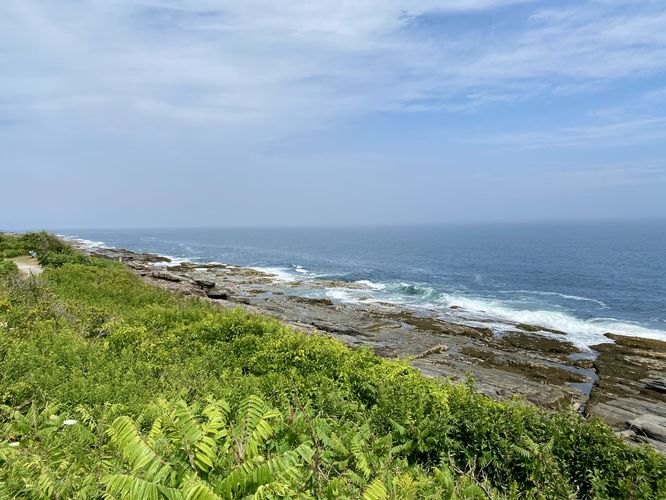
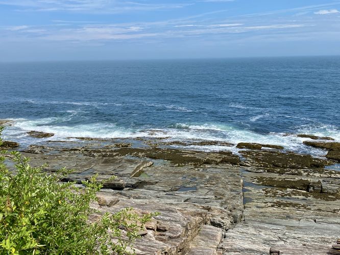
From this part of the trail, located around mile 0.15, to about mile 0.35, you'll find stunning views of the Atlantic Ocean as it crashes along Maine's rugged rocky coastline. The trail leads back uphill to reach the universal access path before it runs northeast along the coast. The trail provides hikers and visitors with a plethora of spots to take-in the views or hike off-trail and explore the rocky coastline. Along the way, hikers will find plenty of benches, just watch out for the bunches of poison ivy too.
Forest Hiking - Mile 0.35 to 0.6
After exploring the coastline and taking-in the views of the waves crashing ashore, you'll head into the forest for an optional hike away from the water that leads back to parking. This route brings hikers along the outer-most trail which encompasses the parking lot before leading right back to it. Along the way, you'll find stone staircases and evergreens that shade the trail -- a nice change of pace from the exposed trail along the coast. Eventually, this path leads right back to parking to complete this short but ultra-scenic 0.6-mile loop hike.
Parking & Fees
There's a per-person entry fee, as of July 2024. For non-residents, it's a $7/adult fee. For Maine residents, the fee is $5/adult. Hikers will find a large parking lot at the end of the park's entrance road which can hold many dozens of vehicles as of July 2024.
Pets
Dogs are allowed only if leashed and must be cleaned up after.
Warning
Poison ivy: This trail has a bunch of poison ivy located near bench areas and dirt cut-outs along the trail (placed where hikers stop to take-in views). Watch your step and take precautionary measures after the hike to ensure you don't accidentally spread poison ivy oils from your boots/shoes.
Hike
This hike begins at the main parking lot and starts by first heading to the trailhead information kiosk. From the kiosk, we explored the abandoned military fort bunkers at the trailhead before walking-in along the paved, universally-accessible path. The route leads visitors to the old fort battery location (large circular patch of grass) that sits in front of yet another large bunker door. Despite the reason we came here, for the ocean views, these old military forts are pretty cool to check out along the trail.
This route then leads visitors downhill and away from the paved universal-access trail to reach the coastline views. The route takes a left-hand turn before heading up a series of scenic stairs that sit alongside a view of the ocean.
Coastline Views - Mile 0.15 to 0.35
From this part of the trail, located around mile 0.15, to about mile 0.35, you'll find stunning views of the Atlantic Ocean as it crashes along Maine's rugged rocky coastline. The trail leads back uphill to reach the universal access path before it runs northeast along the coast. The trail provides hikers and visitors with a plethora of spots to take-in the views or hike off-trail and explore the rocky coastline. Along the way, hikers will find plenty of benches, just watch out for the bunches of poison ivy too.
Forest Hiking - Mile 0.35 to 0.6
After exploring the coastline and taking-in the views of the waves crashing ashore, you'll head into the forest for an optional hike away from the water that leads back to parking. This route brings hikers along the outer-most trail which encompasses the parking lot before leading right back to it. Along the way, you'll find stone staircases and evergreens that shade the trail -- a nice change of pace from the exposed trail along the coast. Eventually, this path leads right back to parking to complete this short but ultra-scenic 0.6-mile loop hike.
Parking & Fees
There's a per-person entry fee, as of July 2024. For non-residents, it's a $7/adult fee. For Maine residents, the fee is $5/adult. Hikers will find a large parking lot at the end of the park's entrance road which can hold many dozens of vehicles as of July 2024.
Pets
Dogs are allowed only if leashed and must be cleaned up after.
Warning
Poison ivy: This trail has a bunch of poison ivy located near bench areas and dirt cut-outs along the trail (placed where hikers stop to take-in views). Watch your step and take precautionary measures after the hike to ensure you don't accidentally spread poison ivy oils from your boots/shoes.