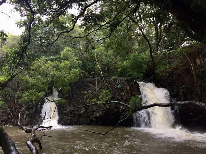
The Twin Falls Trail in Maui, Hawaii is an easy 0.3 mile out-and-back hike to the Twin Falls of Maui that cascade down into the Hoolawa Stream.
This is a heavily-trafficked trail and a popular swimming hole at the base of the falls; however, beware of flash flooding during heavy rainfall.
The trail starts next to the Twin Falls Maui farm stand and runs parallel to the stream. You can take a left-hand turn at the multitude of trails next to the bamboo shortly after entering the trail - or continue hiking straight along the main trail and then take your immediate next left-hand turn to head towards the falls.
The trail will head downhill along a rock ledge, which is about 10 feet tall, so watch your step. Walk another hundred feet after heading down the rock ledge to find the Twin Falls. The hike back is the same - take either of the 2 trails that lead up the rock ledge and then follow the main trail out or hike into the bamboo and over to the trailhead.
Parking: Since these falls are so popular, there are two main parking lots - one on both sides of Hoolawa Stream. If the first lot is full, park in the 2nd lot and walk over to the trailhead.
Warning: Flash flooding is a common occurrence along streams in Hawaii. Please check the weather before hiking this trail and do not hike upstream if the water is brown and rushing. Flash floods can occur anytime upstream where heavy rains fall and you cannot always predict when a flash flood may happen. Be aware of the dangers and hike at your own risk. Also note that people have died at the Twin Falls and in July 2019 this happened after a man jumped into the pools below the falls.
Clothing optional swimming: This trail is technically on private property, but is open to the public, and the owners allow visitors to swim nude; however, the waterfalls are an extremely popular stop on the road to Hana, so chances are people will be clothed.
Respecting the Land
Hawaiian land is considered sacred to native Hawaiians and many locals, so please stay on-trail, take nothing but photos, and leave nothing but footprints. Respect the locals - don't stay for long and have a backup hike planned in case the parking lot is full.