The Trout Run Park Loop at Trout Run Park in Trout Run, Pennsylvania is an easy semi-paved 0.5-mile trail that features a creek view and a peaceful walk through the park.
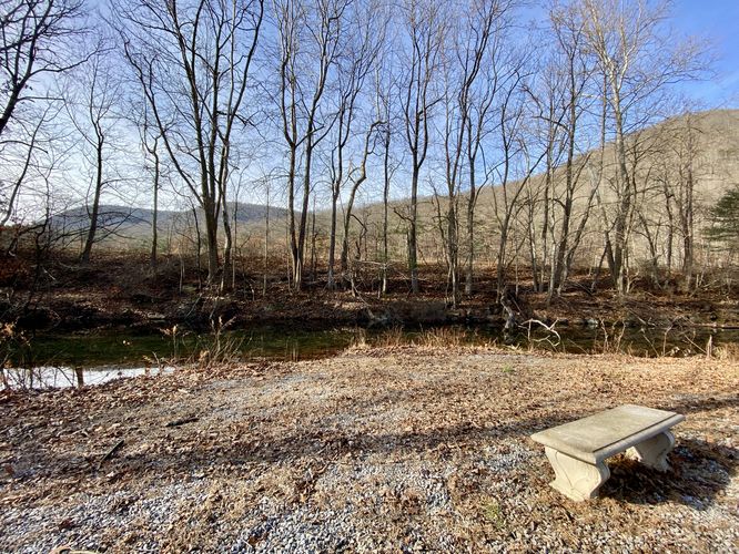
This short trail begins at the main parking lot and can be found on the East side of the main road, adjacent to the entrance gate. As of December 2023, there's an interpretive sign at the trailhead, however, no official trail name. The gravel trail leads along the western side of the park, passing some low-lying ground that tends to flood, where walkers might have to hop into the grass to avoid getting their feet wet. On the south side of the loop is a small creek that passes alongside the park where walkers will find a small bench to sit and relax. From here, the gravel path connects back to the park road. Here, we followed the paved road back to the parking lot for a 0.5-mile walk.
Partial Universal Access
Note that the park's main road is paved and universally accessible; however, at the trailhead, and the gravel path that runs along the western side of the park is not universally accessible.
Parking
Walkers will find parking at the coordinates provided, located straight ahead of the entrance gate after entering the park. The lot is large enough to fit a handful of vehicles. There are other small parking lots located along the main park's drive.
Pets
Dogs are allowed if leashed and must be cleaned up after.