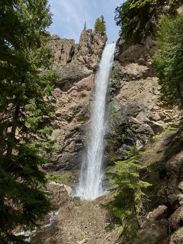
Treasure Falls Trail at San Juan National Forest in Mineral County, Colorado is a moderate 0.8-mile out-and-back trail that features views and leads to the ~120-foot tall waterfall, Treasure Falls.
Hike
This hike begins at the main parking lot for Treasure Falls where hikers will find the trailhead located on the north side of the lot. If you start the walk from the southern end of the parking lot, you'll find views of Treasure Falls cascading over the cliff. The trail begins by heading into the forest and follows switchbacks for a good portion of the way uphill to reach the base of the waterfall.
Saddle Mountain View - Mile 0.1
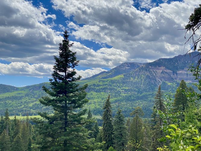
Around mile 0.1, along the switchbacks, is a nice on-trail view of Saddle Mountain located to the west.
This route keeps-right along the way up the hill where the switchbacks continue at a moderate grade. Eventually, after the sixth switchback, hikers will reach a junction that leads up to the "Misty Deck" to the base of Treasure Falls. This route skips the "Misty Deck" and instead heads to the footbridge that crosses Fall Creek.
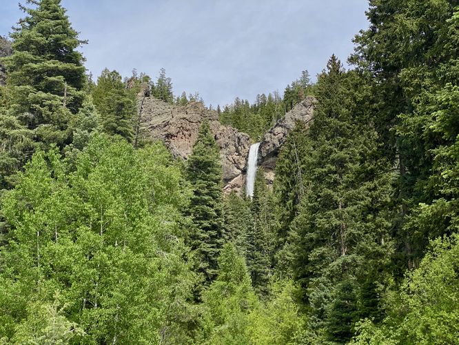
Treasure Falls View - Mile 0.35
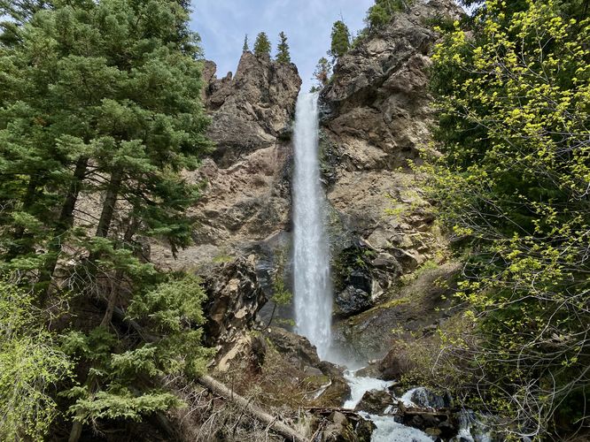
At the footbridge, around mile 0.35, hikers will find a bench that sits under a large overhanging cave-like cliff where you can sit to enjoy the downstream view of the 120-foot tall Treasure Falls and the mist that slowly creeps down the creek. According to a local legend, Treasure Falls is named after the "treasure of gold" hidden in the mountain that the waterfall cascades down from.
Falls Creek Blowout - Mile 0.4
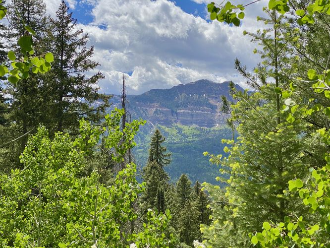
If you hike a bit further, you'll reach the Falls Creek Blowout which is a large landslide that occurred here in the past -- this "blowout" removed land and trees, which opened up a view of Saddle Mountain.
After exploring the blowout, hikers may notice an off-trail scramble that leads uphill between the footbridge and the blowout view. I explored this a bit further to take-in some cliff-top views of Treasure Falls, but ultimately the views were just as good, if not better, from the cliff bench near the footbridge. We then hung out by the footbridge and took in the views of the 120-foot tall Treasure Falls before heading out for a short 0.8-mile hike.
Parking
Hikers will find a very large parking lot at the coordinates provided. The lot is large enough to fit over a dozen vehicles as of June 2024.
Pets
Dogs are allowed only if leashed and should be cleaned up after.
Warning
Steep cliffs: You should stay on-trail at all times due to the number of steep drop-offs and sheer cliffs in the area. There are a number of old trails and unofficial trails that catch the eye, but should be ignored (personal experience).
Hike
This hike begins at the main parking lot for Treasure Falls where hikers will find the trailhead located on the north side of the lot. If you start the walk from the southern end of the parking lot, you'll find views of Treasure Falls cascading over the cliff. The trail begins by heading into the forest and follows switchbacks for a good portion of the way uphill to reach the base of the waterfall.
Saddle Mountain View - Mile 0.1
Around mile 0.1, along the switchbacks, is a nice on-trail view of Saddle Mountain located to the west.
This route keeps-right along the way up the hill where the switchbacks continue at a moderate grade. Eventually, after the sixth switchback, hikers will reach a junction that leads up to the "Misty Deck" to the base of Treasure Falls. This route skips the "Misty Deck" and instead heads to the footbridge that crosses Fall Creek.
Treasure Falls View - Mile 0.35
At the footbridge, around mile 0.35, hikers will find a bench that sits under a large overhanging cave-like cliff where you can sit to enjoy the downstream view of the 120-foot tall Treasure Falls and the mist that slowly creeps down the creek. According to a local legend, Treasure Falls is named after the "treasure of gold" hidden in the mountain that the waterfall cascades down from.
Falls Creek Blowout - Mile 0.4
If you hike a bit further, you'll reach the Falls Creek Blowout which is a large landslide that occurred here in the past -- this "blowout" removed land and trees, which opened up a view of Saddle Mountain.
After exploring the blowout, hikers may notice an off-trail scramble that leads uphill between the footbridge and the blowout view. I explored this a bit further to take-in some cliff-top views of Treasure Falls, but ultimately the views were just as good, if not better, from the cliff bench near the footbridge. We then hung out by the footbridge and took in the views of the 120-foot tall Treasure Falls before heading out for a short 0.8-mile hike.
Parking
Hikers will find a very large parking lot at the coordinates provided. The lot is large enough to fit over a dozen vehicles as of June 2024.
Pets
Dogs are allowed only if leashed and should be cleaned up after.
Warning
Steep cliffs: You should stay on-trail at all times due to the number of steep drop-offs and sheer cliffs in the area. There are a number of old trails and unofficial trails that catch the eye, but should be ignored (personal experience).